- My Forums
- Tiger Rant
- LSU Recruiting
- SEC Rant
- Saints Talk
- Pelicans Talk
- More Sports Board
- Fantasy Sports
- Golf Board
- Soccer Board
- O-T Lounge
- Tech Board
- Home/Garden Board
- Outdoor Board
- Health/Fitness Board
- Movie/TV Board
- Book Board
- Music Board
- Political Talk
- Money Talk
- Fark Board
- Gaming Board
- Travel Board
- Food/Drink Board
- Ticket Exchange
- TD Help Board
Customize My Forums- View All Forums
- Show Left Links
- Topic Sort Options
- Trending Topics
- Recent Topics
- Active Topics
Started By
Message
re: Tornado outbreak, 94 dead, Upwards of 100 unaccounted for search/rescue & cleanup ongoing
Posted on 12/9/21 at 7:13 pm to Duke
Posted on 12/9/21 at 7:13 pm to Duke
quote:
How have you enjoyed the freezer lately?
Freaking brutal
Month of sub-zero temps and with that any winds from the N/NW make it brutal to be outside
 1
1

Posted on 12/9/21 at 7:26 pm to DeoreDX
quote:
When should I see this in Bham?
Saturday morning. Hopefully below severe levels.
Posted on 12/9/21 at 7:30 pm to East Coast Band
They've banned Reed Timmer from tick tock for "dangerous acts". 
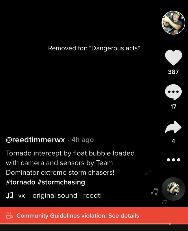
You can break your neck doing the "milk crate challenge", but don't you dare chase a storm.
You can break your neck doing the "milk crate challenge", but don't you dare chase a storm.
Posted on 12/9/21 at 8:02 pm to gaetti15
quote:
Month of sub-zero temps and with that any winds from the N/NW make it brutal to be outside
Im crying because Im going to get subzero for maybe six hours.
Getting some snow now off the system thats going to severe things tomorrow night. Cold front still to come through, so perfect take a flashlight and stand in the snow all night weather.
Posted on 12/10/21 at 12:09 am to Duke
Enhanced has been expanded, and they at least are considering an upgrade to a Moderate risk.
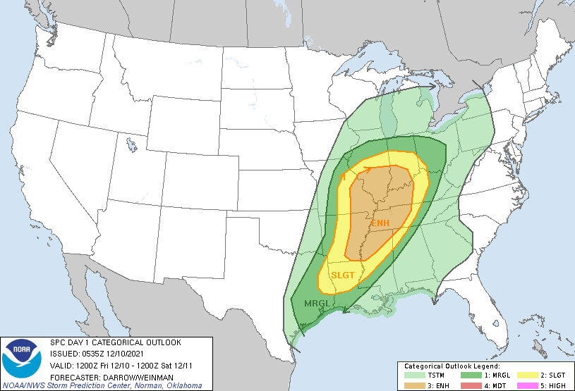
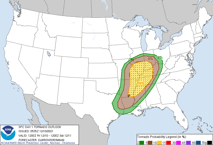
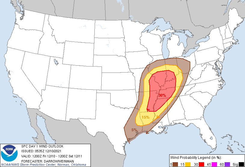
quote:
Day 1 Convective Outlook NWS Storm Prediction Center Norman OK 1135 PM CST Thu Dec 09 2021 Valid 101200Z - 111200Z
...THERE IS AN ENHANCED RISK OF SEVERE THUNDERSTORMS FROM THE LOWER AND MID MISSISSIPPI VALLEY INTO THE LOWER OHIO AND TENNESSEE VALLEY...
...SUMMARY... Scattered severe thunderstorms are expected during the evening and overnight hours across the lower/mid Mississippi Valley into the lower Ohio and Tennessee Valley region. Nocturnal tornado threat is expected with this activity along with the possibility for a few strong tornadoes.
...Lower/Mid Mississippi Valley to the lower Ohio/Tennessee Valley region... Strong upper trough will progress across the Rockies into the Plains by 11/00z then into the mid/upper MS Valley by the end of the period as an intense 500mb speed max (100-110kt) translates into IL late. In response to this feature a surface low will deepen as it tracks from southern KS to north of CHI by 11/06z then into northern lower MI by daybreak Saturday. Severe thunderstorms are expected to develop ahead of this strongly dynamic trough. Serious consideration was given to higher severe probabilities along the MS delta region of eastern AR into the lower OH River valley. Despite the nocturnal initiation, strong tornadoes are possible with supercells Friday night.
Southwesterly LLJ is expected to increase across eastern TX/lower MS early in the period. This southerly branch of the LLJ will encourage higher-quality boundary-layer air mass to advance north into the mid MS Valley ahead of the surging cold front. Early this morning, lower 70s surface dew points are noted as far north as PSN to IER over eastern TX/LA with lower 60s dew points into central AR. There is little reason to doubt moisture will advance into MO/IL ahead of the front as capping will prevent appreciable convection until mostly after sunset. Latest model guidance suggests moisture advection/cooling profiles aloft will result in destabilization ahead of the surface low such that surface-based parcels should become buoyant by 11/02-03z across MO. There is great disparity among the latest HREF regarding timing/spatial distribution of convection during the initiation phase after sunset. Based on forecast soundings have opted to increase severe probabilities farther west across the warm sector ahead of the surface front in MO. Latest thinking is scattered supercells could develop by 03z then track northeast within a very strongly sheared environment. With thunderstorms not expected to develop until after dark diurnal heating will not contribute appreciably to buoyancy across this region. Even so, parameter space appears very favorable for supercells, and with dew points expected to rise into the lower 60s, a few strong, longer-lived tornadoes seem plausible.
Convection should be strongly forced across northern portions of the outlook where intense 500mb flow and strong height falls should aid frontal convection. While wind profiles will support supercells through sunrise, there will be a propensity to evolve into a squall line with more eastward movement. Tornadoes and wind are the primary severe threats, though some hail may be noted with early-evening supercells over MO/AR.
..Darrow/Weinman.. 12/10/2021
This post was edited on 12/10/21 at 12:12 am

Posted on 12/10/21 at 12:14 am to LegendInMyMind
This is gonna be bad
You can feel the energy outside in south la
You can feel the energy outside in south la
Posted on 12/10/21 at 12:16 am to Fusaichi Pegasus
You can certainly feel the Southerly wind pulling the moisture in. It felt like it got warmer as the evening went on tonight.

Posted on 12/10/21 at 12:19 am to LegendInMyMind
We hit the dew point at 11 pm
It looks like it rained. Very odd for this time of night.
It looks like it rained. Very odd for this time of night.

Posted on 12/10/21 at 12:23 am to The Boat
This isn’t looking good for Memphis.
Luckily I just picked my rain coat up from the cleaners.
Luckily I just picked my rain coat up from the cleaners.
Posted on 12/10/21 at 12:29 am to LegendInMyMind
Checking in from LCH.

Posted on 12/10/21 at 1:09 am to AmosMosesAndTwins
If I'm in the Memphis area, and I know we have a few here, I'd be paying close attention late tomorrow night.

Posted on 12/10/21 at 8:26 am to LegendInMyMind
Everything shifted north on this update.

Posted on 12/10/21 at 8:27 am to LegendInMyMind
The latest SPC discussion this morning still notes the possibility of a broken line/super cellular storm mode in advance of the main line.
quote:
..SUMMARY... Severe thunderstorms -- with tornadoes, damaging gusts and isolated large hail -- are likely this evening and overnight from parts of the lower Ohio Valley and adjacent states through the middle and lower Mississippi Valley region. A few of the nighttime tornadoes may be strong.
quote:
Despite the positively tilted nature of the mid/upper trough, intense deep-tropospheric wind fields should spread over the near-frontal warm sector, with effective-shear magnitudes of 50-65 kt in southern areas and 60-75 kt in the north, following a commonly rebalancing shear/buoyancy geospatial relationship often seen with "synoptically evident" cool-season severe events. Despite somewhat veered, southwesterly surface winds over much of the outlook area, forecast hodographs are more curved in the south, longer and less curved in the north, with favorable effective SRH outlook-wide under a 60-75-kt LLJ. A substantial front-parallel component of deep- layer flow suggests dominant quasi-linear mode, with embedded, potentially tornadic supercells and mesovortices possible. Momentum from intense low/middle-level gradient winds above the surface may be transported the short distance to the surface in downdrafts, contributing to the severe-gust potential. Any sustained supercells that can form in the warm sector will pose a threat for significant tornadoes. The severe threat is more conditional with northward extent, but still concerning enough in a low-CAPE/high-shear regime that the unconditional outlook lines have been expanded somewhat northward in the IL/IN/lower MI/western OH area. Lines also have been tightened on the southwest side of the outlook in deference to potential for later development, but rather quick growth to severe levels thereafter. ..Edwards/Leitman.. 12/10/2021
Posted on 12/10/21 at 8:29 am to Briella
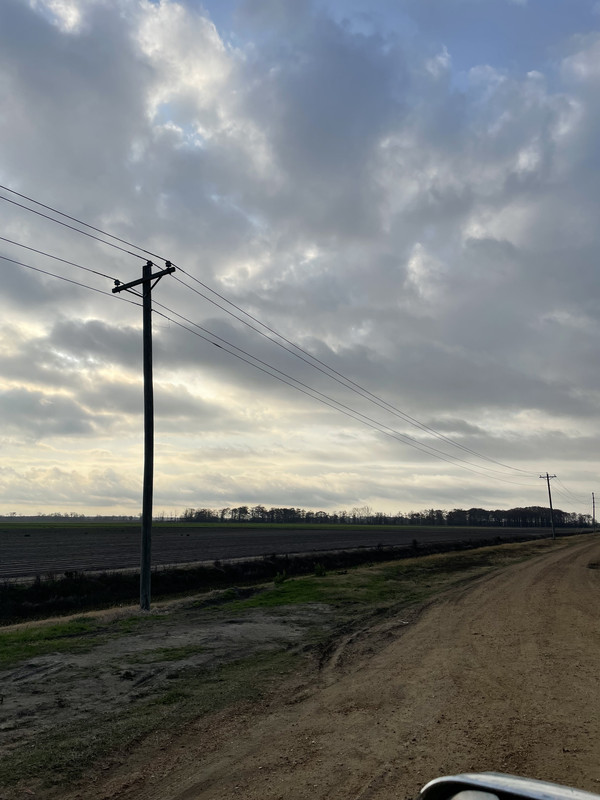
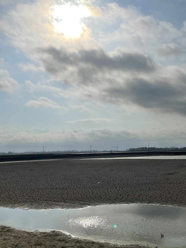
Definitely feels like a severe weather day. Warm humid and strong southern wind. Sky has “that look”
Posted on 12/10/21 at 8:33 am to deltaland
I still believe the Memphis into Northern MS area needs to be paying very close attention. The 12z HRRR shows cells pop preline just West of Memphis, and a break in the line over Northern MS that could lead to a semi-discrete cell or two developing with clean inflow. Eventually it looks to line out, but the line is going to pose problems even if we don't see solid rotation within it.

Posted on 12/10/21 at 8:47 am to The Boat
In South BR, walked outside this morning, its disgusting.. Porch covered in Dew... Humid as hell out there

Posted on 12/10/21 at 8:53 am to Impotent Waffle
Hell, I’m west of Houston and the south wind is pumping and the clouds are hauling arse. Certainly not a lot of deer moving in this weather.
Posted on 12/10/21 at 8:53 am to LegendInMyMind
For those readers here that think December tornadoes are nothing special, I will point out the December 16, 2000 tornado that came through Tuscaloosa and killed a dozen people.
Also it's the one tornado that I got hit by.
James Spann live coverage of December 2000 tornado
Also it's the one tornado that I got hit by.
James Spann live coverage of December 2000 tornado
Posted on 12/10/21 at 9:00 am to East Coast Band
We were in the Smokeys for that storm, it was wild but no tornados thankfully.
Driving back home through all the damaged city was crazy ...
Drive took forever
Driving back home through all the damaged city was crazy ...
Drive took forever
Posted on 12/10/21 at 9:35 am to LegendInMyMind
They keep upping the high temp for today. Sun it out it was supposed to stay cloudy but the sun is bright and heating quickly. Supposed to get to 82 now.
I really think the instability will be worse here than expected. It’s so humid the paved roads are soaking wet and puddling water and it hasn’t rained
You can see the humidity haze against the trees. It just feels unstable out here I don’t know what the dew point will reach but I’m betting it gets higher than originally expected
This post was edited on 12/10/21 at 9:39 am

 Page 4 of 90

Popular
Back to top