




- My Forums
- Tiger Rant
- LSU Recruiting
- SEC Rant
- Saints Talk
- Pelicans Talk
- More Sports Board
- Fantasy Sports
- Golf Board
- Soccer Board
- O-T Lounge
- Tech Board
- Home/Garden Board
- Outdoor Board
- Health/Fitness Board
- Movie/TV Board
- Book Board
- Music Board
- Political Talk
- Money Talk
- Fark Board
- Gaming Board
- Travel Board
- Food/Drink Board
- Ticket Exchange
- TD Help Board
Customize My Forums- View All Forums
- Show Left Links
- Topic Sort Options
- Trending Topics
- Recent Topics
- Active Topics
Started By
Message
re: Tornado! Louisiana and Mississippi Edition
Posted on 11/29/16 at 9:48 pm to When in Rome

Posted on 11/29/16 at 9:48 pm to When in Rome
Yeah. Its still a big bag of "what if" in terms of the really bad stuff. Ought to get a lightshow nonetheless with some gusty winds.
 1
1


Posted on 11/29/16 at 9:49 pm to rds dc
quote:
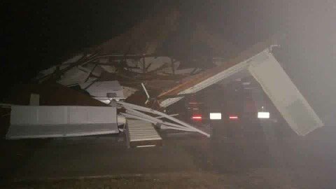
From earlier in Durant, MS
Dorthy heading in..



Posted on 11/29/16 at 9:49 pm to Duke
I don't like the what ifs. 


Posted on 11/29/16 at 9:50 pm to When in Rome
We had some bad winds up here last night. Blew down about 400 foot of wood fence that hadn't had time for the concrete to set. Will see how the rest survives tonight.
Posted on 11/29/16 at 9:51 pm to rds dc

MESOSCALE DISCUSSION 1849 NWS STORM PREDICTION CENTER NORMAN OK 0947 PM CST TUE NOV 29 2016 AREAS AFFECTED...PORTIONS OF CENTRAL/SOUTHWEST MS INTO EASTERN LA CONCERNING...TORNADO WATCH 508... VALID 300347Z - 300445Z THE SEVERE WEATHER THREAT FOR TORNADO WATCH 508 CONTINUES. SUMMARY...THE RISK FOR TORNADOES -- POSSIBLY SIGNIFICANT -- IS INCREASING ACROSS THE AREA. DISCUSSION...DISCRETE/SEMI-DISCRETE SUPERCELL STRUCTURES ARE ONGOING FROM NORTHEAST OF VICKSBURG MS SOUTHWESTWARD INTO EAST-CENTRAL LA... AND ADDITIONAL CONVECTION IS DEVELOPING EASTWARD TOWARD INTERSTATE 55. ALL OF THIS ACTIVITY WILL CONTINUE TRACKING EAST-NORTHEASTWARD. THE JACKSON MS VAD WIND PROFILE IS INDICATING AROUND 300 M2/S2 OF 0-1-KM SRH WITH AROUND 60 KT OF DEEP SHEAR. WITH AMPLE LOW-LEVEL MOISTURE CONTINUING TO EXIST ACROSS THE AREA AIDING IN THE MAINTENANCE OF AROUND 1000 J/KG OF MLCAPE...SUPERCELLS WITH A TORNADO RISK WILL EXIST...AND SIGNIFICANT TORNADOES WILL BE POSSIBLE. THE CORRIDOR AROUND THE NATCHEZ TRACE PARKWAY...AND EASTWARD TOWARD THE INTERSTATE 55 CORRIDOR NEAR/SOUTH OF INTERSTATE 20...COULD BE A FAVORED ZONE FOR MATURING SUPERCELL STRUCTURES CAPABLE OF TORNADOES IN THE SHORT-TERM. ..COHEN.. 11/30/2016
This post was edited on 11/29/16 at 9:52 pm
Posted on 11/29/16 at 9:51 pm to When in Rome
I dont either.
Just got work started on my flooded house. If a tornado takes it out...
I'll be really pissed off I guess.
Just got work started on my flooded house. If a tornado takes it out...
I'll be really pissed off I guess.
Posted on 11/29/16 at 9:52 pm to Bushmaster
Man, what a pain.


Posted on 11/29/16 at 9:52 pm to rds dc
EBR and Ascension look ok for now?
Posted on 11/29/16 at 9:52 pm to Duke
Yeah, that would not be good.


Posted on 11/29/16 at 9:53 pm to When in Rome
Directly in the path of tornado just south of Athens, AL
Posted on 11/29/16 at 9:54 pm to HoLeInOnEr05
Why are you posting?
Posted on 11/29/16 at 9:56 pm to When in Rome
quote:
Too soon to tell how bad it's going to get for south LA?
Yea, the New Orleans weather balloon launch from earlier this evening still showed some things that would keep storms from really getting going until much later. If that holds, then it will most likely be a nasty squall line with straight line winds but pretty low tornado threat. Radar still seems to support that. Keep an eye out for any storms the try to fire off to the SW of BR down towards the coast.
Posted on 11/29/16 at 9:56 pm to When in Rome
No shite. The fence was 2800 ft long. It wasn't cheap.

Posted on 11/29/16 at 9:58 pm to rds dc
Alabama, north Louisiana, Mississippi, Tennessee and Georgia have a 2nd tornado season in November-December. And they usually occur at night. Sucks . And bama is bone dry. Pray for my friends tonight up there and Tennessee.

Posted on 11/29/16 at 9:59 pm to rds dc
Crap
Posted on 11/29/16 at 10:02 pm to rds dc

Posted on 11/29/16 at 10:08 pm to biggsc
Things are messy looking but starting to see some signs that some of these cells are trying to take on supercell structures.

Posted on 11/29/16 at 10:10 pm to sheek
I'd say north Mississippi and north Alabama, you don't see many tornadoes on the coast.


Posted on 11/29/16 at 10:11 pm to rds dc
Are you expecting the storms currently Beaumont, Deridder to push East to Laffy/BR with supercell potential?

 Page 8 of 10

Popular
Back to top
 Follow TigerDroppings for LSU Football News