- My Forums
- Tiger Rant
- LSU Recruiting
- SEC Rant
- Saints Talk
- Pelicans Talk
- More Sports Board
- Fantasy Sports
- Golf Board
- Soccer Board
- O-T Lounge
- Tech Board
- Home/Garden Board
- Outdoor Board
- Health/Fitness Board
- Movie/TV Board
- Book Board
- Music Board
- Political Talk
- Money Talk
- Fark Board
- Gaming Board
- Travel Board
- Food/Drink Board
- Ticket Exchange
- TD Help Board
Customize My Forums- View All Forums
- Show Left Links
- Topic Sort Options
- Trending Topics
- Recent Topics
- Active Topics
Started By
Message
re: Tornado! High Risk Day w/ 3 Active PDS Watches
Posted on 1/20/17 at 9:07 pm to East Coast Band
Posted on 1/20/17 at 9:07 pm to East Coast Band
quote:
familiar with James Spann?
Pretty much the best TV met there is. Guy is money when it comes to svr wx in the south.
 2
2


Posted on 1/20/17 at 9:09 pm to rds dc
Looks like that tornado cell split into two.

Posted on 1/20/17 at 9:11 pm to rds dc
Is James Spann's coat on/off? Sleeves up/down? Thats how I know severity of storm.
Posted on 1/20/17 at 9:12 pm to tigerinthebueche
quote:
Oh look another RDS thread predicting imminent death and destruction. Dude is a master at trolling.
I like his post and I'm sure most everyone else does too.
Do you have something to add to help out or are you just the typical OT tard?
Posted on 1/20/17 at 9:18 pm to notiger1997
It's not his fault that storms sometimes fizzle out.

Posted on 1/20/17 at 9:21 pm to rds dc
Definitely some potential for more rotation to develop in several places, kinda odd looking velocity right now.


Posted on 1/20/17 at 9:35 pm to rds dc
If you don't already (and you aren't him) ,you ought to follow him on Twitter.
He's real good about retreating a lot of weather events across the country, but he does focus on Alabama, of course.
Plus, he'll retweet a hundred sunset photos everydsy.lol.
He's real good about retreating a lot of weather events across the country, but he does focus on Alabama, of course.
Plus, he'll retweet a hundred sunset photos everydsy.lol.
Posted on 1/20/17 at 10:08 pm to rds dc
ZCZC SPCPWOSPC ALL
WOUS40 KWNS 210337
ALZ000-LAZ000-MSZ000-211200-
PUBLIC SEVERE WEATHER OUTLOOK
NWS STORM PREDICTION CENTER NORMAN OK
0937 PM CST FRI JAN 20 2017
...Severe thunderstorms expected over parts of the overnight...
* LOCATIONS...
Southern Louisiana
Southern Mississippi
Southwestern Alabama
* HAZARDS...
A few intense tornadoes
Scattered damaging winds
Isolated large hail up to baseball size
* SUMMARY...
Scattered severe storms are expected to continue developing this
evening across southwestern Louisiana, and spread across the
lower Mississippi Valley and into Alabama and the Florida
Panhandle tonight through Saturday morning. A few tornadoes,
some of which could be strong, large hail and damaging winds
will all be possible.
Preparedness actions...
Tornadoes at night can be particularly dangerous because they
are usually fast-moving and difficult to see. Stay tuned to
NOAA Weather Radio, weather.gov, or other media for watches and
warnings. A tornado watch means that conditions are favorable
for tornadoes to form during the next several hours. If a tornado
warning is issued for your area, move to a place of safety,
ideally in a basement or interior room on the lowest floor of a
sturdy building.
&&
..Edwards.. 01/21/2017
$$


Posted on 1/20/17 at 10:11 pm to Oops Wrong Thread
My new favorite alter, pick your posts wisely so you don't wear it out quick
Posted on 1/20/17 at 10:13 pm to Dizz
quote:
It's not his fault that storms sometimes fizzle out.
We keep the George Bush Weather Machine in the basement at my work
Posted on 1/20/17 at 10:15 pm to rds dc
Damn sons
shite getting real tonight down here huh.
shite getting real tonight down here huh.
Posted on 1/20/17 at 10:35 pm to jefforize
Rizer wtf are you up to these days?
Rds don't know shite - he can bake a fine cake though.
Rds don't know shite
Posted on 1/20/17 at 10:35 pm to rds dc
Looks like there's a definite strong tornado with 4~ in. hail right outside Reeves headed toward Oberlin. This is the same cell that's had the warning all night so far, looks like it'll be the one to watch as it crosses LA. Tornado index, hot storm index, helicity index, and hail index all show 10/10, usually indicates an EF3 - EF5. I wish it was daylight so we could see some chasers on it, since it's rural right now.
This post was edited on 1/20/17 at 10:36 pm
Posted on 1/20/17 at 10:46 pm to RazorBroncs
Update from NWS New Orleans


Posted on 1/20/17 at 10:47 pm to rmnldr
Guess we better get in the basement.
Posted on 1/20/17 at 10:48 pm to rds dc
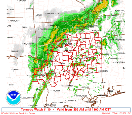
New tornado watch coming soon

Mesoscale Discussion 0083
NWS Storm Prediction Center Norman OK
1044 PM CST Fri Jan 20 2017
Areas affected...southeast Louisiana through southern Mississippi
Concerning...Severe potential...Watch needed soon
Valid 210444Z - 210545Z
Probability of Watch Issuance...95 percent
SUMMARY...Threat for a few tornadoes, damaging wind and large hail
will gradually expand east into southeast LA and southern MS through
the early morning hours. A tornado watch will be issued by around
05Z.
DISCUSSION...Late this evening a warm front extends from near the
Gulf Coast through southern LA. This boundary will move slowly north
through the early morning as the low-level jet strengthens in
response to a northeastward-ejecting shortwave trough. Northward
advection of richer low-level moisture and eastward expansion of
elevated mixed layer plume will destabilize the atmosphere
downstream from storms currently developing from southwest through
south-central LA. The destabilization process, increasing low-level
hodograph size and strong effective bulk shear will promote
supercells and bowing segments as storms continue east. Greatest
tornado threat may be as storms interact with warm front. Otherwise,
large hail and damaging wind will also be likely.
..Dial/Edwards.. 01/21/2017
Posted on 1/20/17 at 10:57 pm to bubbz
Watching hockey and playing nhl 17 fam
Posted on 1/20/17 at 11:02 pm to bubbz
quote:
Rds don't know shite - he can bake a fine cake though.
How do you think I keep getting promotions!?

 Page 2 of 27

Back to top