




- My Forums
- Tiger Rant
- LSU Recruiting
- SEC Rant
- Saints Talk
- Pelicans Talk
- More Sports Board
- Fantasy Sports
- Golf Board
- Soccer Board
- O-T Lounge
- Tech Board
- Home/Garden Board
- Outdoor Board
- Health/Fitness Board
- Movie/TV Board
- Book Board
- Music Board
- Political Talk
- Money Talk
- Fark Board
- Gaming Board
- Travel Board
- Food/Drink Board
- Ticket Exchange
- TD Help Board
Customize My Forums- View All Forums
- Show Left Links
- Topic Sort Options
- Trending Topics
- Recent Topics
- Active Topics
Started By
Message
re: Tornado! High Risk Day w/ 3 Active PDS Watches
Posted on 1/21/17 at 6:09 pm to Salmon

Posted on 1/21/17 at 6:09 pm to Salmon
quote:
Crazy that it is all quiet in Shreveport but it all around us
That's what I was just thinking. I'm in the South Highlands area and still nothing here. Radar has us in a sort of bubble right now. Hoping it stays that way.
 0
0


Posted on 1/21/17 at 6:09 pm to Salmon
quote:
Crazy that it is all quiet in Shreveport but it all around us
5 active tornado warnings in the immediate area.


Posted on 1/21/17 at 6:12 pm to slackster
South of us too around Natchitoches
This post was edited on 1/21/17 at 6:13 pm
Posted on 1/21/17 at 6:13 pm to Salmon
The south of you will be helpful. It'll cut off the warm flow into your area.
Posted on 1/21/17 at 6:16 pm to Salmon
Warning got extended in Natchitoches area and a new one was just issued right below it.



Posted on 1/21/17 at 6:18 pm to tiger rag 93

When shite gets real.


Posted on 1/21/17 at 6:19 pm to slackster
Gonna have to see what the northward progression of the war front is/how far north it can get. That will play the main role in who in places like the southern half of MS and AL will be in the greatest risk.
Posted on 1/21/17 at 6:29 pm to Roll Tide Ravens
Won't be surprised if this storm gets warned in the near future. North of Bay St. Louis moving ENE.

Posted on 1/21/17 at 6:34 pm to slackster
Crazy how close this tornado outlook has come to defining where the cells would pop up, especially considering this was issued when there wasn't a cell to be found in LA or even east TX to be honest.
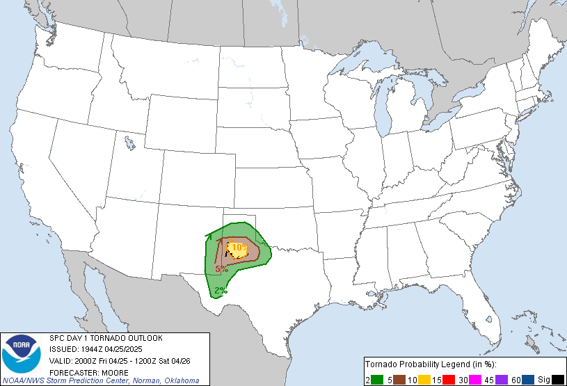
The 10% area runs from the Red River to the Mississippi River, and then the Mississippi River to the GOM. So far we haven't seen any tornado warnings west of that line and everything early is occurring right on that line.
The 10% area runs from the Red River to the Mississippi River, and then the Mississippi River to the GOM. So far we haven't seen any tornado warnings west of that line and everything early is occurring right on that line.
Posted on 1/21/17 at 6:36 pm to slackster
How does greenville ms look tonight? Sitting here at a hunting camp really hoping we don't see hail or bad weather tonight.

Posted on 1/21/17 at 6:44 pm to slackster
The cell near Rosedale is definitely one to watch into the night. All alone since it started south of Lafayette and has steadily strengthened. Don't know if it will get it's act together before BR/Zachary, but it has had an impressive ~2 hours or so.

Posted on 1/21/17 at 6:46 pm to TigerDog83
quote:
How does greenville ms look tonight? Sitting here at a hunting camp really hoping we don't see hail or bad weather tonight.
Ehh...
Not great. Your window is supposed to be from 7-12pm.

Posted on 1/21/17 at 6:50 pm to slackster
I think the Rosedale cell is more likely to get really popping off north of BR as it gets toward Mississippi. Basically right where the 10% tornado line is.

Posted on 1/21/17 at 6:52 pm to Salmon
Supposedly a tornado touched down in Natchitoches Parish east of the city
Posted on 1/21/17 at 6:53 pm to slackster
Tornado warning for Mobile.
quote:
052
WFUS54 KMOB 220049
TORMOB
ALC097-220130-
/O.NEW.KMOB.TO.W.0012.170122T0049Z-170122T0130Z/
BULLETIN - EAS ACTIVATION REQUESTED
Tornado Warning
National Weather Service Mobile AL
649 PM CST SAT JAN 21 2017
The National Weather Service in Mobile has issued a
* Tornado Warning for...
Central Mobile County in southwestern Alabama...
* Until 730 PM CST
* At 649 PM CST, a severe thunderstorm capable of producing a tornado
was located 7 miles southwest of Mobile Regional Airport, or 8
miles west of Tillmans Corner, moving northeast at 40 mph.
HAZARD...Tornado and half dollar size hail.
SOURCE...Radar indicated rotation.
IMPACT...Flying debris will be dangerous to those caught without
shelter. Mobile homes will be damaged or destroyed.
Damage to roofs, windows, and vehicles will occur. Tree
damage is likely.
* This dangerous storm will be near...
Tillmans Corner around 655 PM CST.
Mobile Regional Airport and I10 And I65 around 700 PM CST.
Midtown Mobile and Semmes around 705 PM CST.
Downtown Mobile around 710 PM CST.
Prichard, Chickasaw, I65 And AL 158 and I65 And I165 around 715 PM
CST.
Saraland around 720 PM CST.
Satsuma around 725 PM CST.
Creola around 730 PM CST.
PRECAUTIONARY/PREPAREDNESS ACTIONS...
TAKE COVER NOW! Move to a basement or an interior room on the lowest
floor of a sturdy building. Avoid windows. If you are outdoors, in a
mobile home, or in a vehicle, move to the closest substantial shelter
and protect yourself from flying debris.
&&
LAT...LON 3053 8840 3060 8841 3096 8829 3090 8794
3089 8794 3090 8796 3088 8798 3086 8798
3086 8796 3085 8796 3087 8794 3086 8794
3077 8802 3076 8802 3077 8801 3052 8813
3048 8825
TIME...MOT...LOC 0049Z 217DEG 35KT 3059 8831
TORNADO...RADAR INDICATED
HAIL...1.25IN
$$
Posted on 1/21/17 at 6:56 pm to Duke
quote:
I think the Rosedale cell is more likely to get really popping off north of BR as it gets toward Mississippi. Basically right where the 10% tornado line is.
It is organizing pretty quickly now
Posted on 1/21/17 at 6:57 pm to rds dc
New PDS tornado watch issued, be safe in S. Bama tonight. 1st January PDS since 2012.

This post was edited on 1/21/17 at 6:58 pm
Posted on 1/21/17 at 7:00 pm to rds dc
The radar indicated tornado to the southwest of El Dorado, Arkansas is starting to tighten up quite a bit.

Posted on 1/21/17 at 7:03 pm to rds dc
quote:
It is organizing pretty quickly now
Just got a severe thunderstorm warning on it.
[img]477
WUUS54 KLIX 220057
SVRLIX
LAC033-037-077-121-220130-
/O.NEW.KLIX.SV.W.0023.170122T0057Z-170122T0130Z/
BULLETIN - IMMEDIATE BROADCAST REQUESTED
Severe Thunderstorm Warning
National Weather Service New Orleans LA
657 PM CST SAT JAN 21 2017
The National Weather Service in New Orleans has issued a
* Severe Thunderstorm Warning for...
Northwestern West Baton Rouge Parish in southeastern Louisiana...
Southeastern Pointe Coupee Parish in southeastern Louisiana...
Northwestern East Baton Rouge Parish in southeastern Louisiana...
Southern East Feliciana Parish in southeastern Louisiana...
* Until 730 PM CST
* At 656 PM CST, a severe thunderstorm was located near Erwinville,
or 9 miles southeast of New Roads, moving northeast at 45 mph.
HAZARD...Quarter size hail.
SOURCE...Radar indicated.
IMPACT...Damage to vehicles is expected.
* Locations impacted include...
Zachary, Baker, Slaughter, Pride and Erwinville.
PRECAUTIONARY/PREPAREDNESS ACTIONS...
For your protection move to an interior room on the lowest floor of a
building.
&&
A tornado watch remains in effect until 900 PM CST for southeastern
Louisiana.
LAT...LON 3068 9135 3066 9133 3065 9131 3067 9130
3070 9132 3071 9131 3088 9109 3071 9090
3048 9144 3059 9147
TIME...MOT...LOC 0056Z 233DEG 38KT 3058 9137
HAIL...1.00IN
WIND...<50MPH
$$
[/img]
Posted on 1/21/17 at 7:03 pm to rds dc
Text to go with the watch graphic:
quote:
URGENT - IMMEDIATE BROADCAST REQUESTED Tornado Watch Number 17 NWS Storm Prediction Center Norman OK 650 PM CST Sat Jan 21 2017 The NWS Storm Prediction Center has issued a * Tornado Watch for portions of Central and southern Alabama Western and central Florida Panhandle Small part of southeastern Mississippi Coastal Waters * Effective this Saturday night and Sunday morning from 650 PM until 300 AM CST. ...THIS IS A PARTICULARLY DANGEROUS SITUATION... * Primary threats include... Several tornadoes and a few intense tornadoes likely Scattered damaging winds and isolated significant gusts to 75 mph possible Isolated very large hail events to 2.5 inches in diameter possible SUMMARY...A cluster of storms now moving into extreme southwestern Alabama is the first of what likely will be several areas of severe weather moving across this watch overnight. As a warm front moves northward across the region, conditions will moisten and destabilize considerably amidst strong vertical shear. The resulting parameter space is one often associated with long-lasting, intense tornadoes rated EF2 or greater. The tornado watch area is approximately along and 100 statute miles north and south of a line from 80 miles north of Mobile AL to 50 miles south of Columbus GA. For a complete depiction of the watch see the associated watch outline update (WOUS64 KWNS WOU7). PRECAUTIONARY/PREPAREDNESS ACTIONS... REMEMBER...A Tornado Watch means conditions are favorable for tornadoes and severe thunderstorms in and close to the watch area. Persons in these areas should be on the lookout for threatening weather conditions and listen for later statements and possible warnings. && OTHER WATCH INFORMATION...CONTINUE...WW 15...WW 16... AVIATION...Tornadoes and a few severe thunderstorms with hail surface and aloft to 2.5 inches. Extreme turbulence and surface wind gusts to 65 knots. A few cumulonimbi with maximum tops to 450. Mean storm motion vector 25030. ...Edwards

 Page 14 of 27

Popular
Back to top
 Follow TigerDroppings for LSU Football News