- My Forums
- Tiger Rant
- LSU Recruiting
- SEC Rant
- Saints Talk
- Pelicans Talk
- More Sports Board
- Fantasy Sports
- Golf Board
- Soccer Board
- O-T Lounge
- Tech Board
- Home/Garden Board
- Outdoor Board
- Health/Fitness Board
- Movie/TV Board
- Book Board
- Music Board
- Political Talk
- Money Talk
- Fark Board
- Gaming Board
- Travel Board
- Food/Drink Board
- Ticket Exchange
- TD Help Board
Customize My Forums- View All Forums
- Show Left Links
- Topic Sort Options
- Trending Topics
- Recent Topics
- Active Topics
Started By
Message
re: Southeast and Midwest Severe Weather Outbreak & Flood Event: April 2-7, 2025
Posted on 4/6/25 at 5:02 am to Roll Tide Ravens

Posted on 4/6/25 at 5:02 am to Roll Tide Ravens
Confirmed tornado near Bay Spring, MS. Not too far north of Laurel.

Debris signature on radar:

Debris signature on radar:
This post was edited on 4/6/25 at 5:07 am
 1
1

Posted on 4/6/25 at 5:16 am to Roll Tide Ravens
That’s not fun to wake up to.

Posted on 4/6/25 at 8:02 am to WylieTiger
quote:
That’s not fun to wake up to.
Speaking of things not fun to wake up to, at 6:30 this morning I was sound asleep when a flash of light and what sounded like a 500 lb bomb exploding woke us up. Pretty sure it hit one of the transformer boxes because now the power is out at our house and the houses around our cul-de-sac. We got an alert from Alabama power right after that they’ve detected the outage and their “estimated” repair time is 9:30 AM. Is 8:00 now and I still haven’t seen an Alabama Power truck.
Scared the hell out of us. We initially thought the lighting had hit our house.
This post was edited on 4/6/25 at 8:04 am
Posted on 4/6/25 at 11:16 am to Darth_Vader
That's a whole lot of water that now has to go somewhere.
Loading Twitter/X Embed...
If tweet fails to load, click here.Posted on 4/6/25 at 11:45 am to LegendInMyMind
Been a rough spring so far, especially for northern Arkansas and southern Missouri.
Bakersfield, MO got an EF3 tornado, fires, and flooding, all within a couple of weeks.
West Plains, MO has had numerous tornadoes in the area and is now flooded.
Diaz, AR is damaged heavily, as are Cave City, AR and Lake City, AR.
Then you also have multiple areas in the region still trying to recover from EF3 tornadoes last spring.
Posted on 4/6/25 at 11:49 am to LegendInMyMind
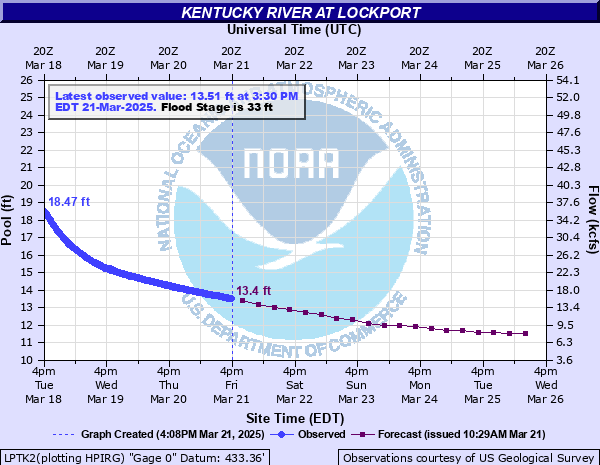
Looks rough for some parts of Kentucky. 28 years since last major flood and 6 more feet before cresting.
Historic Crests
1. 56.85 ft on 01-26-1937
2. 53.60 ft on 03-06-1997
Flood Impacts ??
54 - Low lying roads near the river along and west of KY 355 flood.
51 - More than half of Monterey floods. Water is four feet deep in homes closest to the river. Water is up to two feet deep on Taylor St. Flooding may occur in low lying buildings along Crittenden Street in Gratz.

Posted on 4/6/25 at 11:53 am to LegendInMyMind
Yeah it’s pretty nasty right now. They’ve got the sandbags out in Frankfort for fear that the water is going to get up over the flood walls.
Loading Twitter/X Embed...
If tweet fails to load, click here.Posted on 4/6/25 at 12:04 pm to BluegrassBelle
Posted on 4/6/25 at 12:23 pm to LegendInMyMind
Fortunately the hogs love the slop.

Posted on 4/6/25 at 12:40 pm to beaverfever
I’ll never forget the shot ton of rain we got in Monroe spring of 16. It was surreal driving around and seeing water like that.

Posted on 4/6/25 at 4:41 pm to LegendInMyMind
Flood Stages Question-
The rain is currently moving through GA and I'm monitoring my local NWS/NOAA stream gauge for my local creek.
There are 4 levels of flood on the graph-
1- Action
2- Minor
3- Moderate
4- Major
My stream gauge is in the "Action" zone. What does this mean?
The rain is currently moving through GA and I'm monitoring my local NWS/NOAA stream gauge for my local creek.
There are 4 levels of flood on the graph-
1- Action
2- Minor
3- Moderate
4- Major
My stream gauge is in the "Action" zone. What does this mean?
Posted on 4/6/25 at 4:42 pm to Pedro
People out here wakeboarding on 67/167

Posted on 4/6/25 at 4:43 pm to Roll Tide Ravens
Posted on 4/6/25 at 4:53 pm to deeprig9
quote:
My stream gauge is in the "Action" zone. What does this mean?
I had no idea, but good ol' Wikipedia came through for me:
quote:
Action Stage
Rivers: typically at this level, the water surface is generally near or slightly above the top of its banks, but no man-made structures are flooded; typically any water overflowing is limited to small areas of parkland or marshland.
It has the definitions/standards of the others, as well
Posted on 4/6/25 at 5:20 pm to LegendInMyMind
Posted on 4/6/25 at 6:08 pm to Mr Roboto
I need that stalling arse front to move on already.
Of course we’re under a freeze watch for in the AM.
Of course we’re under a freeze watch for in the AM.
Posted on 4/6/25 at 6:17 pm to Mr Roboto
We got 2.75" of rain last night/this morning in my part of north AL.
Posted on 4/6/25 at 6:27 pm to Mr Roboto
Damn that’s a lot of agua.
Posted on 4/6/25 at 7:37 pm to beaverfever
Surveys for the Sheffield and Florence tornadoes last night:
Loading Twitter/X Embed...
If tweet fails to load, click here.
Posted on 4/6/25 at 7:41 pm to WhuckFistle
quote:
People out here wakeboarding on 67/167
That's the newly signed I-57

 Page 36 of 38

Popular
Back to top