- My Forums
- Tiger Rant
- LSU Recruiting
- SEC Rant
- Saints Talk
- Pelicans Talk
- More Sports Board
- Fantasy Sports
- Golf Board
- Soccer Board
- O-T Lounge
- Tech Board
- Home/Garden Board
- Outdoor Board
- Health/Fitness Board
- Movie/TV Board
- Book Board
- Music Board
- Political Talk
- Money Talk
- Fark Board
- Gaming Board
- Travel Board
- Food/Drink Board
- Ticket Exchange
- TD Help Board
Customize My Forums- View All Forums
- Show Left Links
- Topic Sort Options
- Trending Topics
- Recent Topics
- Active Topics
Started By
Message
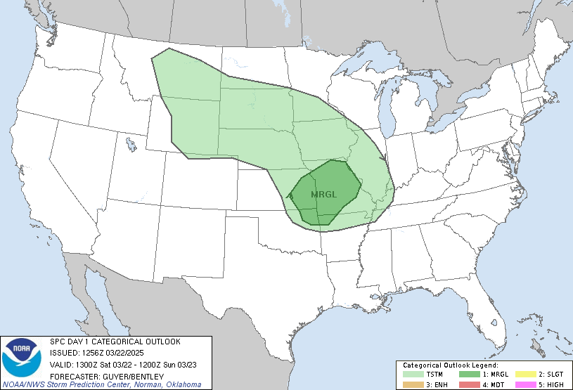
Pre-Thanksgiving Severe Weather
Posted on 11/19/23 at 6:02 am
Posted on 11/19/23 at 6:02 am
Monday...

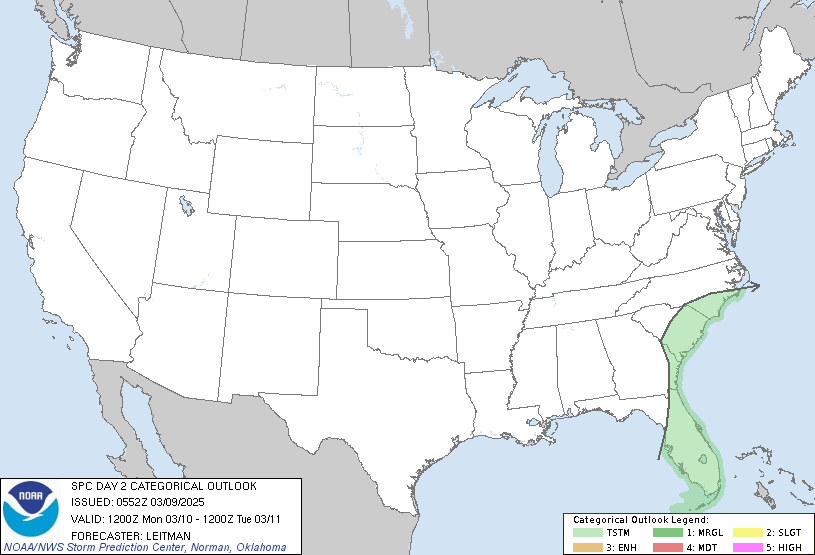
Tuesday...

Updated ...

Tuesday...

quote:
...SUMMARY... Tornadoes (some strong), damaging thunderstorm winds and isolated large hail are expected from this afternoon across east Texas and parts of Louisiana, into tonight across the Delta region into portions of Mississippi and Alabama. ...Synopsis... The mid/upper-level pattern will be dominated by extensive, progressive synoptic troughing, shifting eastward across the central CONUS. A broad, complex cyclone, with multiple circulation centers and vorticity maxima, is apparent in moisture-channel imagery from SD through the central Plains and parts of the lower Missouri Valley, to the southern High Plains and parts of OK. Part of a northern-stream shortwave trough over western Canada is expected to dig southeastward to the northern Plains through the period. As that occurs, a 500-mb low should consolidate across central/eastern KS today, shifting across northern MO toward northern IL by the end of the period. A high-amplitude, positively tilted trough will extend southwestward from that low, reaching the Ozarks, north-central to southwest TX, and Chihuahua/Sonora by 12Z tomorrow. A surface low was analyzed at 11Z near CHK, with cold front across southwestern OK to the TX South Plains and east-central NM. In response to the mid/upper-level processes, the low should move/ redevelop southeastward over the Arklatex by 00Z, then swing northeastward to near EVV by 12Z. At 00Z, the cold front should extend southwestward over east TX and deep south TX. The warm front's baroclinicity should diffuse somewhat diurnally and shift rapidly northeastward across LA and portions of MS today. The warm front should reach parts of western/southern AL overnight before being overtaken from north-south by the cold front or (more likely, by then) pre-cold-frontal belt of convection. ...East TX/Arklatex to central Gulf Coast States... Multiple rounds of thunderstorms are possible through tonight along and especially ahead of the cold front, shifting northeastward and eastward across the outlooked areas. Convection may develop earliest -- in the next few hours -- in/near an expanding field of midlevel UVV and related altocumuli now apparent in satellite imagery over north-central/northeast TX. The 12Z FWD sounding indicates these clouds were rooted near 600 mb, though they have deepened since, and that a weak EML-capping regime persists. Any sustained thunderstorms developing in this area will pose a large- hail threat initially, but what becomes surface-based may pose wind and perhaps tornado concern later today as the boundary layer beneath destabilizes. This convection should expand/shifts east- northeastward toward the Arklatex vicinity. The core concentration of severe threat -- including the potential for several tornadoes, some strong (EF2+) -- should be from parts of east TX across central LA to central/southern MS this afternoon into late evening. In step with the warm front, 60s F surface dewpoints are expected to shift east-northeastward. Though tempered some by low-cloud cover, diabatic heating (along with theta-e advection) should destabilize the warm sector diurnally. This will remove MLCINH, favoring potential for gradual development ahead of the main band of lift over east TX, as well as supporting strong-severe thunderstorms in the band. In turn, that renders the possibility of supercells with long warm-sector residence times in 500-1200 J/kg MLCAPE, 55-65 kt effective-shear magnitudes, 200-400 J/kg effective SRH, and 100-250 J/kg of 1/2-km SRH,. Highest SRH and largest hodographs should be in the evening, near an LLJ. However, considerable uncertainty remains as to number/coverage of storms that can remain restively discrete while in that environment. If confidence increases in associated longer-tracked tornado potential, based on 12Z guidance and daylight mesoanalysis trends, an upgrade may be needed in a succeeding outlook. Overnight, a line of strong-severe thunderstorms should continue advancing eastward over the remainder of MS and into parts of AL, gradually moving into progressively weaker (but still at least marginally favorable) surface-based buoyancy by 12Z. The eastern extent still is uncertain, given a common bias in models (including most convection-allowing guidance as well as synoptic progs) to underforecast nocturnal squall-line speed in this area of the country. Therefore actual severe potential by 12Z probably has a much sharper east edge than we can depict now, due to those timing uncertainties. Embedded mesovortices, moving into favorable SRH and high RH, but weak low-level lapse rates, will locally maximize the damaging-wind threat and at least brief tornado potential tonight.
Updated ...
This post was edited on 11/20/23 at 7:09 am
Posted on 11/19/23 at 6:37 am to East Coast Band
Good, our food plots need the rain.
Posted on 11/19/23 at 9:15 am to East Coast Band
Between the hurricanes, hard freeze and drought, I’m not looking forward to heavy winds. Lots of dead trees in the woods
Posted on 11/19/23 at 9:48 am to East Coast Band
Seeing a lot of dead looking trees close houses and power lines. If we get enough heavy wind, insurance rate hikes incoming and power outages coming.
Posted on 11/19/23 at 10:25 am to East Coast Band
quote:
Relatively rich
OT poor for comparison sake for the non-weather guys
Posted on 11/19/23 at 10:33 am to East Coast Band
We desperately need the rain though. It’s been dry as bone here the last month and a half.
Posted on 11/19/23 at 10:40 am to BluegrassBelle
Time to get your bone wet.
Posted on 11/19/23 at 10:42 am to East Coast Band
TORCON 3 for most of LA tomorrow.
Posted on 11/19/23 at 11:12 am to East Coast Band
First severe chance for the Fall/Winter season. I'm hoping for some decent rain in north AL with no big wind. Locals are calling for gusts of 40-50mph.
For us, three or four days ago the GFS was showing over 4.5". When the NAM got into range it was showing just under 3". Now that the HRRR is in range, it brings us maybe 1".
Any amount of rain is welcomed as long as it isn't a huge amount and the wind isn't too bad.
For us, three or four days ago the GFS was showing over 4.5". When the NAM got into range it was showing just under 3". Now that the HRRR is in range, it brings us maybe 1".
Any amount of rain is welcomed as long as it isn't a huge amount and the wind isn't too bad.
Posted on 11/19/23 at 11:24 am to Paul Allen
That’s a pretty big deal…
Posted on 11/19/23 at 11:55 am to East Coast Band
Just got the bump to Enhanced with a 10% hatched for tornadoes.


Posted on 11/19/23 at 12:08 pm to LegendInMyMind
TORCON 5 in the darker red shaded areas in central LA. Just saw this on Weather Channel.
Posted on 11/19/23 at 12:57 pm to LegendInMyMind
Need the rain.
Any significant wind and this is going to be like a hurricane coming through with all the dead trees.
Any significant wind and this is going to be like a hurricane coming through with all the dead trees.
Posted on 11/19/23 at 1:17 pm to Paul Allen
quote:
TORCON
Do OT weather thread rules allow this?
Posted on 11/19/23 at 1:19 pm to TaderSalad
quote:
Awww hail…
Send that Hail Hail to Michigan!
Posted on 11/19/23 at 2:12 pm to BluegrassBelle
quote:T&Ps
It’s been dry as bone here the last month and a half.
Not here.
Posted on 11/19/23 at 2:12 pm to East Coast Band
quote:My porn name.
vigorous vorticity maximum
Popular
Back to top


 21
21


