- My Forums
- Tiger Rant
- LSU Recruiting
- SEC Rant
- Saints Talk
- Pelicans Talk
- More Sports Board
- Fantasy Sports
- Golf Board
- Soccer Board
- O-T Lounge
- Tech Board
- Home/Garden Board
- Outdoor Board
- Health/Fitness Board
- Movie/TV Board
- Book Board
- Music Board
- Political Talk
- Money Talk
- Fark Board
- Gaming Board
- Travel Board
- Food/Drink Board
- Ticket Exchange
- TD Help Board
Customize My Forums- View All Forums
- Show Left Links
- Topic Sort Options
- Trending Topics
- Recent Topics
- Active Topics
Started By
Message
re: Major Louisiana Flood Event
Posted on 3/13/16 at 3:48 pm to White Roach

Posted on 3/13/16 at 3:48 pm to White Roach
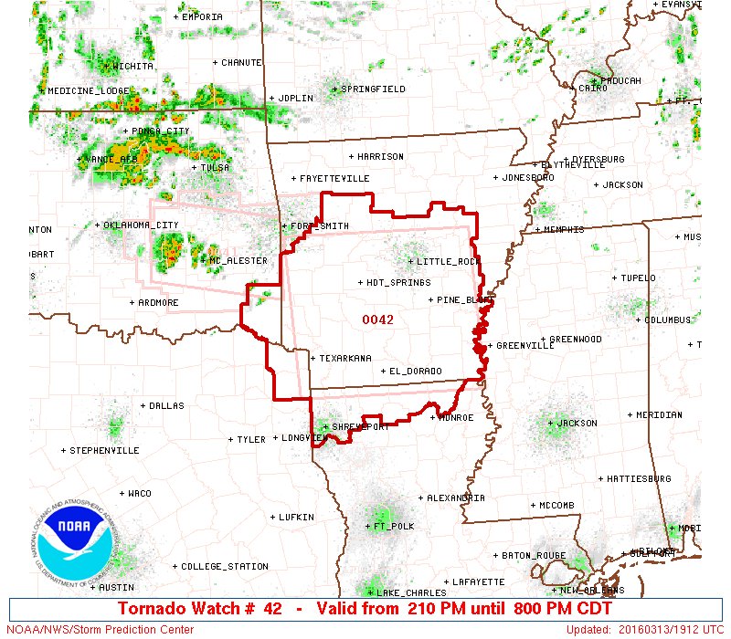
This is nuts. Line of cells trying to form in NWLA and it looks like they are gonna be potentially tornadic.
 2
2

Posted on 3/13/16 at 3:53 pm to Scoop
Hardly a few specs moving NE
This post was edited on 3/13/16 at 3:54 pm
Posted on 3/13/16 at 3:54 pm to Scoop
quote:
This is nuts. Line of cells trying to form in NWLA and it looks like they are gonna be potentially tornadic.
N. Louisiana might have the best parameters if any storms can fire in that area
Posted on 3/13/16 at 4:02 pm to rds dc
The action has grown a tail in the last 20 min or so. Popping in SW Arkansas but not extending into NWLA just yet.
Posted on 3/13/16 at 4:02 pm to rds dc
They are strengthening pretty quick once they form.
Posted on 3/13/16 at 4:22 pm to Scoop
Cells firing west of Monroe need to be watched. They shouldn't bring much in the way of heavy rain but no one up there wants to see anymore rain at this point.
Posted on 3/13/16 at 4:24 pm to rds dc
Sabine River flooding update

Posted on 3/13/16 at 4:26 pm to rds dc
Yeah, been watching them since they formed a little bit ago. Not showing much yet. I keep waiting on that cell Southwest of Little Rock headed that way to get a warning. It looks meaner than the ones with tornados north of it.
ETA it is showing circulation. Should be a warning in the next 10 minutes. Headed right for Little Rock.
ETA it is showing circulation. Should be a warning in the next 10 minutes. Headed right for Little Rock.
This post was edited on 3/13/16 at 4:29 pm

Posted on 3/13/16 at 4:39 pm to Hammertime
quote:I was going by the Tchefuncta gauge at 190
Not at my buddy's house. It was lower than Isaac on the Mandeville/Madisonville line
Posted on 3/13/16 at 4:50 pm to rds dc
There is a tornado in this cell heading into Little Rock and I am confused as to why they haven't called a warning.
Posted on 3/13/16 at 5:29 pm to Scoop
It was pretty broad in rotation.
There might be some tighter rotation getting together on the far south side of the current severe warning. I think it'll get a tornado warning soon.
There might be some tighter rotation getting together on the far south side of the current severe warning. I think it'll get a tornado warning soon.
This post was edited on 3/13/16 at 5:31 pm
Posted on 3/13/16 at 5:42 pm to Duke
It has been there for a while. It just tightened up. Going into a metro area, looks like they slow played it too much. It's gonna happen.
Posted on 3/13/16 at 5:43 pm to Duke
They finally called it as I was typing the above post.
Posted on 3/13/16 at 5:48 pm to Scoop
It was kind of messy looking for a while but things are clearing out and opening up the inflow.
There looks to still be a bit of cap in N. Louisiana that is keeping storms in check.
There looks to still be a bit of cap in N. Louisiana that is keeping storms in check.
Posted on 3/13/16 at 5:50 pm to Duke

Posted on 3/13/16 at 5:52 pm to rds dc
Yeah, nothing ever popped south of Arkadelphia. Those cells that formed on I-20 west of Monroe never showed a thing.
Posted on 3/13/16 at 6:03 pm to Scoop
Possible debris ball on that tornado.
Posted on 3/13/16 at 6:24 pm to Scoop
Things continue to be kind of sloppy
Posted on 3/13/16 at 6:26 pm to rds dc
Starting to get nasty over by Lonoke. Watching a chaser that's over in that area and clearly see the wall cloud.
Posted on 3/13/16 at 6:27 pm to rds dc
The Little Rock weather guys are terrible.
15 minutes ago one of them were standing in front of a radar that had a clear debris ball and they didn't even see it.
15 minutes ago one of them were standing in front of a radar that had a clear debris ball and they didn't even see it.

 Page 87 of 102

Popular
Back to top