- My Forums
- Tiger Rant
- LSU Recruiting
- SEC Rant
- Saints Talk
- Pelicans Talk
- More Sports Board
- Fantasy Sports
- Golf Board
- Soccer Board
- O-T Lounge
- Tech Board
- Home/Garden Board
- Outdoor Board
- Health/Fitness Board
- Movie/TV Board
- Book Board
- Music Board
- Political Talk
- Money Talk
- Fark Board
- Gaming Board
- Travel Board
- Food/Drink Board
- Ticket Exchange
- TD Help Board
Customize My Forums- View All Forums
- Show Left Links
- Topic Sort Options
- Trending Topics
- Recent Topics
- Active Topics
Started By
Message
re: Laura - President Trump visits Lake Charles, Louisiana for Hurricane Response Update
Posted on 8/23/20 at 7:40 pm to treyk89
Posted on 8/23/20 at 7:40 pm to treyk89
It's the outlier? The other models are pushing it west. GFS/Euro ensembles do leave an eastern push on the table but in the ensembles they seem to support weaker storms if it goes east. Also, the Euro has been horrible at predicting these 2 storms. The GFS and Euro have actually performed bad on these 2 storms.
This post was edited on 8/23/20 at 7:42 pm
 1
1


Posted on 8/23/20 at 7:40 pm to Duke
quote:
What is GFS?
It's one of the primary computer models forecasters use for weather. It is the American model and forecasts weather for the entire globe out past two weeks. It's short for Global Forecasting System.
_______________
Thank you.
What is GFS?
It's one of the primary computer models forecasters use for weather. It is the American model and forecasts weather for the entire globe out past two weeks. It's short for Global Forecasting System.
_______________
Thank you.
Posted on 8/23/20 at 7:41 pm to AmosMosesAndTwins
They just now finally got the greens and bunkers in decent shape at my course and now this shite comes
Posted on 8/23/20 at 7:45 pm to deuce985
quote:
Seems like you always have to put at least model up the pooper of that area.
Same way every first run of a storm puts a model straight up the mouth of the Mississippi.
Posted on 8/23/20 at 7:46 pm to TDsngumbo
quote:
Are we going to pretend the 18z EURO doesn't exist or are we going to have a discussion about it?
IIRC, the main EURO runs are 0z and 12z. The others are shorter/less in-depth (?).
So it's something to be aware of, but not definitive (what is in this sort of fluid situation?).
If it happens again for the 0z run of the EURO, then it's something to really start to worry about and then look for confirmation with either GFS and/or the other assorted models (HWRF, HMON, etc).
But then again, I'm a total layman at this besides years spent following what more experienced people have been saying and forecasting. I could be totally wrong.
This post was edited on 8/23/20 at 7:50 pm
Posted on 8/23/20 at 7:47 pm to treyk89
quote:
Where does the last two runs of the Euro fit in to all of this?
I don't pay for the 6z/18z Euro from Weather.us, but it's something. It's more data, but will take some time to see if it's an outlier or something more.
Posted on 8/23/20 at 7:48 pm to TDsngumbo
as far as im concerned the models dont know shite about laura right now
Posted on 8/23/20 at 7:48 pm to bbrownso
quote:Currently has Laura as a Cat 5 destroying SWLA.
HWRF

Posted on 8/23/20 at 7:49 pm to bbrownso
Marco looks like he wants to dance.
But who is leading?
But who is leading?
Posted on 8/23/20 at 7:51 pm to DVinBR
seems that way doesnt it.
Posted on 8/23/20 at 7:53 pm to ell_13
I'd get worried on the Euro runs if other models follow it like it picked up the trend before them. The HWRF has consistently shown Laura as a strong hurricane and has been pretty solid on the track. It has outperformed the Euro for sure.
Posted on 8/23/20 at 7:55 pm to deuce985
Has Marco made the turn to Destin like Dlab2013 had been adamant it would?
quote:
10-4. I just see a messed up Marco being pushed East toward Mobile Bay..........Which will alter Laura.
Guess we will all just see what happens.
This post was edited on 8/23/20 at 7:59 pm
Posted on 8/23/20 at 7:55 pm to fightin tigers
It’s coming. He makes too much money from weather for that to be wrong
Posted on 8/23/20 at 7:56 pm to burdman
I'm sure we just misunderstood him.
Posted on 8/23/20 at 8:00 pm to fightin tigers
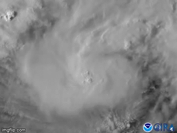
Couple of convective bursts at sunset on Marco

Posted on 8/23/20 at 8:00 pm to fightin tigers
I’ve had dryer martinis than what Marco will bring

Posted on 8/23/20 at 8:00 pm to Bobby OG Johnson
Woah
Posted on 8/23/20 at 8:01 pm to DVinBR

Posted on 8/23/20 at 8:02 pm to fightin tigers
Another interesting thing on the HWRF model is that it has been on the high end of intensity levels and NHC consistently keep upping the intensity forecast for Laura since yesterday.
Posted on 8/23/20 at 8:02 pm to slackster
Panama City is about to get rolled!!

 Page 183 of 815

Popular
Back to top