- My Forums
- Tiger Rant
- LSU Recruiting
- SEC Rant
- Saints Talk
- Pelicans Talk
- More Sports Board
- Fantasy Sports
- Golf Board
- Soccer Board
- O-T Lounge
- Tech Board
- Home/Garden Board
- Outdoor Board
- Health/Fitness Board
- Movie/TV Board
- Book Board
- Music Board
- Political Talk
- Money Talk
- Fark Board
- Gaming Board
- Travel Board
- Food/Drink Board
- Ticket Exchange
- TD Help Board
Customize My Forums- View All Forums
- Show Left Links
- Topic Sort Options
- Trending Topics
- Recent Topics
- Active Topics
Started By
Message

 0
0

Posted on 6/8/24 at 8:23 am to iron banks
quote:
Just another sad tale in the loss of coastal Louisiana. It makes me sad to go down to Saint Bernard, Plaquemines and Terrebonne and see the staggering loss of land. It truly is unfathomable what has happened since I was a teenager in the 1980s. Look up Manilla Village down in Barataria Bay. I believe that was in lower Jefferson Parish North of Grand Isle.
Prior to the 1856 hurricane 2/3 of all American millionaires lived in Louisiana. Among some of the other destruction of the LA coast and political corruption, this storm was one of the initial Turin g points in the overall decline of a once great state.

Posted on 6/8/24 at 8:25 am to Saunson69
quote:
. I don't think cars existed then,
There were wagons and buggies etc. for a few thousand years previously

Posted on 6/8/24 at 8:42 am to SloaneRanger
quote:
quote:Just another sad tale in the loss of coastal Louisiana.
South Louisiana is deltaic plain. When you levee up all the rivers and prevent them from flooding, guess what happens.
More relevant however, is what happens when people drill a maze of thousands of canals throughout the coastal region, that all act as a storm surge funnel system each hurricane, allowing it to penetrate and erode much higher inland.
Posted on 6/8/24 at 8:57 am to KLSU
There wasn't land all the way to it, or it wouldn't have been an island. All visitors still had to take a steam ferry to the island, hence the massive loss of life when the storm hit. If they could've taken horses/walked north the outcome would've been different.
I believe the Last Isle book recounts a story of the steamer captain who was bringing people off the island when the storm hit...he turned around to rescue more people, crashing and marooning his boat on the island. He rescued nearly 30 people by tying a rope around his waist and latching onto drowning people in 120+ mph winds and waves.
Others managed to survive by digging their feet and legs into the sand and huddling in groups in an attempt to avoid being swept off the island by the storm surge. It still sounds unbelievable to me that they were able to survive as the island was underwater for the duration of the storm

Posted on 6/8/24 at 9:04 am to Havoc
Which would remedy itself if levees weren't in place. Fact is there are hundreds of thousands of people living in areas they shouldn't be. There should be no permanent residence south of BC or Houma. Knock the levees out south of BC and dig a overflow canal to between Dulac and Golden Meadow from Moonshine or Montz bend.
Posted on 6/8/24 at 9:13 am to Geauxldilocks
quote:
Prior to the 1856 hurricane 2/3 of all American millionaires lived in Louisiana. Among some of the other destruction of the LA coast and political corruption, this storm was one of the initial Turin g points in the overall decline of a once great state.
I read some here that prior to the civil war La. was the second wealthiest state behind Mass. I believe.
We had a thriving economy because of the Miss. River and all the trade it brought.

Posted on 6/8/24 at 9:32 am to doubleb
quote:
I read some here that prior to the civil war La. was the second wealthiest state behind Mass. I believe.
We had a thriving economy because of the Miss. River and all the trade it brought
A lot that wealth was in property, specifically chattel slaves.
That's why Carroll Parish was the wealthiest county in the US in the 1860 Census and the poorest in 1870.
Posted on 6/8/24 at 10:01 am to Saunson69
I read one of the many books about it. It’s fascinating, especially when you’ve been in the area of where it’s located and try to imagine a vacation spot with a hotel and cabins and stores and restaurants.
It was a popular spot for people who wanted to escape the oppressive heat and sickness of the close-quartered cities and I believe was commonly accessible via steamboat.
Also of pretty gnarly note, after the hurricane, when the bodies started washing up with the remnants of the structures that got wiped out, pirates came and looted the wreckage and the decomposing victims. Some were reported found with missing fingers as the pirates had likely cut them off to gather rings and other jewelry.
Posted on 6/8/24 at 10:03 am to udtiger
The lighthouse has an interesting history you can find in the link. Here’s some tidbits.
Ship Shoal Lighthouse
Ship Shoal Lighthouse
quote:
In 1876, Keeper James Williams and Assistant Keeper Frederic Hamilton caught a shark measuring nine feet eight inches. On cutting it open, they found a watch, two metal buttons, and a buckle in the creature’s stomach, leading them to believe it had “made a meal of some poor unfortunate.” The watch was fully jeweled and claimed by Keeper Williams
quote:
Edward Dunn was serving as head keeper at Ship Shoal Lighthouse in 1882 with three assistant keepers, when one day, two of the assistants headed to Morgan City for supplies. Five days after the pair had departed, Keeper Dunn and Third Assistant Keeper Fred Leach were tarring the outside of the tower, when they noticed a ship becalmed south of the tower. Leach rowed out to the boat and found James Woods, a stranger, aboard the vessel the two keepers had taken to shore. Woods claimed that he had purchased the boat for $100 in Morgan City and was on his was to Pascagoula.
Leach towed the vessel back to the lighthouse, where Woods was fed and granted full access to the station. During his fourth night at the lighthouse, Woods sneaked into Leach’s room and attacked him with a hatchet. Startled from his sleep by a searing pain, Leach fought back and cried out “Murder!, Murder!,” attracting the attention of Keeper Dunn. An exchange of gunfire then ensued, during which both keepers were struck three times and Woods was shot in the knee. The keepers barricaded Woods in the upper part of the tower, and though this prevented them from tending the light, it cut Woods off from any provisions and forced him to eventually surrender.
Keeper Leach took the station’s prisoner to Morgan City, where Woods was dispatched to New Orleans and Leach was treated for his wounds. Woods was sentenced to fourteen years for the attack on the keepers, while the disfigured Leach was later described as “a hideous-looking man, all the lower left side of his face having been chopped away.”
Posted on 6/8/24 at 10:59 am to WestSideTiger
US corps of engineers did 2 things that caused a large part of the delta loss
1. In 1906, the corps closed the Donaldsonville river access to the bayou feeding the area below raceland. About 18% of the Mississippi had flowed through that bayou. And within 5 years saltwater intrusion was seen as far north as the sugar mill at raceland.
2. Check the river water solids content at the atchaflya diversion from 1945 to 1960. You will see suspended solids content drop off by 80%. The corp in the 50's really pushed soil erosion elimination across the whole Mississippi . It worked and the delta soil replenishment dropped by 80%
Posted on 6/8/24 at 3:04 pm to doubleb
quote:
Miss. River and all the trade it brought.
To a degree true, but financing cotton and financing slave labor moved a lot of money through NOLA banks. Structure of financing changed with Civil War.
Posted on 6/8/24 at 3:46 pm to Tarps99
Isle Denieres is where I spent most of my off time from 1970 till about 1993.
In 1970 we could drive from the Chevron platform @Wine Island Pass to Whiskey Pass. This was before the rocks@WineIsland. We could drive and fish the birds all day from the beach.
This was before the island was cut by storms.
Trinity Bayou, Trinity Bay and California Canal was still intact and there were camps there. Some summers we spent at Timbalier.
I could swim across Whiskey Pass when the current was slack. The statue was still on the West side of the pass. We moved the statue to Trinity Bayou in the 80’s. Also drove piling and made a dock with a platform.
The Whiskey Pass Rodeo Association would hold a rodeo every year on the island. The priest would come and say mass. Only time I went to mass sitting on an ice chest of beer.
As for as a road and driving a wagon. I think the road would have to come down Bayou Sale’ on the West side of Lake Pelto from Four Point Road.
There are many books about it.
Never saw a cow on isle Deniere ( Last Island ). The Vigueries ran cattle on Timbalier Island for a long time. That’s why we called on of the canals “The Cattle. Pen Canal. There was a cow shute and pen there. We parked the camp there sometime.
We would buy a wrecked Volkswagen, cut the body off, put a plywood deck on the back to carry gear and the coonasses were off and running. No telling how many thousand’s of trout and flounder we caught over the years.
Get Davis’ book. Washed Away.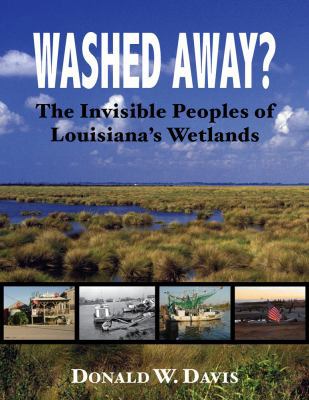
You will love it. I guarantee.
There never was a train. You are referring to Henry Flagler’s train to Key West.
Someone mentioned ShipShoal light. My friend and I climbed it to the top many times.
I used to be an island rat. Could run anywhere from the Mouth of the Mississippi to Eugene Island in the dark. Wouldn’t attempt that now.
Google Port Texaco. WW 2. U boat victims were shuttled off of the shrimp boats that rescued them from the burning ships. Put on a crew boat at the pass, then brought to the Texaco facility in Montegut. Ther they put them in station wagons to bring them to the Ellender Clinic in Houma.
This post was edited on 6/8/24 at 3:56 pm
Posted on 6/8/24 at 3:50 pm to Tree_Fall
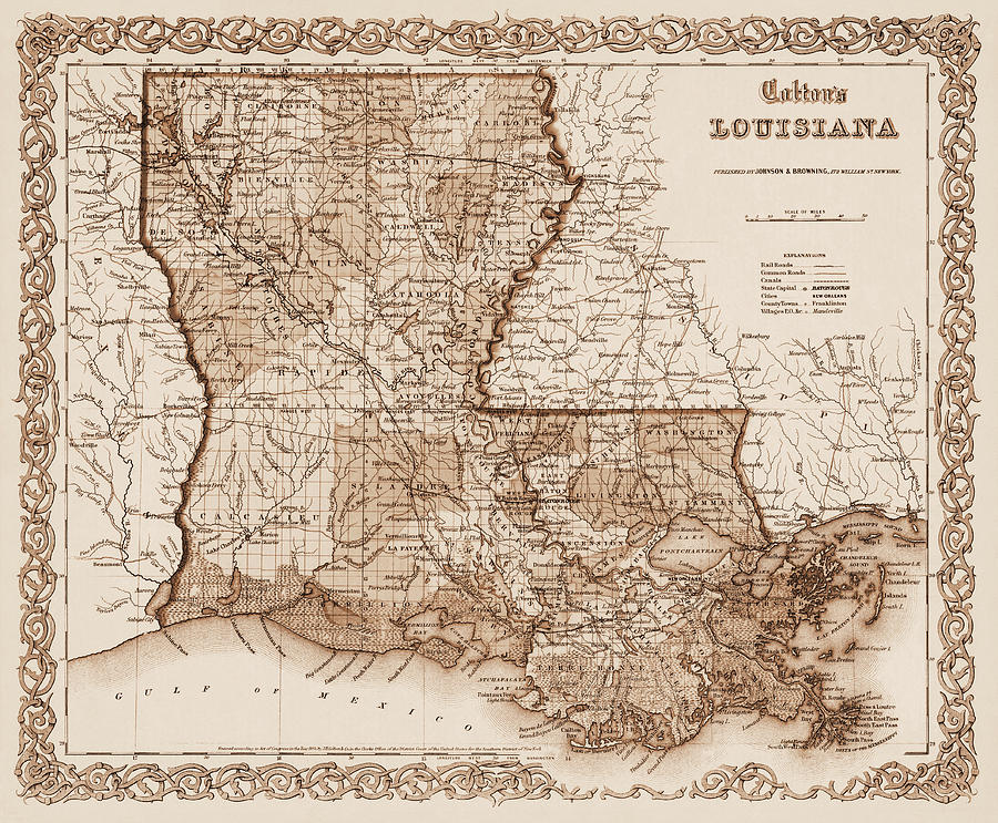
1855 map
This post was edited on 6/8/24 at 3:52 pm
Posted on 6/8/24 at 3:55 pm to deltaland
quote:put wallet in front pocket
Muggah's
Posted on 6/8/24 at 3:59 pm to Saunson69
I wonder if anyone has scuba dived the area.

Posted on 6/8/24 at 4:13 pm to SloaneRanger
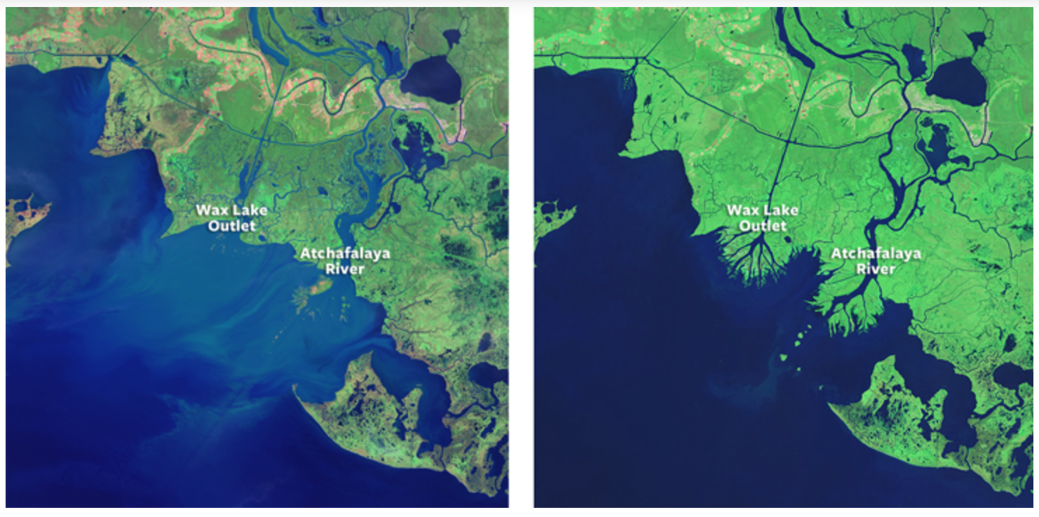
quote:Yep, check out these pics of the Wax Lake delta that flows into the gulf. Don’t know when the first one was taken, but that’s how you prevent coastal erosion and actually make more marsh.
South Louisiana is deltaic plain. When you levee up all the rivers and prevent them from flooding, guess what happens.
This post was edited on 6/8/24 at 4:28 pm
Posted on 6/8/24 at 4:27 pm to Rick9Plus
quote:
I wonder if anyone has scuba dived the area.
quote:The water is probably like chocolate milk. Very little visibility.
I wonder if anyone has scuba dived the area.
Metal detectors are probably the best bet.
Posted on 6/8/24 at 4:29 pm to Tarps99
Just ordered the book. Thanks.
Posted on 6/8/24 at 4:44 pm to doubleb
Which is precisely why the shipping, flood control work was done.
I’m not studied enough on the topics of economics and civil engineering to know if there could’ve been a win-win solution to preserve commerce AND natural landscapes along the river clear up to Memphis. But I’m confident that the USA would look very different (LA and MS certainly would) if not for the MS river flood control practices. Does WW2 turn out different?? … And I say this not as USACoE apologist… I shake my head in disgust at the headcutting in the loess hills caused by these efforts every time I’m at the camp.
I’m not studied enough on the topics of economics and civil engineering to know if there could’ve been a win-win solution to preserve commerce AND natural landscapes along the river clear up to Memphis. But I’m confident that the USA would look very different (LA and MS certainly would) if not for the MS river flood control practices. Does WW2 turn out different?? … And I say this not as USACoE apologist… I shake my head in disgust at the headcutting in the loess hills caused by these efforts every time I’m at the camp.

 Page 2 of 3

Popular
Back to top