- My Forums
- Tiger Rant
- LSU Recruiting
- SEC Rant
- Saints Talk
- Pelicans Talk
- More Sports Board
- Fantasy Sports
- Golf Board
- Soccer Board
- O-T Lounge
- Tech Board
- Home/Garden Board
- Outdoor Board
- Health/Fitness Board
- Movie/TV Board
- Book Board
- Music Board
- Political Talk
- Money Talk
- Fark Board
- Gaming Board
- Travel Board
- Food/Drink Board
- Ticket Exchange
- TD Help Board
Customize My Forums- View All Forums
- Show Left Links
- Topic Sort Options
- Trending Topics
- Recent Topics
- Active Topics
Started By
Message
 0
0

Posted on 9/21/22 at 11:49 pm to deuce985
Gunna act like i didn't see this run. Go to sleep. and wait on 6z.
Posted on 9/21/22 at 11:49 pm to deuce985
Odd that is sits in the middle of the gulf for 2 days just hanging out, dosent strengthen then weakens heading in.
This post was edited on 9/21/22 at 11:51 pm
Posted on 9/21/22 at 11:51 pm to LSU5508
upwelling if it did sit for 2 days?
Posted on 9/21/22 at 11:51 pm to gaetti15
If you're in the crosshairs by the time it forms and it's past sunday then it may be time to pucker your arse. Until it forms, these models are fantasy land. They're just giving you an idea how it might steer when it gets in the gulf but anything past 5 days isn't close to being reliable.
Posted on 9/21/22 at 11:51 pm to OldSouth
quote:
Personally, I ignore everything in these models after hour 120. The GFS seems pretty accurate 120 hrs out, but after that its a crap shoot.
The trick is trying to figure out why a model run is doing what it is doing.
Posted on 9/21/22 at 11:52 pm to LegendInMyMind
quote:
The trick is trying to figure out why a model run is doing what it is doing.
fancy math that only a few people understand
how can we trust them?
Posted on 9/21/22 at 11:53 pm to VCeagle2013
Everyone had a good panic yet?
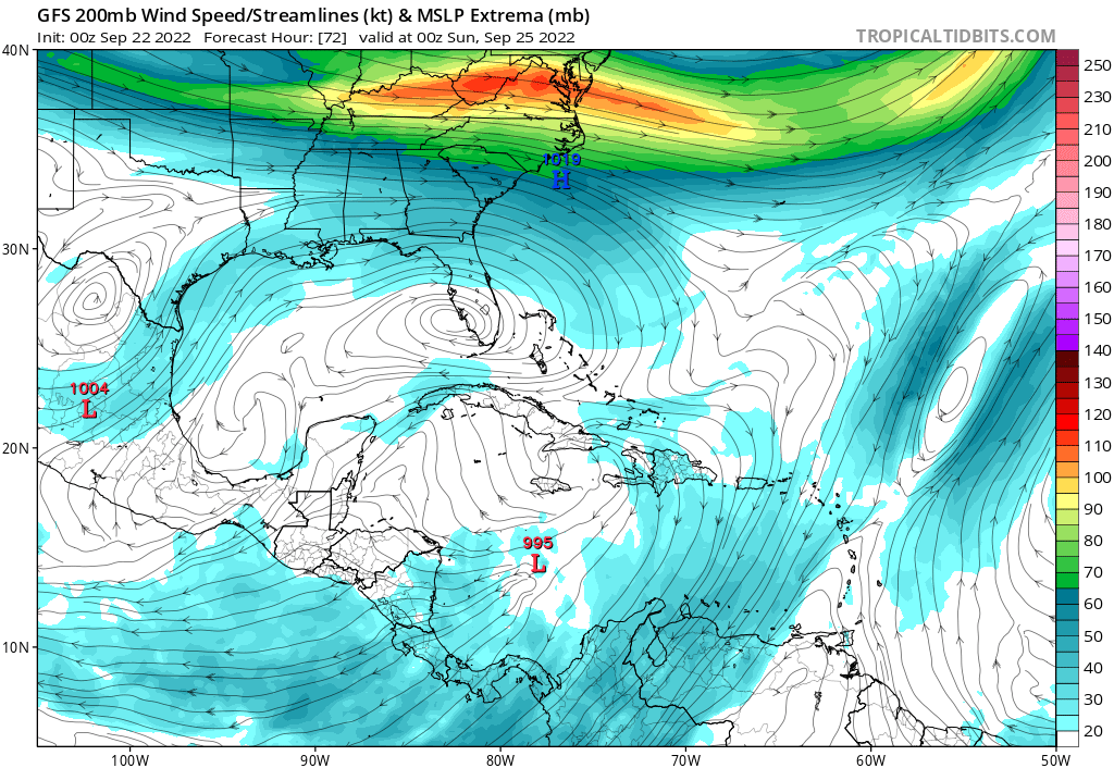
Ok, I'm suspicious of what the GFS is doing early on. It leads to the storm forming farther SW, not getting as hard of a pull north in the Caribbean, and then getting stuck with a ridge building back to the east and pushing it north into LA/MS.
And I'm not 100% sure the GFS is wrong, but I'm seeing a common bias show up with overconvecting/spinning shite up too fast. It pulses up downshear, which do note is something that happens, but if the GFS is doing it's convective feedback thing it would mean the model gets it too far SW in the near term.
Going to have to watch the convective pattern over the next couple of days to see if the GFS is actually right or this is it's biases leading to a short term track error.
I honestly don't know the answer at this point.

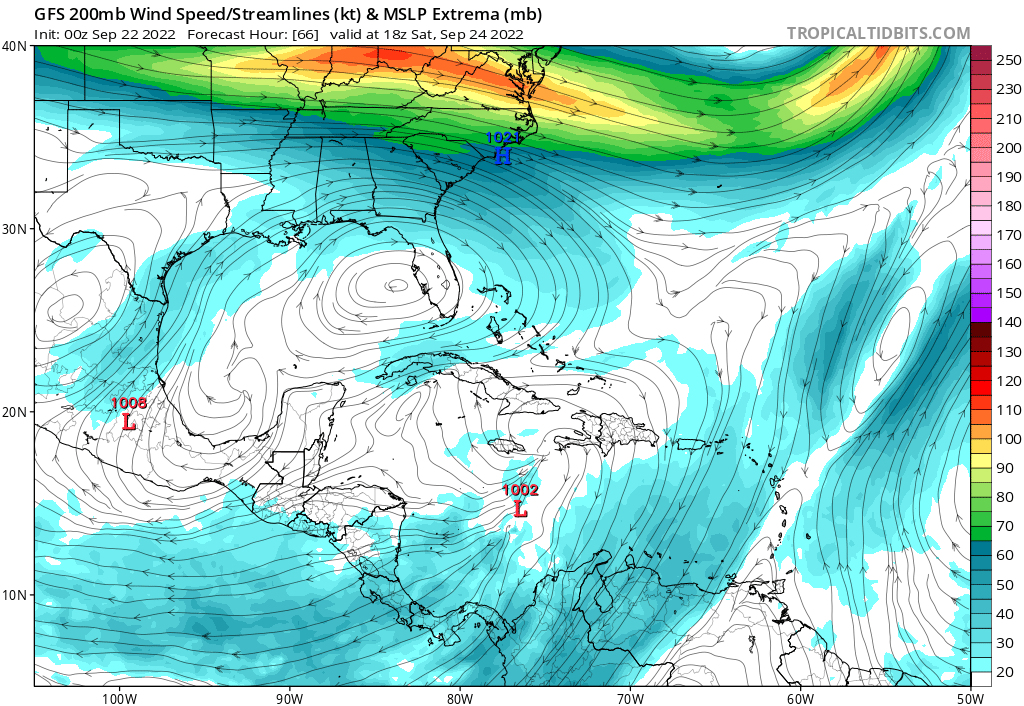
See how there are two vort maxes in the area? The NE one is the one we've been tracking, and then in the next frame it has spun up that new strong one on the SW side. That ends up getting spun up into the true center, SW of where it would otherwise be.
Definitely staying up for those ensembles.
Ok, I'm suspicious of what the GFS is doing early on. It leads to the storm forming farther SW, not getting as hard of a pull north in the Caribbean, and then getting stuck with a ridge building back to the east and pushing it north into LA/MS.
And I'm not 100% sure the GFS is wrong, but I'm seeing a common bias show up with overconvecting/spinning shite up too fast. It pulses up downshear, which do note is something that happens, but if the GFS is doing it's convective feedback thing it would mean the model gets it too far SW in the near term.
Going to have to watch the convective pattern over the next couple of days to see if the GFS is actually right or this is it's biases leading to a short term track error.
I honestly don't know the answer at this point.
See how there are two vort maxes in the area? The NE one is the one we've been tracking, and then in the next frame it has spun up that new strong one on the SW side. That ends up getting spun up into the true center, SW of where it would otherwise be.
Definitely staying up for those ensembles.
This post was edited on 9/21/22 at 11:56 pm
Posted on 9/21/22 at 11:56 pm to rds dc
50 pages tomorrow from the latest GFS
Posted on 9/21/22 at 11:57 pm to Duke
quote:
I honestly don't know the answer at this point.
I would say panic as an over-reaction, but I see what you are saying as well.
With how the GFS is trending, it will be hitting Lake Charles two model days from now.
ETA: I mean shite, it moved from Ft. Walton to Barataria Bay from 18Z to 0Z
This post was edited on 9/21/22 at 11:58 pm
Posted on 9/21/22 at 11:58 pm to Duke

Posted on 9/21/22 at 11:58 pm to Duke
Is it just me or is the GFS an outlier in how far west it goes before making landfall?
Posted on 9/21/22 at 11:58 pm to Duke
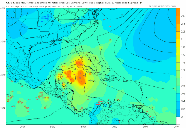
The ensembles through 150 hrs are coming in very clustered btw Cuba and Yucatán. The spread is fairly tight.
18z to 0z trend:
18z to 0z trend:
This post was edited on 9/22/22 at 12:04 am
Posted on 9/22/22 at 12:00 am to lsugolfredman
quote:
The ensembles through 150 hrs are coming in very clustered btw Cuba and Yucatán. The spread is fairly tight
through 156 hours out, seems like we have a split. Some east, some west.
ETA: Still east of operational
This post was edited on 9/22/22 at 12:01 am
Posted on 9/22/22 at 12:00 am to Keys Open Doors
Screw it Texas needs rain just head to Brownsville.
Posted on 9/22/22 at 12:01 am to Duke
You can see that process when you look frame-by-frame at the low position at 200mb.
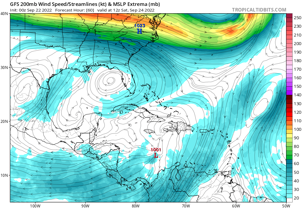
It isn't as obvious on still frames, but in the second frame it jumps North. In the next it is right back South again.
It isn't as obvious on still frames, but in the second frame it jumps North. In the next it is right back South again.
This post was edited on 9/22/22 at 12:04 am
Posted on 9/22/22 at 12:02 am to Duke
quote:
Everyone had a good panic yet?
Given the history of the last 17 years, I wouldn't call it panic. I see it as a perfectly reasonable reaction.
Posted on 9/22/22 at 12:03 am to Keys Open Doors
quote:
Is it just me or is the GFS an outlier in how far west it goes before making landfall?
It is. It's all in that first 120 hours where it sets the table to end up that far west.
Farther to the North and it feels the powerful pull north and NE toward Florida. The GFS has it way SW early, it feels that big tug north but it's not enough to pull it NE. Ridge builds as the trough pulls away to the east, no where out.
I am skeptical of what it does early to get it that far SW, but I can't write it off yet.
Posted on 9/22/22 at 12:03 am to Keys Open Doors
What is the GFS’ track record so far this year?

Posted on 9/22/22 at 12:05 am to Duke
quote:
Definitely staying up for those ensembles
I'm not in freak out mode yet (still a long ways out), but I'm really not liking the continued west shifts. We usually see the windshield wiper effect, but it's like it's stuck in the left position.
This post was edited on 9/22/22 at 12:06 am

 Page 63 of 465

Back to top