- My Forums
- Tiger Rant
- LSU Recruiting
- SEC Rant
- Saints Talk
- Pelicans Talk
- More Sports Board
- Fantasy Sports
- Golf Board
- Soccer Board
- O-T Lounge
- Tech Board
- Home/Garden Board
- Outdoor Board
- Health/Fitness Board
- Movie/TV Board
- Book Board
- Music Board
- Political Talk
- Money Talk
- Fark Board
- Gaming Board
- Travel Board
- Food/Drink Board
- Ticket Exchange
- TD Help Board
Customize My Forums- View All Forums
- Show Left Links
- Topic Sort Options
- Trending Topics
- Recent Topics
- Active Topics
Started By
Message
re: Hurricane Milton - The Cleanup Begins...
Posted on 10/8/24 at 10:07 am to OU Guy
Posted on 10/8/24 at 10:07 am to OU Guy
Stocking Mill Coffee
@smcroasters
Share
Just because I left NC/SC to get ready for Milton doesn’t mean we’re still not helping.
Sending supplies up today.
So if there is a need please dm us and we will try to get it done.
@smcroasters
Share
Just because I left NC/SC to get ready for Milton doesn’t mean we’re still not helping.
Sending supplies up today.
So if there is a need please dm us and we will try to get it done.
 0
0


Posted on 10/8/24 at 10:09 am to MasterAbe1
quote:
Where did your brother live in the burg? We lived over close to Purvis at the time off Old 11
About a block east of 49, between Forrest General and Broadway.
This post was edited on 10/8/24 at 10:10 am
Posted on 10/8/24 at 10:09 am to Cosmo
Thats Katrina.
This post was edited on 10/8/24 at 10:10 am

Posted on 10/8/24 at 10:10 am to kengel2
What are you trying to prove there? Covington didnt get Cat 3 hurricane conditions
This post was edited on 10/8/24 at 10:11 am

Posted on 10/8/24 at 10:12 am to Psych23
quote:
No serious person would ever recommend an evacuation for people 100 miles inland. And frankly, if you evacuate from that far inland and put more traffic on the roads and take hotel rooms and resources from the people who are actually in danger, you're pretty fricking selfish.
goal posts keep moving here don't they
quote:
Most of Tampa can sit tight and leave some space on the road who are in legitimate danger
This post was edited on 10/8/24 at 10:12 am
Posted on 10/8/24 at 10:12 am to im4LSU
I had a few friends live over there. Ironically I worked at the tophers on broadway as my first job in HS but that was years after Katrina. Good burger if you ever get a chance to try
Posted on 10/8/24 at 10:13 am to Cosmo
quote:
What are you trying to prove there?
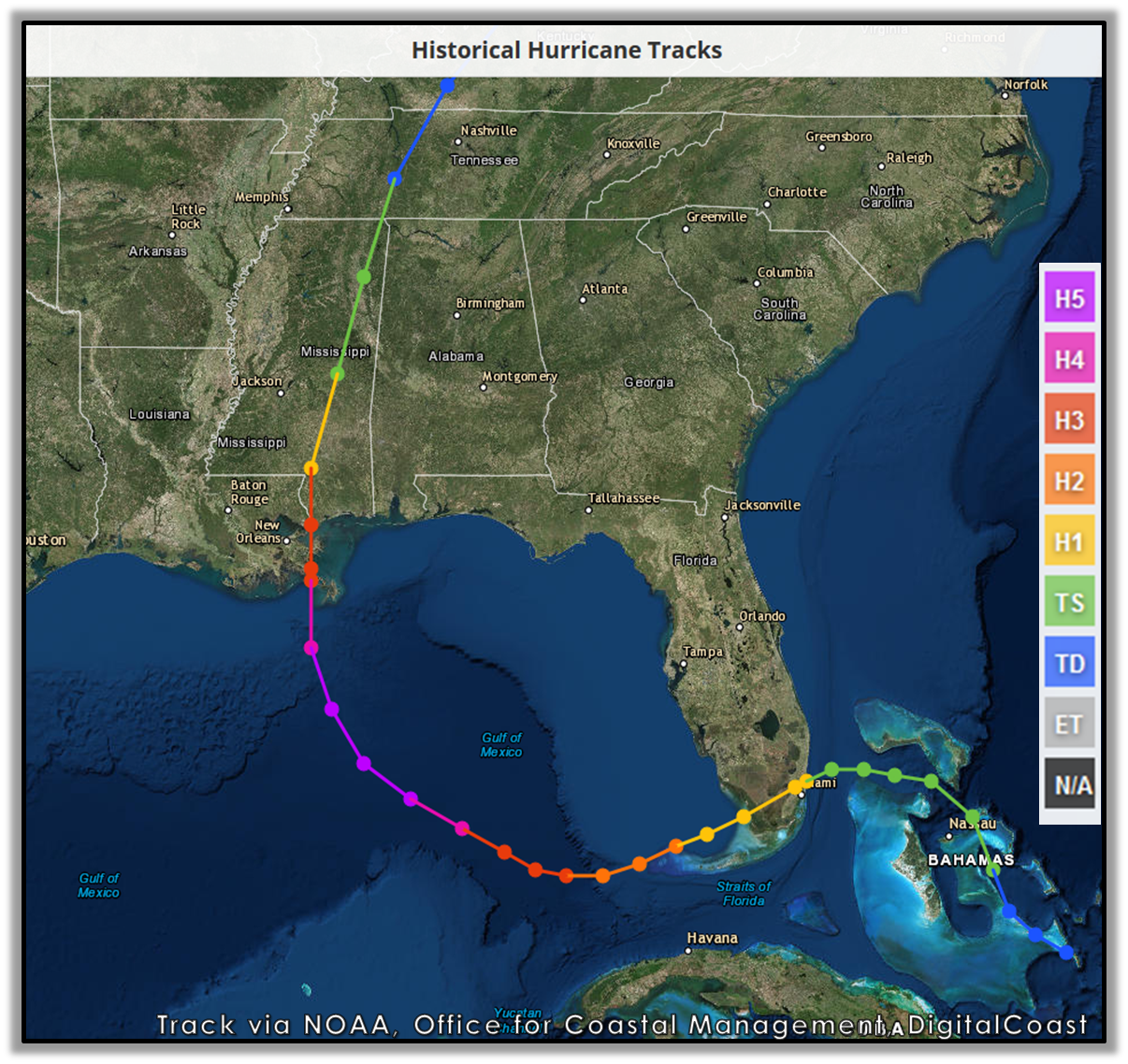
I just put the track up, youre the one trying to prove something.
quote:
Covington didnt get Cat 3 hurricane conditions
How close to the line do you need to be to feel those conditions?
Posted on 10/8/24 at 10:16 am to Cosmo
judging by the massive amounts of big pine trees snapped like tooth picks i witnessed in the area after Katrina, yes it did
Posted on 10/8/24 at 10:16 am to DVinBR
quote:
judging by the massive amounts of big pine trees snapped like tooth picks i witnessed in the area after Katrina, yes it did
Cat 1 winds will take down pine trees. Pine trees suck
Posted on 10/8/24 at 10:17 am to Cosmo
maybe small pine trees, big arse pine trees
Posted on 10/8/24 at 10:20 am to Wally Sparks
quote:
Is there any way Tampa Bay/Sarasota doesn't get cooked by this?
The further south the better but Tampa itself is low. There will be surge issues either way but a southerly track will be less. If it jogs a bit north of Tampa, well...
Posted on 10/8/24 at 10:21 am to rds dc

Posted on 10/8/24 at 10:23 am to Cosmo
Friend,
Cosmo is correct in saying that Covington did not experience Category 3 winds during Katrina. LINK shows peak winds recorded in the area. The station in the middle of Lake Pontchartrain, which likely had stronger winds than Covington, peaked at 77 mph sustained.
Yours,
TulaneLSU
Cosmo is correct in saying that Covington did not experience Category 3 winds during Katrina. LINK shows peak winds recorded in the area. The station in the middle of Lake Pontchartrain, which likely had stronger winds than Covington, peaked at 77 mph sustained.
Yours,
TulaneLSU

Posted on 10/8/24 at 10:23 am to cgrand
000
WTNT44 KNHC 081455
TCDAT4
Hurricane Milton Discussion Number 14
NWS National Hurricane Center Miami FL AL142024
1000 AM CDT Tue Oct 08 2024
Sequences of microwave images and recent Hurricane Hunter
observations suggest that Milton completed an eyewall replacement
overnight, and the new eyewall has contracted down from 22 n mi to
12 nm in diameter. However, it does not appear that the hurricane
weakened much after the eyewall replacement, and it could have
rebounded with the outer eyewall contraction. A dropsonde released
by the NOAA P-3 in the northeastern eyewall recently measured an
average wind of 156 kt in the lowest 150 m of the sounding, which
equates to an intensity of 130 kt. The latest pressure reported by
the planes is 929 mb.
The recent aircraft fixes show that Milton has turned a bit
leftward and is moving toward the east-northeast (065/8 kt).
Milton is forecast to turn northeastward and begin accelerating
later today as it moves between a trough digging into the Gulf of
Mexico and a ridge near the Greater Antilles. The track guidance
is honed in on a landfall along the west-central coast of Florida
sometime Wednesday night. However, it is critical to remember that
even at 36-48 hours away, NHC's track forecasts can be off by an
average of 60-70 n mi, which means we still can't pinpoint an exact
landfall location, especially if the hurricane wobbles as it
approaches the coast. After landfall, Milton is forecast to cross
Florida and emerge over the Atlantic waters on Thursday.
Milton is expected to maintain major hurricane strength while it
moves across the Gulf of Mexico and approaches the west coast of
Florida. Stronger vertical shear is expected to set in about 24
hours, but even if this causes some weakening, it will not be
enough to keep Milton from being an extremely dangerous hurricane
when it reaches shore. Additionally, the first stages of
extratropical transition may be just underway as Milton is reaching
the coast, which could impart some baroclinic energy and slow the
rate of weakening. The NHC intensity forecast is close to the top
end of the model envelope, which includes the GFS and ECMWF models,
since these models should have a better handle on a potential
positive trough interaction.
Milton's wind field is expected to expand as it approaches Florida.
In fact, the official forecast shows the hurricane and
tropical-storm-force winds roughly doubling in size by the time it
makes landfall. Therefore, damaging winds, life-threatening storm
surge, and heavy rainfall will extend well outside the forecast
cone. It is worth emphasizing that this is a very serious situation
and residents in Florida should closely follow orders from their
local emergency management officials. Evacuations and other
preparations should be completed today. Milton has the potential to
be one of the most destructive hurricanes on record for west-central
Florida.
Key Messages:
1. Damaging hurricane-force winds and a life-threatening storm
surge with destructive waves are expected across portions of the
northern coast of the Yucatan Peninsula today.
2. A large area of destructive storm surge, with highest
inundations of 10 ft or greater, is expected along a portion of the
west-central coast of the Florida Peninsula. If you are in the
Storm Surge Warning area, this is an extremely life-threatening
situation, and you should evacuate today if ordered by local
officials. There will likely not be enough time to wait to leave on
Wednesday.
3. Devastating hurricane-force winds are expected along portions of
the west coast of Florida, where a Hurricane Warning is in effect.
Milton is forecast to remain a hurricane as it crosses the Florida
Peninsula and life-threatening hurricane-force winds, especially in
gusts, are expected to spread inland across the peninsula.
Preparations to protect life and property, and to be ready for
long-duration power outages, should be complete by tonight.
4. Heavy rainfall across the Florida Peninsula through Thursday
brings the risk of life-threatening flash and urban flooding along
with moderate to major river flooding, especially in areas where
coastal and inland flooding combine to increase the overall flood
threat.
FORECAST POSITIONS AND MAX WINDS
INIT 08/1500Z 22.7N 88.4W 130 KT 150 MPH
12H 09/0000Z 23.6N 87.2W 130 KT 150 MPH
24H 09/1200Z 25.2N 85.5W 125 KT 145 MPH
36H 10/0000Z 26.8N 83.8W 110 KT 125 MPH
48H 10/1200Z 28.1N 81.5W 85 KT 100 MPH...INLAND
60H 11/0000Z 29.1N 78.4W 65 KT 75 MPH...OVER WATER
72H 11/1200Z 29.7N 74.9W 55 KT 65 MPH...POST-TROP/EXTRATROP
96H 12/1200Z 30.4N 67.9W 45 KT 50 MPH...POST-TROP/EXTRATROP
120H 13/1200Z 31.8N 60.6W 35 KT 40 MPH...POST-TROP/EXTRATROP
$$
Forecaster Berg
Posted on 10/8/24 at 10:23 am to doublecutter
Probably. But those thieves will get their funds back via premium increase. It’s a scam.
Posted on 10/8/24 at 10:27 am to kengel2
quote:
How close to the line do you need to be to feel those conditions?
Pretty close particularly if on west side. Covington was about 40 miles west. So similar to orange texas for Laura or tallahassee for Helene
Orange Texas and Tallahassee didnt get much
Posted on 10/8/24 at 10:27 am to glb
quote:
Most of the homes in Babcock Ranch have a finished floor elevation of 30 feet or a bit above, depending if you are in the southern or northern part of the community
Yeah, this along with all the other built in hurricane protections is why we initially looked at Babcock when moving from the Midwest. Then we fell in love with the city when visiting.
Posted on 10/8/24 at 10:29 am to Dixie2023
quote:
Not to mention it might be too late to leave now. Remember Hurricane Rita and those stuck on the roadside.
We left last minute @ midnight for Katrina and Ida and roads were clear.
Posted on 10/8/24 at 10:30 am to rds dc
(no message)
This post was edited on 10/8/24 at 10:31 am
Posted on 10/8/24 at 10:34 am to DVinBR
quote:
maybe small pine trees, big arse pine trees
Pines suck, not as much as water oaks but they suck. Shallow root system doesn’t do well in saturated ground
This from the may derecho in Houston. 75 to 100 Mph winds for 15-20minutes


 Page 123 of 242

Popular
Back to top