





 1
1








- My Forums
- Tiger Rant
- LSU Recruiting
- SEC Rant
- Saints Talk
- Pelicans Talk
- More Sports Board
- Fantasy Sports
- Golf Board
- Soccer Board
- O-T Lounge
- Tech Board
- Home/Garden Board
- Outdoor Board
- Health/Fitness Board
- Movie/TV Board
- Book Board
- Music Board
- Political Talk
- Money Talk
- Fark Board
- Gaming Board
- Travel Board
- Food/Drink Board
- Ticket Exchange
- TD Help Board
Customize My Forums- View All Forums
- Show Left Links
- Topic Sort Options
- Trending Topics
- Recent Topics
- Active Topics
Started By
Message
re: Hurricane Isaias - Approaching Landfall in the FL Panhandle
Posted on 10/9/26 at 4:21 pm to Sampson
Posted on 10/9/26 at 4:21 pm to Sampson
quote:
My brother lives in Navarre just called me and said it’s a nothing burger there. Power on, rain with slight wind just chilling.
Hes in for a rude awakening
Posted on 10/9/26 at 4:23 pm to Cosmo
I texted him that the OT said buckle up buddy. He is very unbothered 
Posted on 10/9/26 at 4:23 pm to Sampson
quote:
My brother lives in Navarre just called me and said it’s a nothing burger there. Power on, rain with slight wind just chilling.
This is the equivalent of posting “game over” after the opening drive.
Posted on 10/9/26 at 4:24 pm to Ten Bears
quote:
Looks like Navarre / Mary Esther / FWB gonna get the brunt of it
Yeah. The last Vortex message had the eye 30 miles in diameter.
With hurricane force winds extending 35 miles from center, that means the areas 15 to 35 miles east of the center landfall point will get the hurricane force winds without being in the eye.
That area is Mary Esther and FWB (+ Eglin AFB, Shalimar, Ocean City, Wright) with Destin being right on the edge of the hurricane force winds. Navarre will get the northern and southern eyewalls but will likely get the eye and have at least a brief break.
Pensacola will be very close to the western eye/eyewall boundary.
Posted on 10/9/26 at 4:25 pm to LegendInMyMind
quote:
Here is where the shear becomes a bad thing. It will help with tornado production as this moves onshore.
How does the the hurricane's forecasted bend from a nne to nnw motion in response to the high pressure in the traditional "wedge" influencing it at landfall affect the tornado threat?
Where the warm moist humid onshore flow begins to meet resistance from that area of relatively high(er) pressure and relatively dryer from the Carolinas down into Georgia would seem in my uneducated opinion to create a boundary and an enhanced area of shear over eastern Alabama and western Georgia as the hurricane shifts from nne to nnw through Alabama
Posted on 10/9/26 at 4:26 pm to AHM21
quote:
ISAIAS AT 4:00
Sustained winds 115 mph
Located about 125 miles south/southeast of Mobile
Moving north at 17 mph
*Landfall comes around 7pm CT near Navarre Beach with winds around 100-105 mph
*Storm surge of 6-9 ft from the AL/FL Border to Grayton Beach
*Storm surge of 4-6 ft for the Alabama Gulf Coast including Dauphin Island
*Storm surge of 3-5 ft for Lower Mobile Bay
*Storm surge of 2-4 ft for Upper Mobile Bay
*Highest tornado risk over the Florida Panhandle, Georgia, and the southeast tip of Alabama
*Rain amounts 4-6 inches near the coast, 2-3 inches for most of inland Alabama.
*Wind is the BIG issue. Winds at hurricane force on the coast. Due to the accelerating forward speed and expanding wind field, most all of inland Alabama could see gusts to 50/60 mph overnight tonight. This will likely create major power outages and considerable tree damage.
*Winds will diminish late tomorrow morning, and by tomorrow night the weather will be completely dry with lighter wind.
Please continue to watch our live coverage on the Alabama Weather Network!
Loading Twitter/X Embed...
If tweet fails to load, click here.Posted on 10/9/26 at 4:27 pm to rds dc
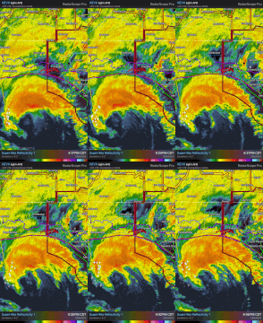
Outer edge of the eyewall is nearing shore. Gonna be rough between Pensacola and Panama City Beach.
Posted on 10/9/26 at 4:30 pm to Sampson
quote:
My brother lives in Navarre just called me and said it’s a nothing burger there. Power on, rain with slight wind just chilling.
No better time to join TD than in the eye of a hurricane. Tell him to sign on and give us live updates.
Posted on 10/9/26 at 4:34 pm to NorthEndZone
quote:
with Destin being right on the edge of the hurricane force winds.
Idk its not going 0 degrees north, its like 10 degrees north. So like NNNNE.
Radar might be a wobble but I would be shocked if destin got nail with the eyewall
Posted on 10/9/26 at 4:34 pm to LPLGTiger
Live cams just shut off in perdido key. Think the power is out.
ETA: Anybody on the ground?
ETA: Anybody on the ground?
This post was edited on 10/9/26 at 4:35 pm
Posted on 10/9/26 at 4:39 pm to angryslugs
quote:
This is the equivalent of posting “game over” after the opening drive.
More like after getting off the bus
Posted on 10/9/26 at 4:42 pm to Sput
quote:before seeing the competition
quote:
This is the equivalent of posting “game over” after the opening drive.
More like after getting off the bus
Posted on 10/9/26 at 4:43 pm to Triple Bogey
Alabama already with over 42K out of power. Florida over 26K so far.
Posted on 10/9/26 at 4:44 pm to NorthEndZone
In Daphne, AL , very close to the Bay still with power. It's blinked a few times but not off yet.
Posted on 10/9/26 at 4:46 pm to Triple Bogey
I have still have power on my ring cameras in perdido
Posted on 10/9/26 at 4:47 pm to Sampson
quote:
My brother lives in Navarre just called me and said it’s a nothing burger there. Power on, rain with slight wind just chilling.
Well he’s about to get the eye wall so we will see if that changes.
Posted on 10/9/26 at 4:47 pm to gaetti15
quote:
I would be shocked if destin got nail with the eyewall
I was just saying the minimal hurricane force winds may be getting to west side of Destin. I'm defining the eyewall as about 10 miles wide where the Cat 2/3 winds are (my arbitrary definition). I agree that Destin will probably only get hurricane force gusts and maybe sustained on west end.
Posted on 10/9/26 at 4:49 pm to rds dc
Posted on 10/9/26 at 4:51 pm to GEAUXT
quote:
I have still have power on my ring cameras in perdido
Same for GS
Posted on 10/9/26 at 4:51 pm to Roll Tide Ravens
Power just went out in Panama City

 Page 147 of 151


Popular

Back to top
 Follow TigerDroppings for LSU Football News