- My Forums
- Tiger Rant
- LSU Recruiting
- SEC Rant
- Saints Talk
- Pelicans Talk
- More Sports Board
- Coaching Changes
- Fantasy Sports
- Golf Board
- Soccer Board
- O-T Lounge
- Tech Board
- Home/Garden Board
- Outdoor Board
- Health/Fitness Board
- Movie/TV Board
- Book Board
- Music Board
- Political Talk
- Money Talk
- Fark Board
- Gaming Board
- Travel Board
- Food/Drink Board
- Ticket Exchange
- TD Help Board
Customize My Forums- View All Forums
- Show Left Links
- Topic Sort Options
- Trending Topics
- Recent Topics
- Active Topics
Started By
Message
Posted on 8/28/19 at 4:21 pm to Jake88
quote:
Does it still have a small wind field?
For now but as eyewall replacement cycles occur, it will increase the field.
Posted on 8/28/19 at 4:24 pm to deltaland
quote:
Rapid Intensification
Lots of systems go through RI at some point. RI is considered an increase of 30kt in 24hrs. Dorian has increased 25kt in the last 18hrs.
This is causing issues for the models as they play catch up to Dorian. The models were seeing a weaker system steered by the lower levels and now we have a deeper system feeling a different set of steering factors. Combining a stronger deeper storm with a stronger ridge and we are going to see a harder westward turn or even SW. Something needs to give... Either a weaker storm or a stronger Northern Stream disturbance to break down the ridge and allow the system to turn north sooner.
Posted on 8/28/19 at 4:25 pm to tgrbaitn08
quote:
Damn. That doesn’t look good for Florida
My neck of the woods (The Villages). I've been checking my generator, etc.; Publix is having a run on bottled water. More in my post on pg 32.
Posted on 8/28/19 at 4:25 pm to rds dc
quote:
Lots of systems go through RI at some point. RI is considered an increase of 30kt in 24hrs. Dorian has increased 25kt in the last 18hrs.
Thank you for explaining that.
Posted on 8/28/19 at 4:28 pm to rds dc
Thats one thing I haven't wrapped my head around the last day. These model runs aren't even close to initializing at the correct strength.
Even the 18z ICON isn't showing Dorian @ 997mb until 39 hrs out.
Even the 18z ICON isn't showing Dorian @ 997mb until 39 hrs out.
Posted on 8/28/19 at 4:28 pm to rds dc
This thing is definitely going to enter the gulf
Posted on 8/28/19 at 4:33 pm to BallsEleven
quote:
Thats one thing I haven't wrapped my head around the last day. These model runs aren't even close to initializing at the correct strength.
I haven't looked closely, so that may be the case, but also remember when you see initialization on a model it's actually in the past so you have to look on the model chart where it should be at the moment at whatever hour it actually is and see if it matches up, or go in the past and see what the storm looked like at the time the model actually initialized. Just something to think about.
Posted on 8/28/19 at 4:34 pm to rds dc
quote:
we are going to see a harder westward turn or even SW.
Posted on 8/28/19 at 4:36 pm to BadBrad29
quote:
This thing is definitely going to enter the gulf
No way to say for sure but odds seem greater today than yesterday or before. Still plenty that could trip up this storm and lots of potential for change. However, I posted this early on in this thread:
quote:
If the system were to miss the ULL and the Islands then it would be forced to ride the edge of the Atlantic ridge and probably be steered into the Gulf.

This is an unlikely scenario. However, there is enough ensemble support for this solution that there is a low end chance that Dorian ends up in the Gulf.
Posted on 8/28/19 at 4:38 pm to OmniPundit
I’m nearby in Ocala. Losing power is the biggest inconvenience here also. Had several trees taken down last year, so no problems there. It’s probably going to mess up my daughter and son-in-law from coming from Louisiana this weekend ??
Posted on 8/28/19 at 4:43 pm to Turftoe
Is there a graph that predicts wind field?
Posted on 8/28/19 at 4:45 pm to BadBrad29
quote:
This thing is definitely going to enter the gulf
I’m safe where I am at now, but unfortunately, my work requires me to go into the storm’s path to one of my communities that I am responsible for.
Bye wife and kids, I’m going to thrust myself into danger. It is what it is.
Posted on 8/28/19 at 4:47 pm to GEAUXmedic
ICON

EURO (closest to current position I could get)

The GFS pretty much has the correct initial intensity.
EURO (closest to current position I could get)

The GFS pretty much has the correct initial intensity.
Posted on 8/28/19 at 4:48 pm to Jake88
quote:
Is there a graph that predicts wind field?

Posted on 8/28/19 at 4:49 pm to GEAUXmedic
Scary that this thing can kick back out into the gulf and threaten LA.
Posted on 8/28/19 at 4:51 pm to Latebloomer
Hello neighbor. There are times when it's good to be in the center of the peninsula instead of beachfront property.
Duke's latest (also on pg 32) was looking like we're going to get a LOT of rain and wind. Fortunately power lines here are underground. I know a lot of the lines around here aren't.
Regards and best wishes.
Duke's latest (also on pg 32) was looking like we're going to get a LOT of rain and wind. Fortunately power lines here are underground. I know a lot of the lines around here aren't.
Regards and best wishes.
Posted on 8/28/19 at 4:52 pm to JS87
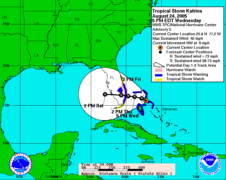
I suppose, but I want to point out also, cause people will no doubt try to stretch this, this is not Katrina as far as prediction and path.


This post was edited on 8/28/19 at 4:52 pm
Posted on 8/28/19 at 4:53 pm to JS87
No sticky, no worry.
Pure speculation this far out. However, if it hooks NE and away from Louisiana after entering the Gulf like many are forecasting that will be the second storm that we were miraculously sparred from in a season.
When was the last time Louisiana enjoyed that much luck?
Pure speculation this far out. However, if it hooks NE and away from Louisiana after entering the Gulf like many are forecasting that will be the second storm that we were miraculously sparred from in a season.
When was the last time Louisiana enjoyed that much luck?
Posted on 8/28/19 at 4:54 pm to The People
quote:
Pure speculation this far out. However, if it hooks NE and away from Louisiana after entering the Gulf like many are forecasting that will be the second storm that we were miraculously sparred from in a season.
Wut? What was the other storm? Hurricane Barely was a direct hit, FwIW
Popular
Back to top


 1
1


