- My Forums
- Tiger Rant
- LSU Recruiting
- SEC Rant
- Saints Talk
- Pelicans Talk
- More Sports Board
- Fantasy Sports
- Golf Board
- Soccer Board
- O-T Lounge
- Tech Board
- Home/Garden Board
- Outdoor Board
- Health/Fitness Board
- Movie/TV Board
- Book Board
- Music Board
- Political Talk
- Money Talk
- Fark Board
- Gaming Board
- Travel Board
- Food/Drink Board
- Ticket Exchange
- TD Help Board
Customize My Forums- View All Forums
- Show Left Links
- Topic Sort Options
- Trending Topics
- Recent Topics
- Active Topics
Started By
Message
 0
0

Posted on 8/25/17 at 3:49 pm to slackster
Was Ivan the hurricane that had Thunder Horse get loose? Buoy 42001 recorded 60/70 foot waves before it stopped signal.
Posted on 8/25/17 at 3:49 pm to Mudminnow
quote:
TX is proactive. They'll be fine. Lots of resources in TX and they have always invested heavily in infrastructure
Not positive of everything that's going on, but there are 700 National Guard folks in route to the coastal areas already. At least 16 mobile kitchens in route. Texas may not be loved by everyone east of here but the state government has their shite together usually.
Texas National Guard on the way!

Posted on 8/25/17 at 3:49 pm to ForeverLSU02
quote:
Hurricane Ivan, which struck U.S. shores September 15, 2004, kicked up the tallest, most extreme waves ever measured, scientists announced today. At more than 90 feet (27 meters) tall from crest to trough and 600 feet (183 meters) long,
Posted on 8/25/17 at 3:50 pm to TexasTiger08
quote:
and I'm 150 miles away
What a bad feeling. Hope and praying for you folks

Posted on 8/25/17 at 3:50 pm to Duke
quote:What do you mean by this? Are you referring to the potential intensity?
Glad Harvey wasn't 10 hours slower.
Posted on 8/25/17 at 3:50 pm to Rakim
(no message)
This post was edited on 4/3/23 at 2:39 pm
Posted on 8/25/17 at 3:52 pm to Duke
Harvey looks like he's going to be intensifying right into landfall. Rockport or whoever catch the right front eyewall are going be for a hell of a ride. Could very well have a strengthening Cat 4 on top of them.
At least that wind field is narrow.
At least that wind field is narrow.

Posted on 8/25/17 at 3:52 pm to msutiger
The channel I'm watching just interviewed Randy from Trailer Park Boys doppelgänger.
Posted on 8/25/17 at 3:52 pm to Rakim
The latest recon flight into #HurricaneHarvey has recorded flight level winds of 146 mph.... the next advisory should be interesting #Harvey 941 mb

Posted on 8/25/17 at 3:53 pm to CharlesLSU
No doubt. In BR? I thought it was horrible, I've lots of family and some friends there and own a house in pecan creek. A few of them lost everything. So, of you think I'm underestimating what we face you're wrong.
Posted on 8/25/17 at 3:53 pm to tiger91
Thanks for the prayers. I have fam in Swla as well and they aren't out of harms way either. A lot of people are in big danger. If you pray now. Is the time.
Posted on 8/25/17 at 3:54 pm to msutiger
quote:
Port Lavaca and Point Comfort are in serious trouble
I sure hope there was mandatory evacuations in these places

Posted on 8/25/17 at 3:54 pm to Rakim
quote:
quote:
I believe Ivan had multiple waves over 90 feet.
That's hard to imagine
That's what took out the Escambia Bay bridge east of Pensacola.
This post was edited on 8/25/17 at 4:09 pm
Posted on 8/25/17 at 3:55 pm to kcon70
125mph in 4pm update from NHC.

Posted on 8/25/17 at 3:55 pm to Duke
quote:
Rockport or whoever catch the right front eyewall are going be for a hell of a ride
The Public Safety center there is only 4ft above sea level and about .25 mile from the bay area. Going to be a life changing event for most of the people in the area.
Couple of homes on the bay
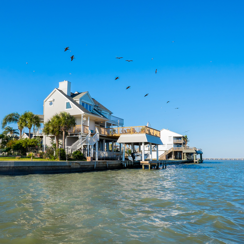
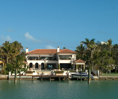
George Straits home in Rockport

Posted on 8/25/17 at 3:55 pm to Rebel
Dude just wants to be irresponsible for a few hours of his life
Posted on 8/25/17 at 3:55 pm to kcon70
I am in Houston and manage an engineering firm that works with both the City and the Harris County Flood Control District. You are underestimating this event.
Posted on 8/25/17 at 3:55 pm to Tiger Ryno
...MAJOR HURRICANE HARVEY BEARING DOWN ON THE TEXAS COAST... ...CATASTROPHIC FLOODING EXPECTED DUE TO HEAVY RAINFALL AND STORM SURGE...
4:00 PM CDT Fri Aug 25
Location: 27.5°N 96.5°W
Moving: NW at 10 mph
Min pressure: 941 mb
Max sustained: 125 mph
4:00 PM CDT Fri Aug 25
Location: 27.5°N 96.5°W
Moving: NW at 10 mph
Min pressure: 941 mb
Max sustained: 125 mph
Posted on 8/25/17 at 3:56 pm to Duke
quote:
Harvey looks like he's going to be intensifying right into landfall. Rockport or whoever catch the right front eyewall are going be for a hell of a ride. Could very well have a strengthening Cat 4 on top of them. At least that wind field is narrow.
I feel so bad for my parents. Glad to evacuated Rockport and are out but not sure what will be left.

 Page 218 of 618

Popular
Back to top