- My Forums
- Tiger Rant
- LSU Recruiting
- SEC Rant
- Saints Talk
- Pelicans Talk
- More Sports Board
- Fantasy Sports
- Golf Board
- Soccer Board
- O-T Lounge
- Tech Board
- Home/Garden Board
- Outdoor Board
- Health/Fitness Board
- Movie/TV Board
- Book Board
- Music Board
- Political Talk
- Money Talk
- Fark Board
- Gaming Board
- Travel Board
- Food/Drink Board
- Ticket Exchange
- TD Help Board
Customize My Forums- View All Forums
- Show Left Links
- Topic Sort Options
- Trending Topics
- Recent Topics
- Active Topics
Started By
Message

 3
3


Posted on 5/24/18 at 1:27 pm to NorthEndZone
quote:
Winds are stronger on this Euro run but in the eastern half.
This thing is going to be really lopsided towards the east. Early season storms always have their tops blown off. The only way Nola and BR see any impacts from this are if it hits around Morgan City.
Posted on 5/24/18 at 1:27 pm to Cosmo
I dont see anybody cheering for this thing to strengthen. Most of us here have a personal stake in tropical weather, having experienced more of it than we care to.

Posted on 5/24/18 at 1:31 pm to The Boat
Doesnt take nola much to flood these days
No rain for a month then get a couple of inches one day last week and multiple streets under water
Thanks mitch
No rain for a month then get a couple of inches one day last week and multiple streets under water
Thanks mitch
Posted on 5/24/18 at 1:32 pm to slackster
quote:
Meh, the "gut-feeling" guys are way worse.
I'm still waiting for Irma to turn north
Posted on 5/24/18 at 1:32 pm to Jim Rockford
Most people enjoy a little rain especially if you need it and dealing with 50 mph winds is ok as well but anything after that no thanks.
Irma's the one that cost me a new roof. That was pretty scary one for us. Been in worse though when i lived in Louisiana.
quote:
I'm still waiting for Irma to turn north
Irma's the one that cost me a new roof. That was pretty scary one for us. Been in worse though when i lived in Louisiana.
This post was edited on 5/24/18 at 1:35 pm
Posted on 5/24/18 at 1:33 pm to The Boat
That's what I've seen suggested by the time it hits land. East side of it will get all the rain and it varies depending on how much dry air ends up wrapping around the system so it's hard to project rainfall totals right now since they don't even know where it's going yet.
Posted on 5/24/18 at 1:33 pm to NorthEndZone
quote:
Winds are stronger on this Euro run but in the eastern half. These are the winds at about 5,000 feet - NOT at the surface.
Here are some surface wind estimates. Middle of the road TS force winds:

Posted on 5/24/18 at 1:35 pm to Cosmo
I mentioned that earlier. NO can't even handle an afternoon shower anymore in low lying areas. That city is in big trouble if anything hits this year where it directly impacts NO. I saw the flooding you were talking about in some areas it was past the shins across the entire area. Ridiculous.
Posted on 5/24/18 at 1:36 pm to deuce985
quote:
handle an afternoon shower anymore in low lying areas.
low lying meaning a construction zone with a hole in the street?
Posted on 5/24/18 at 1:39 pm to slackster
Also, Euro doesn't seem to have it lingering as much based on this run. Most it lingers around is at the 96-120 hour mark. Basically a day where it barely moves inland then slowly moves north by the 144 hour mark it's in northern part of Miss/Bama border. At 168 it's way out of here.
Posted on 5/24/18 at 1:41 pm to slackster
quote:
Here are some surface wind estimates. Middle of the road TS force winds:
This run was better for SE LA in that there is just a slow down vs a stall and that it turns north earlier. If your at the beach, well it looks worse.
Posted on 5/24/18 at 1:42 pm to NorthEndZone
So the 12z GFS brings it down to 983 mb peak intensity and takes it on shore over Gulfport around 11AM Monday morning. The 12z Euro brings it down to 983mb and brings it on shore at the MS/AL state line around 10PM Monday evening.

Posted on 5/24/18 at 1:43 pm to Cosmo
quote:
Doesnt take nola much to flood these days No rain for a month then get a couple of inches one day last week and multiple streets under water Thanks mitch
Tow truck drivers made a killing on Friday, pulling stranded cars out of the water. fricking Landrieu had 8 god damn years to fix this.
Posted on 5/24/18 at 1:45 pm to slackster
12z Euro accumulated rainfall totals thru Wednesday at 1PM:

Posted on 5/24/18 at 1:47 pm to slackster
So euro is actually east of gfs now. Crazy.
Posted on 5/24/18 at 1:55 pm to slackster
Would be nice to get a couple inches or so out of this thing
Tired of watering twice a week
Tired of watering twice a week

Posted on 5/24/18 at 1:55 pm to The Boat
quote:
You know TigahRag is posting on Hell's version of Tigerdroppings
Dude. Tigerdroppings IS the Hell version.
Posted on 5/24/18 at 1:57 pm to slackster
quote:
Meh, the "gut-feeling" guys are way worse.

This post was edited on 5/24/18 at 1:59 pm
Posted on 5/24/18 at 2:10 pm to TigerstuckinMS
I like when the OT gets mad when you tell them a storm isn't heading for Louisiana.
May/June storms in this position almost exclusively get pushed east into Florida.
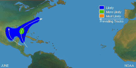
May/June storms in this position almost exclusively get pushed east into Florida.
This post was edited on 5/24/18 at 2:11 pm

 Page 24 of 57

Popular
Back to top