- My Forums
- Tiger Rant
- LSU Recruiting
- SEC Rant
- Saints Talk
- Pelicans Talk
- More Sports Board
- Fantasy Sports
- Golf Board
- Soccer Board
- O-T Lounge
- Tech Board
- Home/Garden Board
- Outdoor Board
- Health/Fitness Board
- Movie/TV Board
- Book Board
- Music Board
- Political Talk
- Money Talk
- Fark Board
- Gaming Board
- Travel Board
- Food/Drink Board
- Ticket Exchange
- TD Help Board
Customize My Forums- View All Forums
- Show Left Links
- Topic Sort Options
- Trending Topics
- Recent Topics
- Active Topics
Started By
Message

 0
0


Posted on 10/13/20 at 9:57 pm to S
Had the 10 course tasting menu. The langoustine was exquisite.
Jean Georges is actually catering my wedding. Invitations going out soon old sport
Reception at the house in Montauk
Jean Georges is actually catering my wedding. Invitations going out soon old sport
Reception at the house in Montauk
This post was edited on 10/13/20 at 9:58 pm
Posted on 10/13/20 at 10:03 pm to Cosmo
While I admit things got a little uncouth for a bit, and there was some rather distasteful banter about, I'm not so sure I prefer the country club vibe that has now overtaken this potential hurricane thread, either.
This post was edited on 10/13/20 at 10:05 pm
Posted on 10/13/20 at 10:05 pm to LegendInMyMind
Wondering myself -

Posted on 10/13/20 at 10:07 pm to Cosmo
Oh, my! I can not wait!
Posted on 10/13/20 at 10:10 pm to S
quote:
S
The man of the hour.
I must say my friend, with the offspring of Oneal taking the hardwood, I feel the ghosts of basketball greatness waking from their slumber.
I think William may have a squad this year.
Posted on 10/13/20 at 10:16 pm to Ignignot
My white palomino steed has been galloping at a Taurean Minor-esque pace in anticipation.
Posted on 10/13/20 at 10:31 pm to S
I can still hear John Brady screaming at Tack.
Posted on 10/14/20 at 6:52 pm to Ignignot

1. A broad area of low pressure near the Lesser Antilles continues to
produce a large area of disorganized showers and thunderstorms,
mainly to the east of its center. Strong upper-level winds are
expected to inhibit significant development while the system moves
west-northwestward over the next couple of days. Regardless of
development, the system could produce locally heavy rainfall and
gusty winds across portions of the Lesser Antilles tonight and
Thursday morning, the Virgin Islands, Puerto Rico, and the eastern
Caribbean Sea late Thursday into Friday, and Hispaniola Friday
night into Saturday.
* Formation chance through 48 hours...low...10 percent.
* Formation chance through 5 days...low...10 percent.
2. A broad non-tropical low pressure system is expected to form over
the weekend several hundred miles southeast of Bermuda. Some slow
development will be possible thereafter into early next week
while the system moves southwestward and then westward, passing
about midway between Bermuda and the northern Lesser Antilles.
* Formation chance through 48 hours...low...near 0 percent.
* Formation chance through 5 days...low...20 percent.
3. A broad area of low pressure could form by early next week over
the southwestern Caribbean Sea. Some gradual development of the
system will be possible thereafter while it moves slowly
west-northwestward.
* Formation chance through 48 hours...low...near 0 percent.
* Formation chance through 5 days...low...20 percent.
Forecaster Stewart
This post was edited on 10/14/20 at 6:53 pm
Posted on 10/14/20 at 6:55 pm to lsuman25
The one down by Central America is the one that has the best chance to spin up, but the models have become more and more bearish on it the last couple days.
Posted on 10/14/20 at 7:08 pm to lsuman25
Phillip Klotzbach and CSU are still calling for an above average end of October. I think at this point they deserve attention. They have been pretty much dead on with every outlook they have given this season.
Posted on 10/14/20 at 7:23 pm to LegendInMyMind
We just got power back .. 5 days without and honestly it was all good. Gas/generator//window unit/water/food cooked on the grill -- and my neighbors with whole house generators were complaining.

Posted on 10/14/20 at 7:25 pm to LegendInMyMind
quote:
Phillip Klotzbach and CSU are still calling for an above average end of October. I think at this point they deserve attention. They have been pretty much dead on with every outlook they have given this season.
You suck and should die for not wanting this in Lousisiana! ~ mattchewdatdickka
This post was edited on 10/14/20 at 7:26 pm
Posted on 10/14/20 at 8:41 pm to lsuman25
It will be interesting to see what the NHC does here with 93L and the new area in the SW Caribbean. Technically, the 93L wave packet will merge with the new yellow area but the vort max might be far enough north that NHC designates a new invest for the SW Caribbean area.

Ultimately, there is a high chance that something will form in the WCAB in the next 6 - 10 days. Where does it go? Climo favors a track off to the NE as cool fronts start to get more frequent and dig deeper into the SE.
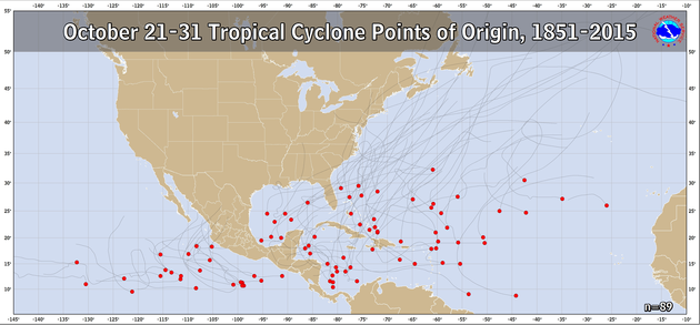
The 18z GEFS has a few clustered track potentials - Westward into the Yucatan or maybe the Gulf (the Canadian model has been showing this), northward into Florida, or off to the NE.

Ultimately, there is a high chance that something will form in the WCAB in the next 6 - 10 days. Where does it go? Climo favors a track off to the NE as cool fronts start to get more frequent and dig deeper into the SE.
The 18z GEFS has a few clustered track potentials - Westward into the Yucatan or maybe the Gulf (the Canadian model has been showing this), northward into Florida, or off to the NE.
Posted on 10/14/20 at 9:30 pm to rds dc
So Climo is climatology?
Posted on 10/14/20 at 11:48 pm to rds dc
Too late for a doomcane to hit Florida they already rescheduled their game with LSU.
Posted on 10/15/20 at 1:09 am to BayouENGR
My LIMITED understanding is saying things like “by then climo may make things less favorable for development” means stuff like bc we are getting late in the seasonal calendar it’s a less favorable environment for hurmicans
In other words, winter is coming
In other words, winter is coming
Posted on 10/15/20 at 11:52 am to rds dc
Let's just stick this one in the model runs of the year folder. This is not to be taken seriously or as a forecast in any way. It's just a funny solution. The 06z GFS-Para from today.


Oh no in the Gulf...

Now confused in the gulf.

frick it, I'm out. Right back over the Keys again.

Back to where it started.
Oh no in the Gulf...
Now confused in the gulf.
frick it, I'm out. Right back over the Keys again.
Back to where it started.
Posted on 10/15/20 at 12:18 pm to Duke
Yeah, that one is something. Throw it in the pile with the Delta run that showed a FL landfall followed by a U-turn and a bee line to NO.
Posted on 10/15/20 at 12:51 pm to Duke
HOW come the NHC website doesn't show anything at all in the GOM now? did it all dissipate?
theres not even a yellow X on the map!!
theres not even a yellow X on the map!!

 Page 11 of 228

Popular
Back to top