- My Forums
- Tiger Rant
- LSU Score Board
- LSU Recruiting
- SEC Rant
- SEC Score Board
- Saints Talk
- Pelicans Talk
- More Sports Board
- Fantasy Sports
- Golf Board
- Soccer Board
- O-T Lounge
- Tech Board
- Home/Garden Board
- Outdoor Board
- Health/Fitness Board
- Movie/TV Board
- Book Board
- Music Board
- Political Talk
- Money Talk
- Fark Board
- Gaming Board
- Travel Board
- Food/Drink Board
- Ticket Exchange
- TD Help Board
Customize My Forums- View All Forums
- Show Left Links
- Topic Sort Options
- Trending Topics
- Recent Topics
- Active Topics
Started By
Message
 0
0

Posted on 5/7/24 at 7:59 pm to LegendInMyMind
Watch that storm slam on the brakes.
Posted on 5/7/24 at 8:03 pm to LegendInMyMind
PDS Warning near Mount Carmel, Indiana moving towards Oxford, Ohio and Reily, Ohio…
on the ground with high wind speeds
on the ground with high wind speeds
This post was edited on 5/7/24 at 8:07 pm

Posted on 5/7/24 at 8:04 pm to BigBro

Posted on 5/7/24 at 8:05 pm to BigBro
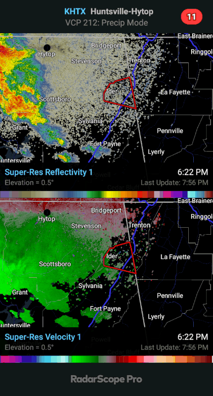
Couplet is very profound on radar on the Oxford storm

Posted on 5/7/24 at 8:07 pm to SWLA92
quote:
Couplet is very profound on radar on the Oxford storm
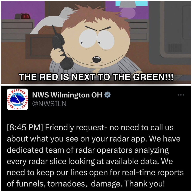
Severe Weather Statement
National Weather Service Wilmington OH
901 PM EDT Tue May 7 2024
INC047-161-OHC017-080130-
/O.CON.KILN.TO.W.0047.000000T0000Z-240508T0130Z/
Franklin IN-Union IN-Butler OH-
901 PM EDT Tue May 7 2024
...A TORNADO WARNING REMAINS IN EFFECT UNTIL 930 PM EDT FOR
NORTHEASTERN FRANKLIN COUNTY IN SOUTHEASTERN INDIANA...SOUTHEASTERN
UNION COUNTY IN EAST CENTRAL INDIANA AND NORTHWESTERN BUTLER COUNTIES
IN SOUTHWESTERN OHIO...
At 901 PM EDT, a large and extremely dangerous tornado was located in
thunderstorms near Brookville, moving east at 30 mph.
This is a PARTICULARLY DANGEROUS SITUATION. TAKE COVER NOW!
HAZARD...Damaging tornado.
SOURCE...Radar indicated rotation.
Posted on 5/7/24 at 8:12 pm to Roll Tide Ravens
new warning near Louisville going towards Georgetown
Posted on 5/7/24 at 8:15 pm to BigBro
new warning in NW Georgia going towards Summerton

Posted on 5/7/24 at 8:49 pm to Roll Tide Ravens
2/3 of Kentucky is under a tornado watch. All of it besides Daniel Boone forest area. Haven’t seen that before.
Looks like all of Nashville and north central Tennessee is under a high risk tomorrow. That’s a lot of people under the gun.
Looks like all of Nashville and north central Tennessee is under a high risk tomorrow. That’s a lot of people under the gun.
Posted on 5/7/24 at 9:00 pm to Pisco
quote:
Looks like all of Nashville and north central Tennessee is under a high risk tomorrow. That’s a lot of people under the gun.
There’s no high risk for tomorrow. There’s a large enhanced risk (level 3/5).

This post was edited on 5/8/24 at 1:26 am
Posted on 5/7/24 at 9:15 pm to Roll Tide Ravens
Was it downgraded from high risk? Or there was never a high risk for tomorrow?
Posted on 5/7/24 at 9:21 pm to SWLA92
quote:
Was it downgraded from high risk? Or there was never a high risk for tomorrow?
There never was one. Only high risk this year was yesterday’s in Oklahoma/Kansas.

Posted on 5/7/24 at 9:49 pm to Roll Tide Ravens
Local news in Mobile is hyping a “level 2 “ risk for severe weather.
But rain chances are %30. Most of the models push rain and storms north of us but they are determined to keep the fear porn up.
But rain chances are %30. Most of the models push rain and storms north of us but they are determined to keep the fear porn up.
Posted on 5/7/24 at 10:15 pm to tilco
Somewhere will likely get a Moderate tomorrow but doubtful we see a High risk.
Posted on 5/7/24 at 10:24 pm to tilco
quote:
Local news in Mobile is hyping a “level 2 “ risk for severe weather.
I don't know how they do their levels, but Mobile isn't in a "level 2" risk. Mobile is in the "General Thunderstorm" risk area for tomorrow, which is basically level 0.
Mobile is in the Slight Risk area for Thursday, which would be SPC's level 2. That threat could extend into the early morning hours of Friday depending on how things go. Tomorrow shouldn't be much of an issue for the area.
That said, it is Mobile......and Mobile does weird shite.
This post was edited on 5/7/24 at 10:24 pm
Posted on 5/7/24 at 11:10 pm to Roll Tide Ravens
I wonder when the last time that much of Tennessee, given its odd shape, was under an enhanced risk
Posted on 5/7/24 at 11:12 pm to Roll Tide Ravens
Posted on 5/8/24 at 1:25 am to Pisco
quote:
Pisco
I see what you’re talking about now. When you said “high risk” it sounded like you were talking about the Storm Prediction Center outlook where the level 5/5 risk is called a “high risk.”
What you posted is a product called NadoCast produced by another group. It’s different from the SPC outlook/products.
This post was edited on 5/8/24 at 1:28 am

 Page 4 of 36

Popular
Back to top