




- My Forums
- Tiger Rant
- LSU Recruiting
- SEC Rant
- Saints Talk
- Pelicans Talk
- More Sports Board
- Fantasy Sports
- Golf Board
- Soccer Board
- O-T Lounge
- Tech Board
- Home/Garden Board
- Outdoor Board
- Health/Fitness Board
- Movie/TV Board
- Book Board
- Music Board
- Political Talk
- Money Talk
- Fark Board
- Gaming Board
- Travel Board
- Food/Drink Board
- Ticket Exchange
- TD Help Board
Customize My Forums- View All Forums
- Show Left Links
- Topic Sort Options
- Trending Topics
- Recent Topics
- Active Topics
Started By
Message

Weather Experts otOT... Midweek severe weather outbreak?
Posted on 2/9/20 at 10:04 am

Posted on 2/9/20 at 10:04 am
RDS, Duke, et al
Just heard Reed Timmer on his FB Live discussing the potential of severe weather, including tornadoes, in the middle of the week through Dixie Alley
seems like he's planning to chase somewhere through SE Louisiana into Mississippi and Alabama on Wednesday
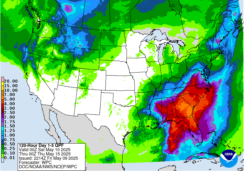
also... local mets here in CenLA were discussing some potential of anywhere up to 7 inches of rain coming this week for an increased flood threat b/c a weather system may decide to stop right on top of us.
What say you?
Just heard Reed Timmer on his FB Live discussing the potential of severe weather, including tornadoes, in the middle of the week through Dixie Alley
seems like he's planning to chase somewhere through SE Louisiana into Mississippi and Alabama on Wednesday
also... local mets here in CenLA were discussing some potential of anywhere up to 7 inches of rain coming this week for an increased flood threat b/c a weather system may decide to stop right on top of us.
What say you?
 7
7


Posted on 2/9/20 at 10:06 am to rt3
We are looking at 7+” here in Huntsville, AL now through Thursday the 20th. I didn’t see any potential of severe though.
This post was edited on 2/9/20 at 10:08 am

Posted on 2/9/20 at 10:14 am to rt3
quote:
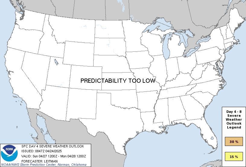
...DISCUSSION... ...Wednesday (day 4)--central Gulf Coast into the Mid-South... A mid-level shortwave trough is forecast to move from the Northeast into the Canadian maritimes prior to Wednesday with a mid-level ridge remaining over FL/Bahamas. As a result, a CP airmass will not likely not infringe on the central Gulf Coast prior to Wednesday. There is increased agreement in model guidance for the evolution of a well-defined mid-level shortwave trough forecast to eject northeast from the southern Great Plains into the OH Valley on Wednesday into Wednesday night. Models are in good agreement showing a previously stalled front advancing north across the Deep South, concurrent with a surface low developing/deepening as it moves northeastward from the northwest Gulf Coast and into TN/KY by early evening. Strong to very strong flow fields overspreading a destabilizing warm sector (featuring low-mid 60s F dewpoints as far north as parts of northern MS/AL) will support the potential for organized severe thunderstorms. In addition to a severe squall line, a supercell risk capable of all hazards is currently forecast.

Posted on 2/9/20 at 10:17 am to rt3
From what I've heard, supposed to be a major rain event moreso than a tornado event.
And this comes on the heels of last week's flooding. Creeks and rivers are high now
And this comes on the heels of last week's flooding. Creeks and rivers are high now
Posted on 2/9/20 at 10:20 am to slackster
quote:
quote:

Posted on 2/9/20 at 10:23 am to OleWarSkuleAlum
Don't need any rain here. 
Posted on 2/9/20 at 10:24 am to rt3
North La is supposed to have a heavy rain event tonight through wednesday. South la not as much.

Posted on 2/9/20 at 10:35 am to Jim Rockford
We had 6.2" of rain in about three days this past week just east of Knoxville. Even with sinkhole drainage and lots of natural caverns for water storage, there was lots of flooding. Don't need the ammount that map suggests is coming at us.
Last February was ridiculously wet (we got a lot more than the 17 inches of rain one of the TV stations reported). Is anybody else wondering if this February pattern is our new normal?
Last February was ridiculously wet (we got a lot more than the 17 inches of rain one of the TV stations reported). Is anybody else wondering if this February pattern is our new normal?

Posted on 2/9/20 at 10:40 am to fishfighter
Did you clip the back 40 last week? I just hit one of my pastures with 2-4-D this morning. Shoulda done it yesterday when there was no wind but a dead battery in the Kubota nixed those plans.
Posted on 2/9/20 at 11:13 am to Jim Rockford
quote:
North La is supposed to have a heavy rain event tonight through wednesday. South la not as much.
I'm in CenLA... so right on the fringe of the predicted high rain totals


Posted on 2/9/20 at 11:45 am to rt3
Reed Timmer really blew his shot...



Posted on 2/9/20 at 11:46 am to rt3
There Gump can't handle much more rain
Posted on 2/9/20 at 12:34 pm to MSUDawg98
I bet she is fire in bed
Posted on 2/9/20 at 1:21 pm to tigerinthebueche
Yes, got it done. One of my nieces brought me her tractor. 100hp dually with a batwing clipper.  Cut my time in a 1/3.
Cut my time in a 1/3. 

Posted on 2/11/20 at 10:02 pm to rt3
Soo... is anything going to come of this? I have to drive up to Shreveport tomorrow morning and back down tomorrow night. :(
Apple weather says 100% t-storms but I know that’s not too reliable.
Apple weather says 100% t-storms but I know that’s not too reliable.

 Page 1 of 1


Popular
Back to top
 Follow TigerDroppings for LSU Football News