- My Forums
- Tiger Rant
- LSU Recruiting
- SEC Rant
- Saints Talk
- Pelicans Talk
- More Sports Board
- Coaching Changes
- Fantasy Sports
- Golf Board
- Soccer Board
- O-T Lounge
- Tech Board
- Home/Garden Board
- Outdoor Board
- Health/Fitness Board
- Movie/TV Board
- Book Board
- Music Board
- Political Talk
- Money Talk
- Fark Board
- Gaming Board
- Travel Board
- Food/Drink Board
- Ticket Exchange
- TD Help Board
Customize My Forums- View All Forums
- Show Left Links
- Topic Sort Options
- Trending Topics
- Recent Topics
- Active Topics
Started By
Message


 1
1

Posted on 8/3/20 at 8:08 pm to NorthEndZone
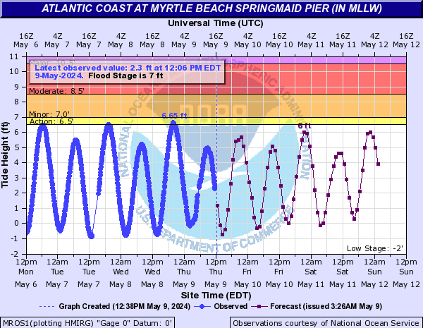
10.18 foot tide at Myrtle Beach...almost 4 feet above normal high tide
 >
>
>This post was edited on 8/3/20 at 8:46 pm
Posted on 8/3/20 at 8:12 pm to NorthEndZone
quote:
almost 4 feet above normal
that's what I said
Posted on 8/3/20 at 8:15 pm to rt3
#CherryGroveSC

Posted on 8/3/20 at 8:16 pm to Bobby OG Johnson
It’s cranking up on Topsail. A strong band is coming ashore and high tide is in 5 minutes. Any idea when we can expect the worst of it?
Posted on 8/3/20 at 8:20 pm to lsu711
quote:
Town of Topsail Beach
@TownofTopsail
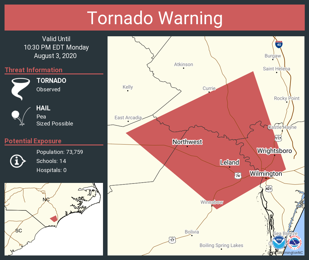
Our area should start to feel tropical storm force winds around 9 pm with the worst of the storm coming through between midnight and 4 am. Flooding of low lying areas and streets is likely. Active tornadoes are possible with this storm so stay alert for warnings overnight.
Posted on 8/3/20 at 8:23 pm to Bobby OG Johnson

Those high winds not really matching up to where the convection is. Honestly looks like it's transitioning to extratropical on this loop.
Posted on 8/3/20 at 8:27 pm to Duke

This post was edited on 8/3/20 at 9:34 pm
Posted on 8/3/20 at 8:39 pm to NorthEndZone
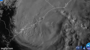
I got 86 kt some 2500 feet off the surface in the heavier rain in the "eyewall" band near the center. That could well be mixing down to the surface. Gusts up to 90 mph wouldn't be surprising as that band runs on shore.
Last radar check seeing 100 kt just 1600 feet off the surface in the rainband.
Last radar check seeing 100 kt just 1600 feet off the surface in the rainband.
This post was edited on 8/3/20 at 8:47 pm
Posted on 8/3/20 at 8:51 pm to Duke
quote:
Last radar check seeing 100 kt just 1600 feet off the surface in the rainband.
Seems to be gaining some traction

This post was edited on 8/3/20 at 8:58 pm
Posted on 8/3/20 at 9:00 pm to Bobby OG Johnson
Yep. Got its act together just before making landfall. The waters just off coast are warmer than normal for this time of year, as well. Could be helping to fuel the strengthening before landfall. That, and isn't fighting sheer nearly as much.
Posted on 8/3/20 at 9:02 pm to Bobby OG Johnson
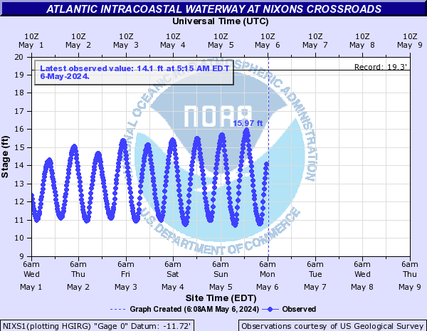
More surge just north of the center...
Posted on 8/3/20 at 9:03 pm to NorthEndZone
Anyone have any good live streams? I have not seen any.
Posted on 8/3/20 at 9:05 pm to NorthEndZone
Pressure 984-985 last pass.
95 kt flight level and 71 kt SFMR. Just off the coast.
95 kt flight level and 71 kt SFMR. Just off the coast.
Posted on 8/3/20 at 9:06 pm to Duke

This post was edited on 8/3/20 at 9:08 pm
Posted on 8/3/20 at 9:26 pm to Bobby OG Johnson
quote:
Buoy 41013 located 10mi WSW of Frying Pan Shoals, NC reporting 18.7 foot waves!

Posted on 8/3/20 at 9:29 pm to Bobby OG Johnson
Getting 100+ mph on the KLTX radar (Wilmington) like 500 feet off the ground. Won't be that strong at the surface but still roaring down near Cape Fear.
83 mph gust at Oak Island.
83 mph gust at Oak Island.
This post was edited on 8/3/20 at 9:30 pm
Posted on 8/3/20 at 9:33 pm to Bobby OG Johnson
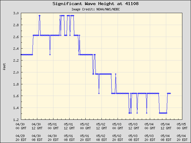
Almost 16 foot waves just a few miles off Wilmington. That is pretty high for that close to shore.
Posted on 8/3/20 at 9:39 pm to NorthEndZone
bad timing... no video from Levi tonight due to travel

Posted on 8/3/20 at 9:44 pm to Duke
Cantore rocking his safety glasses in Wrightsville Beach. No helmet as of now.
This post was edited on 8/3/20 at 9:44 pm

 Page 46 of 50

Popular
Back to top