




- My Forums
- Tiger Rant
- LSU Recruiting
- SEC Rant
- Saints Talk
- Pelicans Talk
- More Sports Board
- Fantasy Sports
- Golf Board
- Soccer Board
- O-T Lounge
- Tech Board
- Home/Garden Board
- Outdoor Board
- Health/Fitness Board
- Movie/TV Board
- Book Board
- Music Board
- Political Talk
- Money Talk
- Fark Board
- Gaming Board
- Travel Board
- Food/Drink Board
- Ticket Exchange
- TD Help Board
Customize My Forums- View All Forums
- Show Left Links
- Topic Sort Options
- Trending Topics
- Recent Topics
- Active Topics
Started By
Message


 3
3


Posted on 2/23/19 at 2:47 pm to Pettifogger
Fox 6 just went wall to wall. Surprised 33/40 isn't on yet.


Posted on 2/23/19 at 2:52 pm to Pettifogger
We are good.
Just a lot of rain
Just a lot of rain
Posted on 2/23/19 at 2:52 pm to Pettifogger
It's rotating, so you're seeing the right thing.
It's just the bit of red isn't very bright (strong) and not quite right next to your green segments. At least the last frame I saw.

Ok better image to run off of. The inbound/outbound is pretty close strength wise, just not quite next to each other. It's rotating but just a broad one vs a tighter tornado.
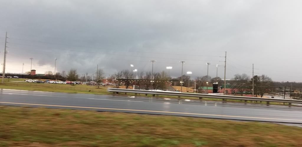
Nice low cloud base on that T-Town storm.
(stolen all images from Spann's twitter)
It's just the bit of red isn't very bright (strong) and not quite right next to your green segments. At least the last frame I saw.
Ok better image to run off of. The inbound/outbound is pretty close strength wise, just not quite next to each other. It's rotating but just a broad one vs a tighter tornado.
Nice low cloud base on that T-Town storm.
(stolen all images from Spann's twitter)
This post was edited on 2/23/19 at 2:57 pm
Posted on 2/23/19 at 2:54 pm to Duke
It’s Wes Wyatt
Posted on 2/23/19 at 2:58 pm to Duke
Keep it away
Posted on 2/23/19 at 3:05 pm to biggsc


Posted on 2/23/19 at 3:06 pm to biggsc
New tornado watch

Posted on 2/23/19 at 3:07 pm to biggsc
Already got the image up in the OP. 
Also:

For our Mississippi folks.
Also:
quote:
KDGX VAD data through the early afternoon has exhibited relatively modest low-level shear (0-1 km SRH less than 150 m2/s2). Coupled with some weakness in the mid-level lapse rate above 500mb, the two factors have combined to limit storm organization in the low levels and the severe risk through 200-230 pm CST. However, a gradual increase in 700mb flow is expected through 6 pm and low-level storm rotation potential is expected to increase coincident with the hodograph enlarging and not exhibiting the degree of veer-back-veer tendency shown in earlier raobs. As such, gradual storm intensification and increase in the severe risk with an accompanying threat for tornadoes is expected.
For our Mississippi folks.
Posted on 2/23/19 at 3:07 pm to Roll Tide Ravens

Posted on 2/23/19 at 3:10 pm to Duke
We had that big storm and it’s still warm and humid outside
Posted on 2/23/19 at 3:21 pm to biggsc
James Spann is finally on
Posted on 2/23/19 at 3:23 pm to biggsc
SUN IS BACK OUT IN TUSCALOOSA
Posted on 2/23/19 at 3:39 pm to biggsc
Here comes another round of rain
Posted on 2/23/19 at 3:48 pm to biggsc
Same shite here, but without the rotation. Basically rains, warms back to convective temp, and rains again. Aint no cap on me.
Posted on 2/23/19 at 3:50 pm to Duke
Severe Storm warning for Birmingham, Tornado warning aimed at Cullman, another storm warning near Hartselle.
Fun times along I-65 (and yes I got PYKL3 back up for one last ride...)

Fun times along I-65 (and yes I got PYKL3 back up for one last ride...)
Posted on 2/23/19 at 3:52 pm to DoctorTechnical
That's a nasty meso rolling into Birmingham. Too broad for a tornado but it's going to bring some wind and some awesome rotating cloud vids.
Watching just east of New Albany, MS. Subtle rotation showing up with some lighting. In a good spot to ramp up.
Watching just east of New Albany, MS. Subtle rotation showing up with some lighting. In a good spot to ramp up.
Posted on 2/23/19 at 3:57 pm to Duke
It sure enough looks like some wind
Posted on 2/23/19 at 4:33 pm to Duke
It’s Parents Weekend at University of Alabama this weekend
Posted on 2/23/19 at 4:36 pm to biggsc


 Page 4 of 7

Popular
Back to top
 Follow TigerDroppings for LSU Football News