- My Forums
- Tiger Rant
- LSU Recruiting
- SEC Rant
- Saints Talk
- Pelicans Talk
- More Sports Board
- Fantasy Sports
- Golf Board
- Soccer Board
- O-T Lounge
- Tech Board
- Home/Garden Board
- Outdoor Board
- Health/Fitness Board
- Movie/TV Board
- Book Board
- Music Board
- Political Talk
- Money Talk
- Fark Board
- Gaming Board
- Travel Board
- Food/Drink Board
- Ticket Exchange
- TD Help Board
Customize My Forums- View All Forums
- Show Left Links
- Topic Sort Options
- Trending Topics
- Recent Topics
- Active Topics
Started By
Message
re: Southeast Severe Weather: 12/28 - 12/29
Posted on 12/29/24 at 5:44 am to LegendInMyMind
Posted on 12/29/24 at 5:44 am to LegendInMyMind
Be interesting to see what the official National Weather Service survey finds. I live 10 minutes from downtown Athens, was watching the Radar Scope app, and never really saw anything significant on Radar Scope. I personally never saw any signs of tight rotation on radar.
 2
2


Posted on 12/29/24 at 6:30 am to HoLeInOnEr05
quote:
Be interesting to see what the official National Weather Service survey finds. I live 10 minutes from downtown Athens, was watching the Radar Scope app, and never really saw anything significant on Radar Scope. I personally never saw any signs of tight rotation on radar.
If there was indeed a tornado, it seems that it basically spun up between scans of the NWS radar. However, a radar operated by UAH appears to have caught the rotation when the potential tornado spun up.
This post was edited on 12/29/24 at 6:31 am
Posted on 12/29/24 at 8:06 am to HoLeInOnEr05
They usually can analyze fairly well between straight line wind damage and tornadic wind damage

Posted on 12/29/24 at 8:21 am to East Coast Band
Posted on 12/29/24 at 8:38 am to Athis
Loading Twitter/X Embed...
If tweet fails to load, click here. And now we get to look forward to a cold snap next week.

Posted on 12/29/24 at 9:33 am to East Coast Band
Posted on 12/29/24 at 10:27 am to East Coast Band
quote:
And now we get to look forward to a cold snap next week.
Signs are pointing to this being a very significant cold snap. It could be similar to what we saw around Christmas in 2022. Perhaps even colder.
The pattern that it looks like we’re going to enter is also favorable for winter weather systems, and while it’s too early to be specific, there are signs that we may see a winter storm in the southeast during this cold snap.
Still a ways out, though.

Posted on 12/29/24 at 11:03 am to Roll Tide Ravens
I woke up to what sounded like a damn hurricane/monsoon outside.
Posted on 12/29/24 at 11:46 am to Roll Tide Ravens
Down the road from us there are several power poles leaning at about a 45° angle. We were that close to losing power last night, but it held on.
ETA: No trees or limbs on the lines, just poles pushed over from the wind.
ETA: No trees or limbs on the lines, just poles pushed over from the wind.
This post was edited on 12/29/24 at 11:48 am
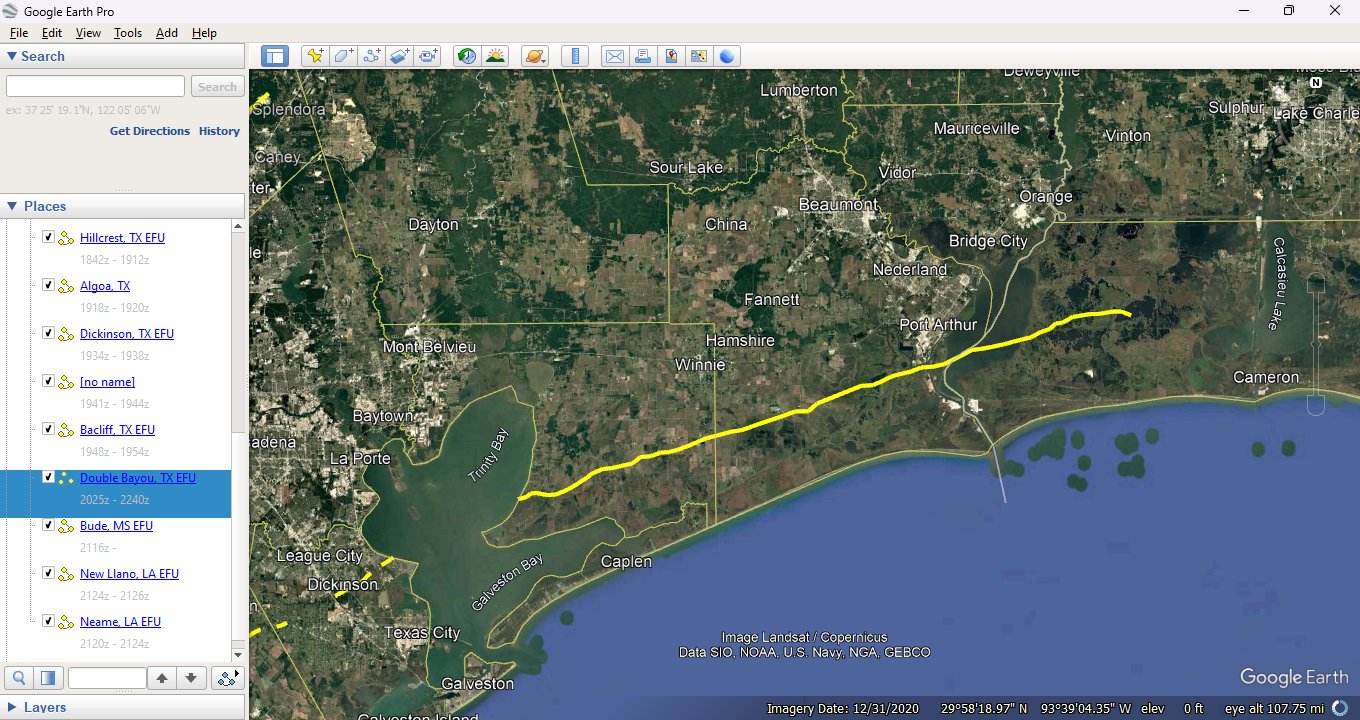
Posted on 12/29/24 at 12:58 pm to LegendInMyMind
Yesterday’s long track storm.
Posted on 12/29/24 at 1:01 pm to Tigerfan1274
Do you have a link to that?
Posted on 12/29/24 at 1:10 pm to LegendInMyMind
Posted on 12/29/24 at 1:59 pm to LegendInMyMind
Posted on 12/29/24 at 2:23 pm to SWLA92

Posted on 12/29/24 at 2:27 pm to SWLA92
Loading Twitter/X Embed...
If tweet fails to load, click here. Perfectly timed development on this tornado. The KHTX radar just missed it between sweeps. It was on the ground less than five minutes. UAH's ARMOR radar caught it, probably because it is timed a bit different on its sweeps.
This one isn't even one of the faster, shorter lived tornadoes. Some can last only a couple of minutes. This is why with these higher end QLCS systems you should treat them like a tornado warning when they move through. You're not going to get much, if any, warning for these type tornadoes. It all lasted maybe 5-7 minutes for us, at least the high wind part.
This post was edited on 12/29/24 at 2:33 pm

Posted on 12/29/24 at 2:46 pm to LegendInMyMind
Posted on 12/29/24 at 10:10 pm to DoctorTechnical

Our house is circled in red. Came right over us. Luckily, just had some damage to our back deck. Tons of trees down and still without power. Estimated restoration is the 31st at 10pm. Wife freaked out while the tornado was coming over us. Spent about 4 hours last night cutting out way out. Highway 27 was blocked by a few trees, so we cut them too. Pretty friggin awesome display of power. Can definitely see a track through the woods of downed trees and ones broken in half.
Posted on 12/29/24 at 10:25 pm to saintkenn
quote:
Came right over us.
Glad to hear y'all are okay and the house didn't get damaged. Hope you get power back asap.
Posted on 12/29/24 at 10:30 pm to saintkenn
Glad you and your family are OK. We used to poke around that area back in my Jackson high school days some 50 years ago.
Meanwhile, NWS is experimenting with replacing the current WSR-88 system with phased-array radar (versus mechanically-rotating dishes). Promises something like a full scan every 20 seconds.
Hope they bring it out soon.
Meanwhile, NWS is experimenting with replacing the current WSR-88 system with phased-array radar (versus mechanically-rotating dishes). Promises something like a full scan every 20 seconds.
Hope they bring it out soon.

 Page 25 of 26

Popular
Back to top