- My Forums
- Tiger Rant
- LSU Recruiting
- SEC Rant
- Saints Talk
- Pelicans Talk
- More Sports Board
- Fantasy Sports
- Golf Board
- Soccer Board
- O-T Lounge
- Tech Board
- Home/Garden Board
- Outdoor Board
- Health/Fitness Board
- Movie/TV Board
- Book Board
- Music Board
- Political Talk
- Money Talk
- Fark Board
- Gaming Board
- Travel Board
- Food/Drink Board
- Ticket Exchange
- TD Help Board
Customize My Forums- View All Forums
- Show Left Links
- Topic Sort Options
- Trending Topics
- Recent Topics
- Active Topics
Started By
Message
 1
1


Posted on 1/3/23 at 6:16 am to beauchristopher
quote:
Whoa, your gif changed. I wasn't aware a gif could have some sort of live update/change
lol I didn’t realize it was a gif. It was a static image when I copied it
Posted on 1/3/23 at 7:38 am to NPComb
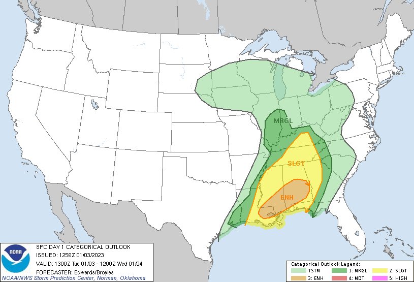
The SPC "Day 1", etc images change every day.
For example a "day 2" gif image issued today will be an image for what tomorrow, Wednesday, will bring.
But, if you go look at that same image tomorrow, the "day 2" gif will display Thursday's forecast.
It is typically updated in the wee hours of the morning
For example a "day 2" gif image issued today will be an image for what tomorrow, Wednesday, will bring.
But, if you go look at that same image tomorrow, the "day 2" gif will display Thursday's forecast.
It is typically updated in the wee hours of the morning

Posted on 1/3/23 at 9:23 am to East Coast Band
New Tornado Watch:
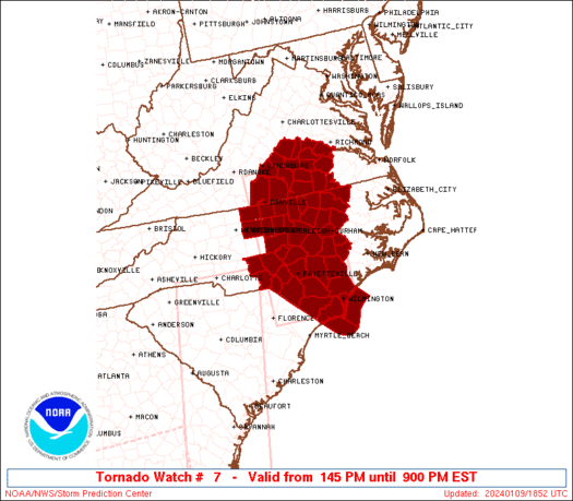
URGENT - IMMEDIATE BROADCAST REQUESTED
Tornado Watch Number 7
NWS Storm Prediction Center Norman OK
915 AM CST Tue Jan 3 2023
The NWS Storm Prediction Center has issued a
* Tornado Watch for portions of
Western Alabama
Southeast Louisiana
Central and Southern Mississippi
Middle Tennessee
* Effective this Tuesday morning and afternoon from 915 AM until
500 PM CST.
* Primary threats include...
A few tornadoes likely with a couple intense tornadoes possible
Scattered damaging winds likely with isolated significant gusts
to 75 mph possible
Isolated large hail events to 1 inch in diameter possible
SUMMARY...A line of thunderstorms extending from parts of Middle
Tennessee southwestward into Mississippi and Louisiana will continue
tracking eastward today across the watch area. Other isolated
thunderstorms will develop ahead of the line throughout the day.
Parameters are favorable for a risk of damaging winds and a few
tornadoes in the more intense storms through the afternoon.
The tornado watch area is approximately along and 70 statute miles
north and south of a line from 75 miles southwest of Mc Comb MS to
50 miles northeast of Huntsville AL. For a complete depiction of the
watch see the associated watch outline update (WOUS64 KWNS WOU7).
This post was edited on 1/3/23 at 9:24 am
Posted on 1/3/23 at 9:44 am to Roll Tide Ravens
A relatively unusual shaped tornado watch area, IMO.
Wide in the Southern portions, narrow in the Northern portion.
Wide in the Southern portions, narrow in the Northern portion.
Posted on 1/3/23 at 9:48 am to East Coast Band
quote:
A relatively unusual shaped tornado watch area, IMO.
Wide in the Southern portions, narrow in the Northern portion
Western TN and much of north MS are covered by a previously issued tornado watch.
Posted on 1/3/23 at 6:02 pm to Roll Tide Ravens
Nasty looking tornado warned storm west of Hattiesburg.
Posted on 1/3/23 at 6:08 pm to Roll Tide Ravens
quote:
Nasty looking tornado warned storm west of Hattiesburg.
Of course! I'm convinced Mississippi is contractually obligated to include either Yazoo City, Hattiesburg, or Laurel in any and all severe weather events.
ETA: Illinois is also in on the tor warnings. They're with in a pretty well sniffed out by the SPC Marginal Risk area.
This post was edited on 1/3/23 at 6:11 pm

Posted on 1/3/23 at 6:25 pm to LegendInMyMind
Looks like a bust for Nola.
Posted on 1/3/23 at 6:33 pm to LegendInMyMind
Bassfield is a tornado magnet
Posted on 1/3/23 at 7:06 pm to deltaland
Getting a little spicy looking in SELA.

Posted on 1/3/23 at 7:08 pm to Kay
(no message)
Posted on 1/3/23 at 7:15 pm to Kay
Strong rotation approaching Laurel, MS.
Posted on 1/3/23 at 7:22 pm to Roll Tide Ravens
Posted at 6:53 PM by the SPC
quote:
..SUMMARY... Tornadoes and damaging gusts remain possible across parts of the Southeast, particularly from southern Mississippi into Alabama, far southwest Georgia and the Florida Panhandle. A strong tornado may occur overnight. ...Southeastern states... The influence of a leading wave which moved out of AL and into GA is currently affecting low-level wind fields over AL, MS and LA this evening, reducing SRH in some areas. However, the main upper trough will move toward the MS Valley tonight, with increasing large-scale ascent over the region. Surface dewpoints in the upper 60s F to lower 70s F will maintain an unstable air mass ahead of a cold front, with a degree of air mass recovery possible over parts of AL and perhaps southwest GA. Numerous storms are expected to develop near the cold front tonight, with an attendant increase in storm relative helicity with 850 mb winds possibly to 50 kt by 12Z Wednesday over AL and western GA. Given the increasing wind shear and favorable ascent, storms may become supercells, either lone or within a broken line, with a threat of tornadoes. By Wednesday morning, the severe threat may extend as far east as southwest GA, and across parts of the FL Panhandle.

Posted on 1/3/23 at 7:27 pm to East Coast Band
Starting to rumble like a homeless man’s stomach in the dirty Doah
Posted on 1/3/23 at 7:33 pm to The Boat
quote:
rumble like a homeless man’s stomach


Posted on 1/3/23 at 7:41 pm to Bobby OG Johnson
Sideways rain and a lot of lightning going on.
Posted on 1/3/23 at 7:43 pm to Bobby OG Johnson
Hail in Prairieville.

 Page 8 of 11

Popular
Back to top