




- My Forums
- Tiger Rant
- LSU Recruiting
- SEC Rant
- Saints Talk
- Pelicans Talk
- More Sports Board
- Fantasy Sports
- Golf Board
- Soccer Board
- O-T Lounge
- Tech Board
- Home/Garden Board
- Outdoor Board
- Health/Fitness Board
- Movie/TV Board
- Book Board
- Music Board
- Political Talk
- Money Talk
- Fark Board
- Gaming Board
- Travel Board
- Food/Drink Board
- Ticket Exchange
- TD Help Board
Customize My Forums- View All Forums
- Show Left Links
- Topic Sort Options
- Trending Topics
- Recent Topics
- Active Topics
Started By
Message

Potential historical flooding
Posted on 8/12/16 at 9:29 am


Posted on 8/12/16 at 9:29 am
Amite at Denham is looking at 42'
Comite at Joor is looking at 32'
Tangipahoa is looking pretty bad too
All per WAFB just now on tv
1983 flooding event
river stages as of 4:42 am
Comite at Joor is looking at 32'
Tangipahoa is looking pretty bad too
All per WAFB just now on tv
1983 flooding event
river stages as of 4:42 am
This post was edited on 8/12/16 at 9:37 am
 6
6

Posted on 8/12/16 at 9:31 am to TheArrogantCorndog
What is historical high mark and when was it? Trying to get a perspective.


Posted on 8/12/16 at 9:32 am to captainahab
amite river gauge @ denham
2001 was TS alison. I was on a cruise ship and missed the event.
quote:
Historic Crests (1) 41.50 ft on 04/08/1983 (2) 41.08 ft on 04/23/1977 (3) 39.88 ft on 01/27/1990 (4) 39.27 ft on 03/15/1921 (5) 38.34 ft on 06/09/2001
2001 was TS alison. I was on a cruise ship and missed the event.
This post was edited on 8/12/16 at 9:35 am
Posted on 8/12/16 at 9:33 am to captainahab
quote:
What is historical high mark and when was it? Trying to get a perspective.
This. I posted in the other thread, but figure I would post here.
What was 83 and some of the other big crest?
I can't deal with moving my elderly parents out of their house and making repairs to their house.


Posted on 8/12/16 at 9:33 am to captainahab
quote:
What is historical high mark and when was it? Trying to get a perspective.
LINK
quote:
On April 7 of 1983, the Comite crested at 29.7 feet, four feet higher than ever recorded at Joor Road, causing heavy flooding along that river, which flows into the Amite. The next day, in the Amite River, rainwater that had gathered from 1,280 square miles of river basin to the north crested at a record high of 41.5 feet at Denham Springs.
Posted on 8/12/16 at 9:34 am to captainahab

Posted on 8/12/16 at 9:35 am to TheArrogantCorndog
Crank up your outboard motors, it's gonna flood bad


Posted on 8/12/16 at 9:35 am to TheArrogantCorndog
"
Posted on 8/12/16 at 9:36 am to East Coast Band
that link shows around 30 ft

Posted on 8/12/16 at 9:36 am to captainahab
quote:
* Flood stage is 20.0 feet. * Forecast...The river will continue rising to near 32.0 feet by early Sunday morning. The river will fall below flood stage Monday morning. * Impact...At 30.6 feet...Highest stage on record, May 19, 1953. * Impact...At 30.0 feet...There will be widespread major flooding. * Impact...At 25.0 feet...Subdivisions between the Comite River and Beaver Bayou will have moderate flooding. High water will prevent recreational and industrial activity from Louisiana Highway 64 downstream to the Amite River junction. Farm animals and equipment should be moved to higher ground.

Posted on 8/12/16 at 9:38 am to TheArrogantCorndog
Remember 83 flood well. Had a house boat at Port Vincent. Following the flood it became a camp at Port Vincent.
Posted on 8/12/16 at 9:39 am to TheArrogantCorndog
quote:42 feet and 32 feet!
Amite at Denham is looking at 42'
Comite at Joor is looking at 32'
Save us!!!
Posted on 8/12/16 at 9:40 am to LSUvegasbombed
quote:
that link shows around 30 ft
Yeah, I'm confused.

Posted on 8/12/16 at 9:41 am to TheArrogantCorndog
My sisters houses in youngsville have a couple inches of water in them
Posted on 8/12/16 at 9:42 am to notiger1997
im not understanding it.
The crest is 30ft in that link.
The crest is 30ft in that link.
Posted on 8/12/16 at 9:42 am to Scruffy
quote:
Save us!!!
I fully believe God Emperor Trump will come save us from this mess

Posted on 8/12/16 at 9:45 am to LSUvegasbombed
quote:
that link shows around 30 ft
Ok, my bad. Thought you were referring to rainfall estimates.

Posted on 8/12/16 at 9:48 am to East Coast Band
30ft of rain doesn't sound too bad
Posted on 8/12/16 at 9:53 am to theunknownknight
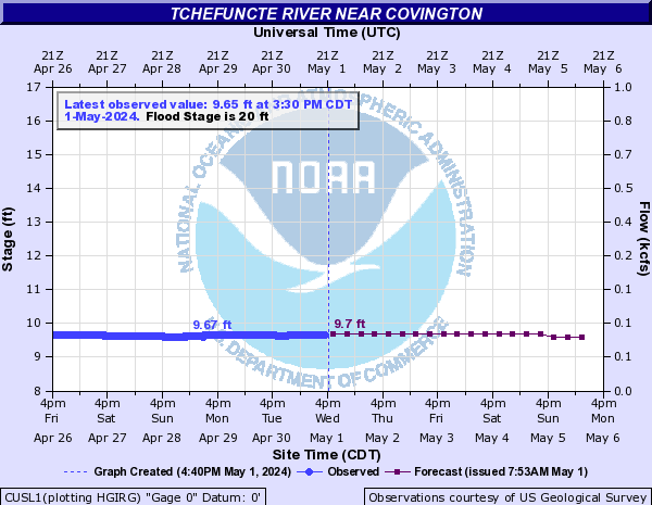
im guessing they will change that prediction soon


Posted on 8/12/16 at 9:55 am to TheArrogantCorndog
quote:
I fully believe God Emperor Trump will come save us from this mess
Maybe HRC could delete the storm

 Page 1 of 2

Popular
Back to top
 Follow TigerDroppings for LSU Football News