- My Forums
- Tiger Rant
- LSU Recruiting
- SEC Rant
- Saints Talk
- Pelicans Talk
- More Sports Board
- Fantasy Sports
- Golf Board
- Soccer Board
- O-T Lounge
- Tech Board
- Home/Garden Board
- Outdoor Board
- Health/Fitness Board
- Movie/TV Board
- Book Board
- Music Board
- Political Talk
- Money Talk
- Fark Board
- Gaming Board
- Travel Board
- Food/Drink Board
- Ticket Exchange
- TD Help Board
Customize My Forums- View All Forums
- Show Left Links
- Topic Sort Options
- Trending Topics
- Recent Topics
- Active Topics
Started By
Message

 1
1


Posted on 3/3/19 at 3:40 pm to Perrydawg
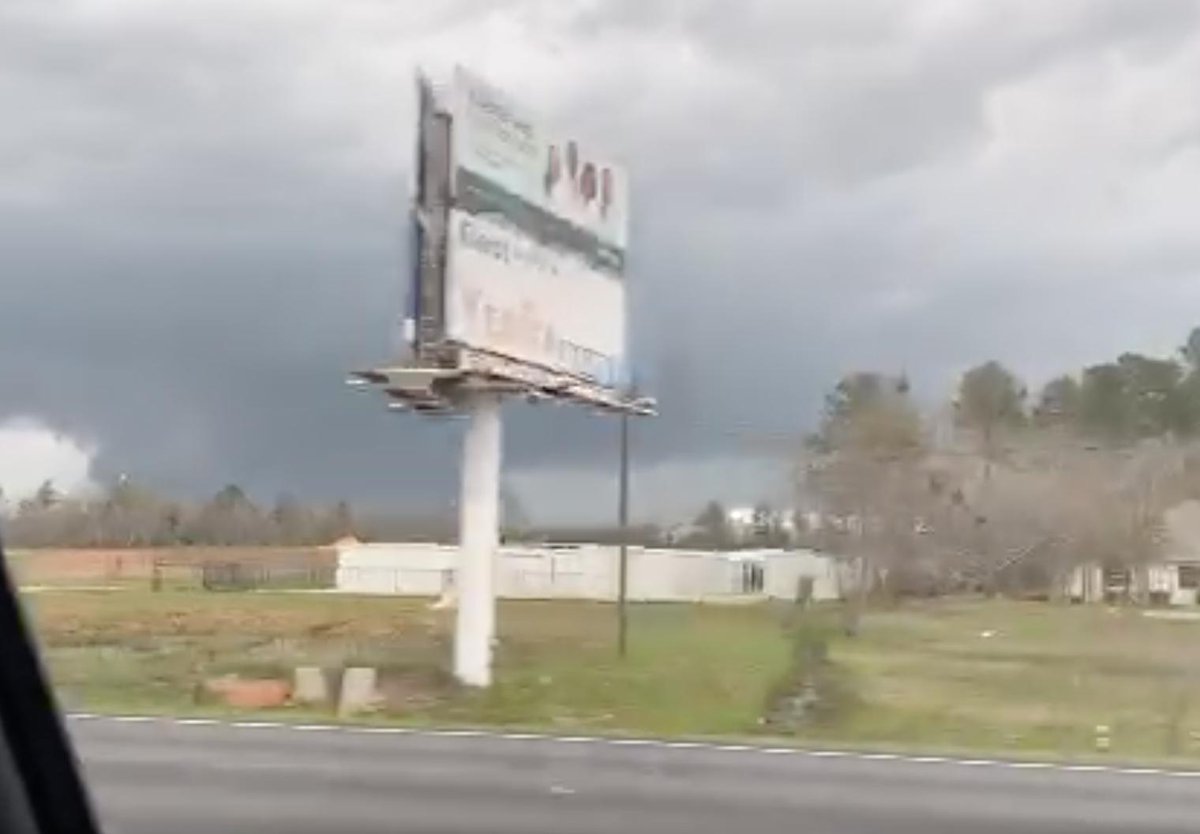
The tornado warned storm near Marshallville, SE of Macon and Warner Robins is nasty looking.
Posted on 3/3/19 at 3:40 pm to Perrydawg
that Macon TV station may have a tornado on skycam here in a minute
Posted on 3/3/19 at 3:41 pm to Bobby OG Johnson
Good god!!!!
Posted on 3/3/19 at 3:45 pm to rds dc
From Jeff P, supposedly the big tornado now ongoing in Georgia
Posted on 3/3/19 at 3:45 pm to Roll Tide Ravens
Gate to gate shear of 150mph on the storm moving toward Perry.
Posted on 3/3/19 at 3:46 pm to Roll Tide Ravens
Perrydawg, if you see this you need to get underground if you can.
This post was edited on 3/3/19 at 3:48 pm
Posted on 3/3/19 at 3:46 pm to GeauxLSUGRL
that has to be a massive tornado north of Marshallville 
Posted on 3/3/19 at 3:47 pm to rt3
quote:
that has to be a massive tornado north of Marshallville
There is no debris signature yet, but we are having to look at it from the Atlanta radar, so the beam is high. The couplet is nasty and I think it has to be on the ground.
Posted on 3/3/19 at 3:48 pm to Roll Tide Ravens
NWS Peachtree City, GA says there is a large and extremely dangerous tornado near Marshallville moving toward Perry.
Posted on 3/3/19 at 3:49 pm to rt3
PDS WARNING for the Marshallville GA tornado...heading toward Perry, GA which is a decent sized place...
Severe Weather Statement
National Weather Service Peachtree City GA
443 PM EST SUN MAR 3 2019
GAC023-153-193-225-289-032230-
/O.CON.KFFC.TO.W.0026.000000T0000Z-190303T2230Z/
Macon GA-Twiggs GA-Bleckley GA-Peach GA-Houston GA-
443 PM EST SUN MAR 3 2019
...A TORNADO WARNING REMAINS IN EFFECT UNTIL 530 PM EST FOR
NORTHEASTERN MACON...SOUTHWESTERN TWIGGS...WEST CENTRAL BLECKLEY...
SOUTHERN PEACH AND CENTRAL HOUSTON COUNTIES...
At 442 PM EST, a large and extremely dangerous tornado was located
over Marshallville, or near Fort Valley, moving east at 50 mph.
This is a PARTICULARLY DANGEROUS SITUATION. TAKE COVER NOW!
HAZARD...Damaging tornado.
SOURCE...Radar indicated rotation.
IMPACT...You are in a life-threatening situation. Flying debris may
be deadly to those caught without shelter. Mobile homes
will be destroyed. Considerable damage to homes,
businesses, and vehicles is likely and complete destruction
is possible.
Locations impacted include...
Perry, Fort Valley, Warner Robins, Marshallville, Robins Air Force
Base, Marion, Saint Louis, Coley Station, Tarversville, Meadowdale,
Sand Bed, Bullard, Houston Lake, Magnolia, Lakewood, Moss Oak,
Porter, Bonaire, Miami Valley and Kathleen.
Posted on 3/3/19 at 3:49 pm to rt3
15,000 people in Perry. Hope it misses or weakens.
This post was edited on 3/3/19 at 3:55 pm
Posted on 3/3/19 at 3:50 pm to Roll Tide Ravens
TWC showed debris ball a few minutes ago...
Posted on 3/3/19 at 3:52 pm to NorthEndZone
Looks like it may go just north of Perry, GA.
Posted on 3/3/19 at 3:53 pm to Roll Tide Ravens
This thing is rain wrapped, so we probably can't see it.
Posted on 3/3/19 at 3:53 pm to Roll Tide Ravens
quote:
NWS Peachtree City, GA says there is a large and extremely dangerous tornado near Marshallville moving toward Perry.
the Macon TV station has a skycam in Perry... they're trying like hell to find a shot of that tornado
ETA: the tornado's about to cross I-75
This post was edited on 3/3/19 at 3:54 pm
Posted on 3/3/19 at 3:56 pm to rt3
Tornado on the ground NW of Eufaula, AL.
This post was edited on 3/3/19 at 3:58 pm
Posted on 3/3/19 at 3:57 pm to rt3
The north side of Perry looks like it has many residential areas. Hope it misses pretty far north.
Posted on 3/3/19 at 3:58 pm to NorthEndZone
quote:
The north side of Perry looks like it has many residential areas. Hope it misses pretty far north.
Yeah, a lot of subdivisions have popped up in the area between Warner Robins and Perry over the last 20 years. Scary situation.
Posted on 3/3/19 at 3:58 pm to rds dc

This post was edited on 3/3/19 at 4:00 pm

 Page 5 of 13

Popular
Back to top