- My Forums
- Tiger Rant
- LSU Recruiting
- SEC Rant
- Saints Talk
- Pelicans Talk
- More Sports Board
- Coaching Changes
- Fantasy Sports
- Golf Board
- Soccer Board
- O-T Lounge
- Tech Board
- Home/Garden Board
- Outdoor Board
- Health/Fitness Board
- Movie/TV Board
- Book Board
- Music Board
- Political Talk
- Money Talk
- Fark Board
- Gaming Board
- Travel Board
- Food/Drink Board
- Ticket Exchange
- TD Help Board
Customize My Forums- View All Forums
- Show Left Links
- Topic Sort Options
- Trending Topics
- Recent Topics
- Active Topics
Started By
Message
 1
1

Posted on 3/24/23 at 9:51 pm to deltaland
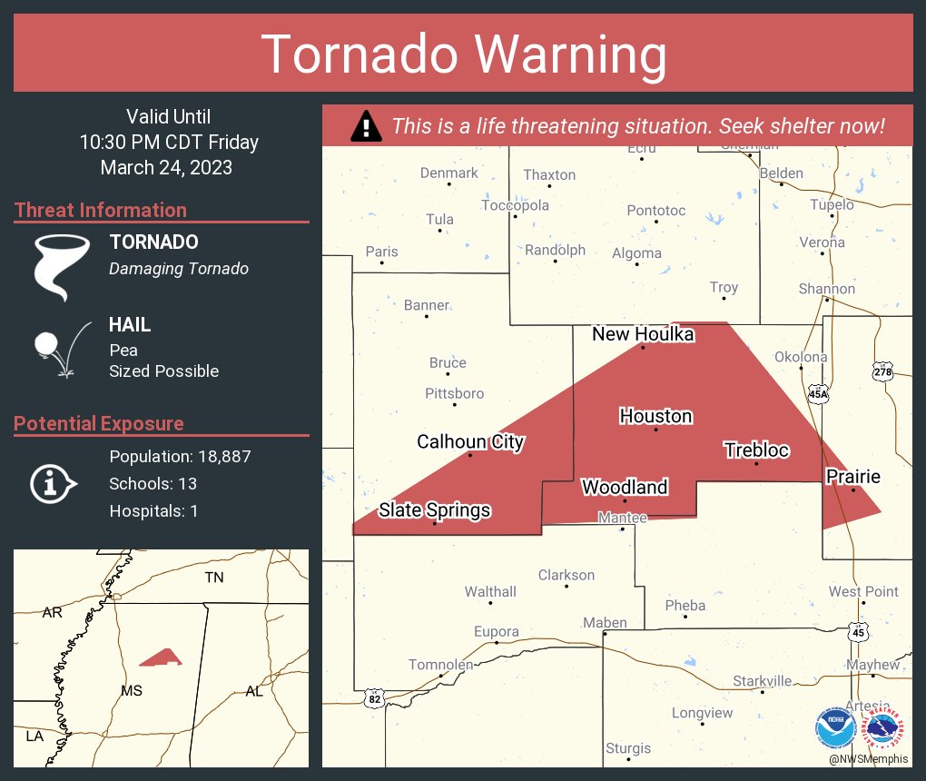
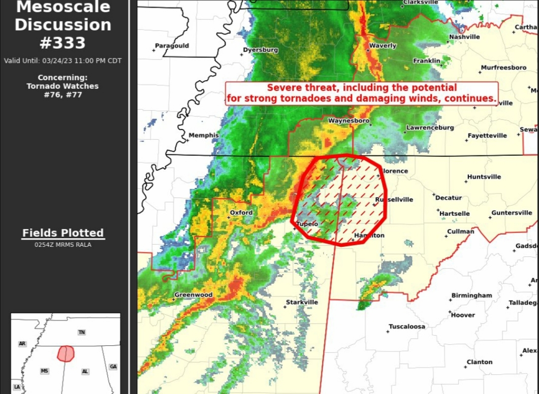
Rolling Fork will almost certainly be an EF4.
Debris got kicked 30k feet into the air. Vrot of like 70-80 kts on radar.
Debris got kicked 30k feet into the air. Vrot of like 70-80 kts on radar.
Posted on 3/24/23 at 9:51 pm to Pisco
quote:
Hopefully north MS will be fine. I have family south of Corinth and I can be there in
less than 3 hours.
Those storms have been more of a QLCS, especially after they passed through Oxford.
Posted on 3/24/23 at 9:51 pm to Easye921
My god, I can’t imagine.

Posted on 3/24/23 at 9:51 pm to LegendInMyMind
quote:
Looks like the tor lifted after passing through Winona. Let's see if it is winding down a bit or cycling.
It lifted sometime after it hit the Rolling Fork area prior to dropping again before hitting Winona, correct?
Posted on 3/24/23 at 9:52 pm to deltaland
I don’t want to speculate but what I’m hearing is it was south of Anguilla but I don’t have any info other than that. I really hate to hear about the damage and fatalities involved in this.

Posted on 3/24/23 at 9:53 pm to Duke
quote:
Rolling Fork will almost certainly be an EF4.
Debris got kicked 30k feet into the air. Vrot of like 70-80 kts on radar.
30k is pretty stout. Just from brief photos and short nighttime vids of damage it looked pretty bad
Posted on 3/24/23 at 9:56 pm to Bobby OG Johnson
quote:
Will Wise
@WillWise_WX
Pray for Rolling Fork. That’s all I can say right now. #mswx

Posted on 3/24/23 at 9:56 pm to tes fou
Sounds like downtown Winona was spared. That’s good news
Posted on 3/24/23 at 9:56 pm to Roll Tide Ravens
quote:
It lifted sometime after it hit the Rolling Fork area prior to dropping again before hitting Winona, correct?
I think so. It cycled at least once. Had a secondary rotation that I'd have to go back and look to see if it was a satellite tor or a cycle.
Posted on 3/24/23 at 9:58 pm to Bobby OG Johnson
Continued
Gettysburg Park Ranger Matt Atkinson is from Houston MS
Gettysburg Park Ranger Matt Atkinson is from Houston MS
Posted on 3/24/23 at 9:58 pm to deltaland
quote:
Sounds like downtown Winona was spared. That’s good news
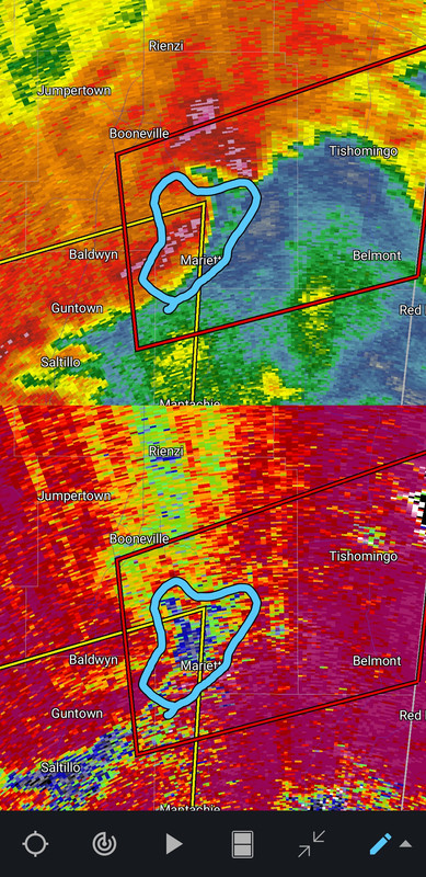
I didn't mention it, but it almost looked like it lifted as it was just going into Winona. It lost an obvious TDS and had the debris fallout look you get when one gusts out.
Posted on 3/24/23 at 9:59 pm to Bobby OG Johnson
quote:
NWS Jackson MS
@NWSJacksonMS
·
1m
9:55 PM: The tornado which passed through Winona and caused damage is now moving northeast through Webster County near Bellefontaine toward MS Highway 9. Take shelter now!

Posted on 3/24/23 at 10:00 pm to LegendInMyMind
Any news out of Rolling Fork? The local school, Sharkey Issaquena Academy, had prom scheduled for tonight. Hopefully they postponed it…
Posted on 3/24/23 at 10:02 pm to Bobby OG Johnson
Fortunately, it doesn't have that distinct TDS with it now and the rotation isn't nearly as impressive.
Posted on 3/24/23 at 10:04 pm to LegendInMyMind
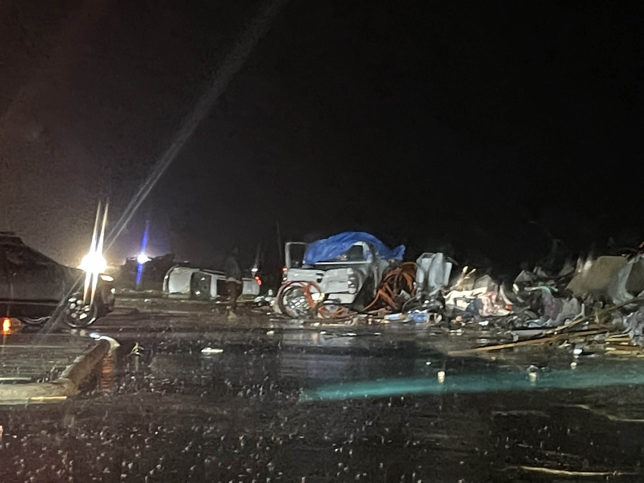
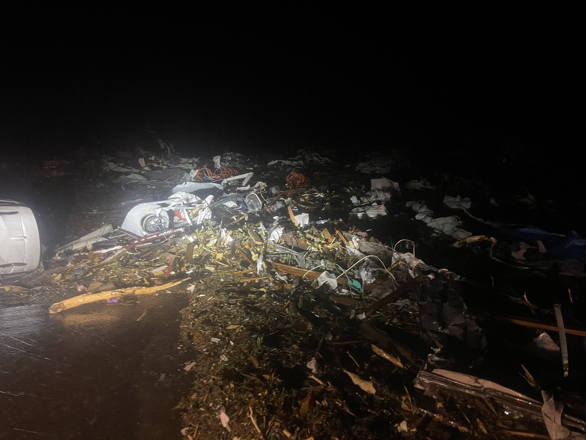
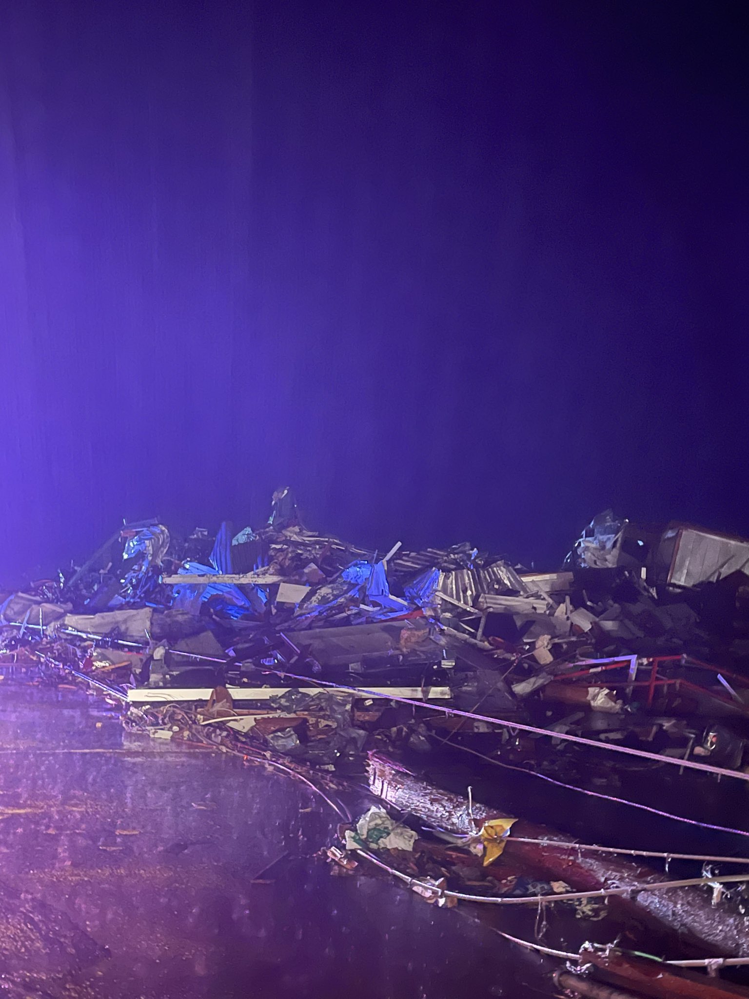
Mayor of Rolling Fork is on TWC. Says they have a lot of injuries and a lot of entrapments. Widespread damage, he says.
He used the word “devastation” to describe the situation.
He used the word “devastation” to describe the situation.
This post was edited on 3/24/23 at 10:06 pm
Posted on 3/24/23 at 10:06 pm to Roll Tide Ravens
This little bowing segment means business. That's all light debris being kicked up ahead of it by the wind.
Posted on 3/24/23 at 10:07 pm to Roll Tide Ravens
Man that's a fricking mess in northeast MS right now, thankful it's to my south
Posted on 3/24/23 at 10:07 pm to LegendInMyMind
NWS Huntsville goes with a Severe T-Storm Warning on that storm instead of continuing the Tor Warning.

 Page 14 of 32

Popular
Back to top