- My Forums
- Tiger Rant
- LSU Recruiting
- SEC Rant
- Saints Talk
- Pelicans Talk
- More Sports Board
- Coaching Changes
- Fantasy Sports
- Golf Board
- Soccer Board
- O-T Lounge
- Tech Board
- Home/Garden Board
- Outdoor Board
- Health/Fitness Board
- Movie/TV Board
- Book Board
- Music Board
- Political Talk
- Money Talk
- Fark Board
- Gaming Board
- Travel Board
- Food/Drink Board
- Ticket Exchange
- TD Help Board
Customize My Forums- View All Forums
- Show Left Links
- Topic Sort Options
- Trending Topics
- Recent Topics
- Active Topics
Started By
Message
re: Ian Observation Thread (Storm Track and Radar inside)
Posted on 9/30/22 at 12:43 pm to Ten Bears

Posted on 9/30/22 at 12:43 pm to Ten Bears
quote:
I have experience with an insurance company going bankrupt in the middle of a claim from Hurricane Sally.
Jeez. That sucks man. I can only imagine the shite you've been through over that.
 1
1


Posted on 9/30/22 at 12:44 pm to OldHickory
They used to have a live webcam but it's down. I hope they get it up by party time.

Posted on 9/30/22 at 12:46 pm to LegendInMyMind

Posted on 9/30/22 at 12:46 pm to Duke

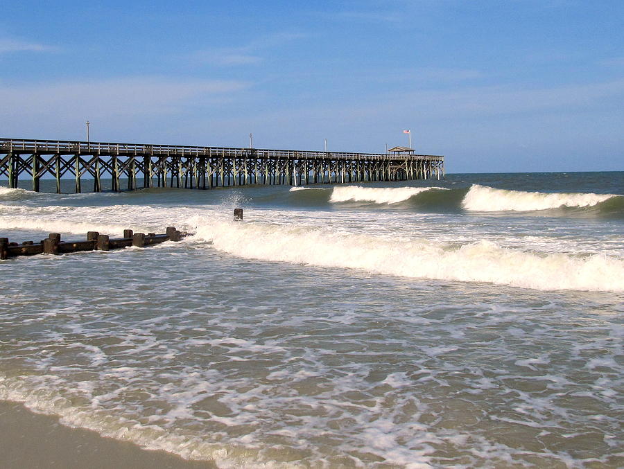
Pawleys island pier
Posted on 9/30/22 at 12:47 pm to DawgCountry
Posted on 9/30/22 at 12:47 pm to NorthEndZone
6.2 feet above normal tide at Myrtle Beach but tide was falling so overall water height was lower than it could have been.

Posted on 9/30/22 at 12:53 pm to deeprig9
Windjammer is an awesome spot. This wind/rain combo needs to move on up out of here. Luckily still have power for now.
Posted on 9/30/22 at 12:54 pm to CarolinaGamecock99
quote:flag hanging in there. This storms Kevin
Pawleys island pier
Posted on 9/30/22 at 12:58 pm to UncleFestersLegs

Posted on 9/30/22 at 1:02 pm to CarolinaGamecock99
Dude.
Posted on 9/30/22 at 1:04 pm to Lonnie Utah
Can’t believe that about the Pawley’s pier. Have been going to Pawley’s my whole life. That’s sad
Posted on 9/30/22 at 1:04 pm to OldHickory
Moving 15mph now but pressure still dropping. 977 according to twc

Posted on 9/30/22 at 1:05 pm to Doctor Grind
That pawleys pier pic...where is that posted?
This post was edited on 9/30/22 at 1:06 pm
Posted on 9/30/22 at 1:06 pm to OldHickory
I would stay on the frying pan
Posted on 9/30/22 at 1:09 pm to CobraCommander83
Getting bigger

Posted on 9/30/22 at 1:09 pm to CobraCommander83
quote:
Rooms cost from $598 per person for three or four nights, plus basic meal supplies, but doesn’t include transfers.
Not too crazy but you do hafta pay to get out there. Actually sounds like a cool place for a short vacation. Fishing, diving, the occasional hurricane
Posted on 9/30/22 at 1:09 pm to mr bojangles
quote:
700 block of Springs Ave. The flooding has been catastrophic. Please stay away from the area.
LINK

There are basically houses built on the beach here with no dunes. This will be bad
This post was edited on 9/30/22 at 1:14 pm
Posted on 9/30/22 at 1:11 pm to CarolinaGamecock99
Pawleys getting battered
Posted on 9/30/22 at 1:17 pm to CarolinaGamecock99
They are on stilts, their boats will be fricked and their cars will be flooded but their houses should be safe.

Posted on 9/30/22 at 1:21 pm to deeprig9
Ian has officially made its final landfall:
Hurricane Ian Tropical Cyclone Update
NWS National Hurricane Center Miami FL AL092022
215 PM EDT Fri Sep 30 2022
...HURRICANE IAN MAKES LANDFALL NEAR GEORGETOWN SOUTH CAROLINA...
Surface observations indicate that the center of Hurricane Ian
made landfall at 205 pm EDT (1805 UTC) near Georgetown, South
Carolina with maximum sustained winds of 85 mph (140 km/h) and an
estimated minimum central pressure of 977 mb (28.85 inches).
SUMMARY OF 205 PM EDT...1805 UTC...INFORMATION
----------------------------------------------
LOCATION...33.3N 79.2W
ABOUT 55 MI...90 KM NE OF CHARLESTON SOUTH CAROLINA
MAXIMUM SUSTAINED WINDS...85 MPH...140 KM/H
PRESENT MOVEMENT...N OR 360 DEGREES AT 15 MPH...24 KM/H
MINIMUM CENTRAL PRESSURE...977 MB...28.85 INCHES
$$
Forecaster Blake/Cangialosi/Huffman

 Page 456 of 465

Popular
Back to top