- My Forums
- Tiger Rant
- LSU Recruiting
- SEC Rant
- Saints Talk
- Pelicans Talk
- More Sports Board
- Coaching Changes
- Fantasy Sports
- Golf Board
- Soccer Board
- O-T Lounge
- Tech Board
- Home/Garden Board
- Outdoor Board
- Health/Fitness Board
- Movie/TV Board
- Book Board
- Music Board
- Political Talk
- Money Talk
- Fark Board
- Gaming Board
- Travel Board
- Food/Drink Board
- Ticket Exchange
- TD Help Board
Customize My Forums- View All Forums
- Show Left Links
- Topic Sort Options
- Trending Topics
- Recent Topics
- Active Topics
Started By
Message
Posted on 7/18/25 at 5:11 pm to TheFonz
quote:
Jefferson Terrace Elementary
Wow, haven’t heard that name in ages. Went to kindergarten there. Lived on Hackberry. Rode bike to school. Good times. Thx for the flashback.
Back on topic, keep that trashy system away from TX. K, thx.
Posted on 7/18/25 at 6:48 pm to Mr Roboto
It doesn't really look like 93L, as it appears the remnant vort max of 93L gets shunted off the East Coast. It looks like a similar gnesis pathway as something might try to spin up on the tailend of an stalled front. Also, there might be a short lived MDR system.
Posted on 7/18/25 at 6:51 pm to jorconalx
quote:
Yea Nick blew that one big time
There was some hi-res model support for isolated higher totals, but the MCS that blew up over CenLa probably kicked off enough subsidence to keep things in check.
Posted on 7/18/25 at 8:07 pm to rds dc
quote:
There was some hi-res model support for isolated higher totals, but the MCS that blew up over CenLa probably kicked off enough subsidence to keep things in check
Talk to me like I’m 5 please.
Posted on 7/18/25 at 8:10 pm to jorconalx
It rained less than the upper end of predictions because weather conditions changed.
This post was edited on 7/18/25 at 8:11 pm
Posted on 7/18/25 at 8:13 pm to jorconalx
Pretty elementary stuff there
Posted on 7/18/25 at 8:16 pm to jorconalx
quote:
Talk to me like I’m 5 please.
The mess of storms that developed over central Louisiana caused the air at higher levels in the atmosphere to cool and sink, leading to drier air along the more coastal areas that kept the rain and storms from reaching their ceiling and dumping higher totals of rainfall.
This post was edited on 7/18/25 at 8:17 pm
Posted on 7/18/25 at 8:17 pm to Mr Roboto
I’m sure both you retards knew what a Mesoscale Convective System was
Posted on 7/18/25 at 9:27 pm to jorconalx
quote:
Talk to me like I’m 5 please.
It was a big nothingburger
Posted on 7/19/25 at 11:41 pm to Jim Rockford
Would not surprise me.
Posted on 7/22/25 at 6:50 pm to LSUEnvy

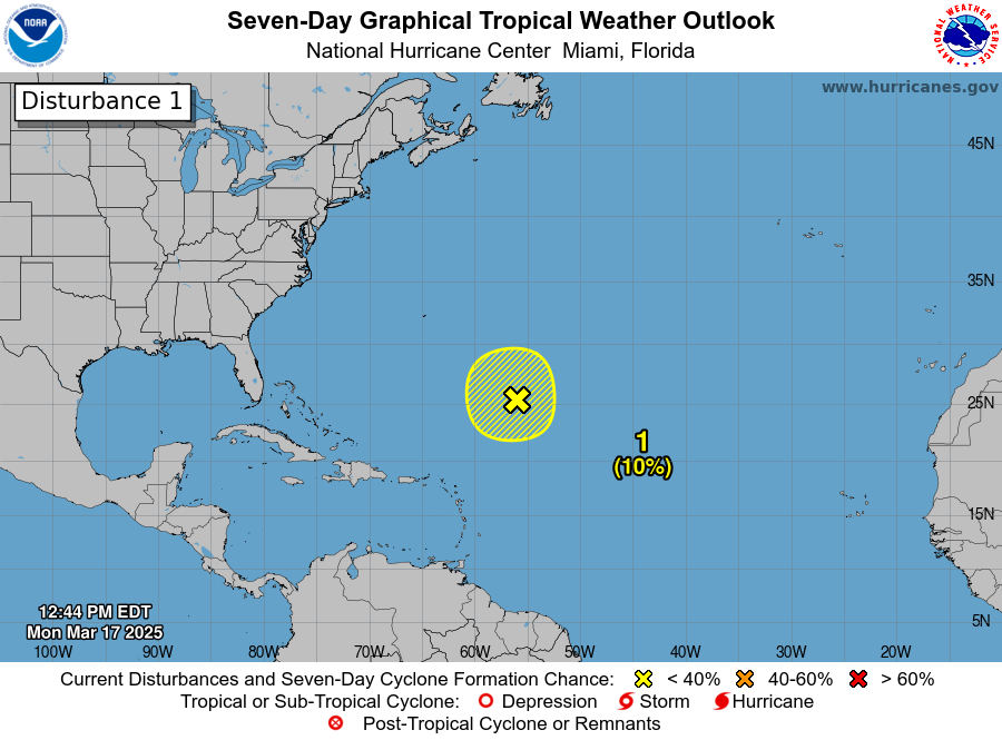
North-Central Gulf:
A trough of low pressure on the southern end of a frontal boundary
is currently located just offshore of the Southeastern U.S. coast.
Over the next few days, this system is forecast to move
west-southwestward into the north-central portion of the Gulf, where
environmental conditions could allow for some slow development if
the system remains far enough offshore. By this weekend, the system
is likely to move inland, ending its chances for development.
Regardless of formation, heavy rainfall could be possible for
portions of the northern Gulf coast through this weekend.
* Formation chance through 48 hours...low...10 percent.
* Formation chance through 7 days...low...10 percent.
Posted on 7/22/25 at 7:05 pm to jorconalx
quote:Isn't that what they make tequila from???
I’m sure both you retards knew what a Mesoscale Convective System was
Posted on 7/22/25 at 7:07 pm to lsuman25
need some rain in Hammond America
Posted on 7/22/25 at 7:26 pm to jorconalx
quote:
I’m sure both you retards knew what a Mesoscale Convective System was
Isn’t that the country they make Tequila in?
Popular
Back to top

 1
1


