- My Forums
- Tiger Rant
- LSU Recruiting
- SEC Rant
- Saints Talk
- Pelicans Talk
- More Sports Board
- Fantasy Sports
- Golf Board
- Soccer Board
- O-T Lounge
- Tech Board
- Home/Garden Board
- Outdoor Board
- Health/Fitness Board
- Movie/TV Board
- Book Board
- Music Board
- Political Talk
- Money Talk
- Fark Board
- Gaming Board
- Travel Board
- Food/Drink Board
- Ticket Exchange
- TD Help Board
Customize My Forums- View All Forums
- Show Left Links
- Topic Sort Options
- Trending Topics
- Recent Topics
- Active Topics
Started By
Message
 5
5

Posted on 7/14/25 at 10:33 pm to rds dc
If that run verified basically nothingburger for southeast Louisiana

Posted on 7/14/25 at 10:40 pm to rds dc
quote:
Interesting, not seeing any 00z ICON images
Babe threads don’t feature 4’s either.
This post was edited on 7/14/25 at 10:41 pm

Posted on 7/14/25 at 10:42 pm to rds dc
quote:
Interesting, not seeing any 00z ICON images
It doesn't matter what forum you're on. Here, Storm2k, etc. people love wishcasting.
Posted on 7/14/25 at 10:44 pm to lsuman25
18z ICON went from 20+ inches in parts of S La to 2-3 inches for S La on the 00z ICON

Posted on 7/14/25 at 10:47 pm to Oates Mustache
quote:
t doesn't matter what forum you're on. Here, Storm2k, etc. people love wishcasting.
Storm2k is on a whole other plane from this place when it comes to wishcasting.

Posted on 7/14/25 at 10:47 pm to rds dc
quote:
Interesting, not seeing any 00z ICON images
Wishcast [off] on
Posted on 7/14/25 at 11:04 pm to Cosmo
The ones that know what they are talking about have been telling these waterhead fricks for 2 days that the icon didn’t make any sense. Now it catches up and they just…they can’t.
Posted on 7/14/25 at 11:08 pm to BregmansWheelbarrow
I wouldn’t toot the horn either way right now. It could become a nothing burger or could be come tropical mischief. Anytime something tropical gets in the Gulf we have to atleast pay attention to it
This post was edited on 7/14/25 at 11:49 pm
Posted on 7/14/25 at 11:17 pm to SWLA92
Did they already stop running the hurricane models on 93L?
Posted on 7/14/25 at 11:20 pm to lsuman25
The 00z hurricane models usually run closer to midnight I think
Posted on 7/14/25 at 11:27 pm to SWLA92
I can never remember 
Posted on 7/15/25 at 2:53 am to SWLA92
00Z Euro ensembles are interesting
Posted on 7/15/25 at 4:50 am to lsuman25
How’s MSY then Houston looking for Saturday am?
Posted on 7/15/25 at 5:00 am to lsuman25
quote:
00Z Euro ensembles are interesting
Mysterious. What does that mean?

Posted on 7/15/25 at 5:57 am to HighRoller
So will we have a storm or not? Or will it impact us more than the rain showers we have been getting daily?

Posted on 7/15/25 at 6:26 am to longhorn22
Posted on 7/15/25 at 6:29 am to Mr Roboto
Great. I’ll be moving the stepdaughter from a Navy base in Pensacola to Destin on Friday. I’m destined to be right in the thick of it.
Destin - destined. Haha. I’m hilarious. Ok, maybe nit
Destin - destined. Haha. I’m hilarious. Ok, maybe nit
Posted on 7/15/25 at 6:34 am to HighRoller
My weather app now says tropical storm for thursday friday.
Weird. It never does that.
Weird. It never does that.
Posted on 7/15/25 at 6:56 am to longhorn22
quote:
So will we have a storm or not? Or will it impact us more than the rain showers we have been getting daily?
It is still hard to tell. Looks like a lot of rain.
Intensity looks like it may not reach tropical storm status. There are a few that do make it to a tropical storm.
But here is where I have trust issues with local media and app alerts.
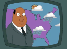
The way they are worded is at times nothing more than conjecture and hyperbole to draw you in. As I was writing this one local station just sent an alert says tropical formation likely, but the intensity guidance shows less than tropical storm winds. I guess their thought is that it is going to be a depression but in my book that is nothing to get your panties in a wad. We have thunderstorms with more intensity.
This post was edited on 7/15/25 at 7:08 am

 Page 17 of 35

Popular
Back to top