




- My Forums
- Tiger Rant
- LSU Recruiting
- SEC Rant
- Saints Talk
- Pelicans Talk
- More Sports Board
- Fantasy Sports
- Golf Board
- Soccer Board
- O-T Lounge
- Tech Board
- Home/Garden Board
- Outdoor Board
- Health/Fitness Board
- Movie/TV Board
- Book Board
- Music Board
- Political Talk
- Money Talk
- Fark Board
- Gaming Board
- Travel Board
- Food/Drink Board
- Ticket Exchange
- TD Help Board
Customize My Forums- View All Forums
- Show Left Links
- Topic Sort Options
- Trending Topics
- Recent Topics
- Active Topics
Started By
Message


 2
2

Posted on 4/13/19 at 11:23 am to rt3
Keep it coming rt3 I’m in Avoyelles next door to you. I will be listening to you and Duke for the remaining day

Posted on 4/13/19 at 11:25 am to rt3
that tornado in Texas is right over the heart of Franklin
Posted on 4/13/19 at 11:26 am to rds dc
think the SPC will put the PDS tag on that watch?
Posted on 4/13/19 at 11:26 am to rt3
Pouring heavy in heart of bossier

Posted on 4/13/19 at 11:27 am to rds dc
quote:
Atmosphere is beyond primed south of there, any storms that realize that parameter space will go off.
Got a scary afternoon ahead as that migrates north into those dynamics closer to the surface low.
Posted on 4/13/19 at 11:28 am to rt3
quote:
that tornado in Texas is right over the heart of Franklin

Posted on 4/13/19 at 11:28 am to Duke
TWC has damage on the screen from Hearne, Texas
Posted on 4/13/19 at 11:29 am to Duke
Duke what’s it looking like for the Rapides Avoyelles area, will it be a hairy ride?

Posted on 4/13/19 at 11:30 am to Duke
there's another tornado warning to the east of that Franklin tornado from a different cell
Posted on 4/13/19 at 11:31 am to 4EvEr Bo REIN
quote:
Duke what’s it looking like for the Rapides Avoyelles area, will it be a hairy ride?
TWC has us with a TOR:CON number of 7 out of 10
that's way too high... you need to know where you'll go if a tornado drops nearby
Posted on 4/13/19 at 11:32 am to rds dc
Ugh. That CC isn't a good look.
Posted on 4/13/19 at 11:33 am to rt3
the new tornado warned cell is headed north towards Alto, Texas
Posted on 4/13/19 at 11:33 am to rt3
10-4 Brother keep us posted I will be watching y’all
Stay safe
Stay safe
Posted on 4/13/19 at 11:40 am to 4EvEr Bo REIN
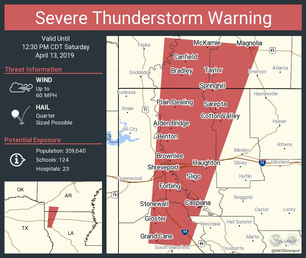

Posted on 4/13/19 at 11:44 am to rds dc
Open warm sector continues to expand northward into CenLA. Watch the cloud streets in eastern TX for new cells to pop, those will have potential to produce tornadoes.



Posted on 4/13/19 at 11:52 am to Bigbee Hills
quote:
What about the east central Mississippi area from, say, Philadelphia going north to Columbus?
Sort of the same as west Alabama. Your area is in the enhanced risk, so I would expect some severe weather and tornado activity later on tonight into the early morning hours.
It is not particularly warm now, but warmer and more unstable air will advect into the area later today. Plus, there will be a lot of low level shear, which will help storms rotate, even if the instability is lower.
This post was edited on 4/13/19 at 11:55 am
Posted on 4/13/19 at 11:52 am to rds dc
there's a 3rd tornado warned cell in Texas in that same area of the other 2


Posted on 4/13/19 at 11:55 am to rds dc
quote:
Those storms are north of the surface warm front and the rain cooled air could slow the northward movement of the WF. South of the WF there is plenty of energy in the atmosphere and that will surge north this afternoon. There are actually some breaks in the clouds south of the WF.
Thanks for the shitty correction.

 Page 21 of 47

Popular
Back to top
 Follow TigerDroppings for LSU Football News