




- My Forums
- Tiger Rant
- LSU Recruiting
- SEC Rant
- Saints Talk
- Pelicans Talk
- More Sports Board
- Fantasy Sports
- Golf Board
- Soccer Board
- O-T Lounge
- Tech Board
- Home/Garden Board
- Outdoor Board
- Health/Fitness Board
- Movie/TV Board
- Book Board
- Music Board
- Political Talk
- Money Talk
- Fark Board
- Gaming Board
- Travel Board
- Food/Drink Board
- Ticket Exchange
- TD Help Board
Customize My Forums- View All Forums
- Show Left Links
- Topic Sort Options
- Trending Topics
- Recent Topics
- Active Topics
Started By
Message


 1
1

Posted on 5/2/17 at 1:42 pm to rds dc
See yeah that's not going to work for me. What time is that projected for?


Posted on 5/2/17 at 1:44 pm to When in Rome
Looks to be between midnight and 4 am Thursday morning
Posted on 5/2/17 at 1:44 pm to rds dc
That's pretty nasty looking
Posted on 5/2/17 at 1:45 pm to ForeverLSU02
Sweet. I will be out of there by then.

Posted on 5/2/17 at 1:50 pm to When in Rome
quote:
What time is that projected for?
Models are typically too slow with big lines like that, so maybe after 9 or 10?
Posted on 5/2/17 at 1:50 pm to rds dc
Let's hope after 10. Flight takes off at 9:15
Posted on 5/2/17 at 1:53 pm to When in Rome
quote:
Let's hope after 10. Flight takes off at 9:15
Good luck with all that
Posted on 5/2/17 at 1:57 pm to rds dc
quote:With this coming from you, I am not feeling hopeful.
Good luck with all that

Posted on 5/2/17 at 2:02 pm to rds dc
Mother Nature has a huge dick for CENLA lately.



Posted on 5/2/17 at 2:10 pm to When in Rome
If for some reason you see it's delayed early in the day, definitely get to the airport much earlier and take a flight through MIA, CLT or PHL in the afternoon to get there. British Airways can rebook you on American to get you to Heathrow. The evening options through DFW and MIA (7:30pm, 5:30pm respectively) are not legal connections meaning you'll be stuck with the British Airways flight however long it gets delayed. Do not go through Ohare or DFW if the weather is coming from the west/midwest tomorrow, the 1 hr 15min flight becomes 2 hours and you'll miss the connection
Posted on 5/2/17 at 2:12 pm to Upperdecker
East Texas has been having crazy weather lately. I drove through Canton, TX on Sunday 
Posted on 5/2/17 at 2:15 pm to CuseTiger
Good to know. Thank you!! 

Posted on 5/2/17 at 2:17 pm to rds dc
That's not a tornado..silly. That's the big ole BLM helicopter with all the Brother's coming into support a felon with a firearm on drugs who shot himself....nothing to see here....move on.
Posted on 5/2/17 at 2:22 pm to rds dc
quote:Do you think the storm will move pretty quickly in and out of the area? Storms don't typically stall over NOLA, do they? Maybe the flight will just be delayed for like an hour.
rds dc

Posted on 5/2/17 at 2:25 pm to rds dc
quote:
like they have been more frequent over the past 5 or so years. It might just better detection methods, epically for tornadoes embedded in squall lines.
Or perhaps you read the OT more now
Posted on 5/2/17 at 2:41 pm to rds dc

Prior to 2017, it looks like the last few years have seen a decrease in tornadic activity. It probably just seems like more because of the better detection technology these days. Seems like they're issuing a lot more watches lately
I believe April, May and June are historically the 2 months with the greatest amount of tornadoes. We're currently at about 550 tornadoes for 2017 through April and these next few months are peak tornado season. Looking at the graph above 10 year average through April is a little more than 500 tornadoes.
Posted on 5/2/17 at 5:09 pm to rds dc
US Tornadoes chimes in and calls for 6 - 14 tornadoes
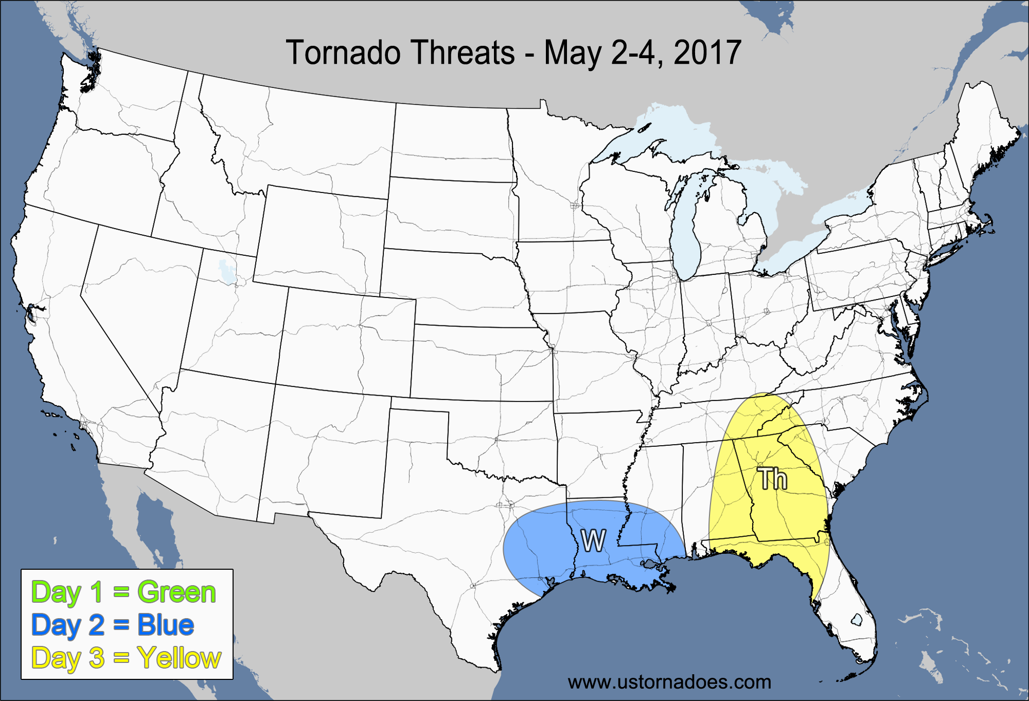
US Tornadoes Website
quote:
Wednesday – Eastern Texas, Louisiana, southern Mississippi NUMBER OF TORNADOES EXPECTED: 6-14 – CONFIDENCE: Normal Tornado Hot-spot: None Pros: Moderate instability, good low-level directional shear, good/excellent speed shear. Cons: Advancing cold front will make storms line-out, some of the best storms may form north of the warm front, staying elevated.
US Tornadoes Website
Posted on 5/2/17 at 5:14 pm to ksayetiger
quote:
Or perhaps you read the OT more now
I have been on TDs more since moving away from DC
After looking at recent Louisiana tornado data, there was a lull in activity in the early 2000's, then an "active" period from '08 - '12, and then pretty much normal since then. The max was 102 in '09 and then the min was 16 in '14.
Posted on 5/2/17 at 5:27 pm to rds dc
NWS has issued a Flash Flood Watch for portions of Louisiana:


 Page 2 of 20

Popular
Back to top
 Follow TigerDroppings for LSU Football News