- My Forums
- Tiger Rant
- LSU Recruiting
- SEC Rant
- Saints Talk
- Pelicans Talk
- More Sports Board
- Fantasy Sports
- Golf Board
- Soccer Board
- O-T Lounge
- Tech Board
- Home/Garden Board
- Outdoor Board
- Health/Fitness Board
- Movie/TV Board
- Book Board
- Music Board
- Political Talk
- Money Talk
- Fark Board
- Gaming Board
- Travel Board
- Food/Drink Board
- Ticket Exchange
- TD Help Board
Customize My Forums- View All Forums
- Show Left Links
- Topic Sort Options
- Trending Topics
- Recent Topics
- Active Topics
Started By
Message
re: The Great Flood of 2016: Fill Out Disaster Forms NOW. Link Inside!
Posted on 8/12/16 at 10:59 pm to bubbz
Posted on 8/12/16 at 10:59 pm to bubbz
Getting a break here southeast of denham. It won't mean much in the long run though. I've taken pics of everything and all my rooms/closets/belongings. Might start getting things off of floors tomorrow. We just got new flooring this year. I will not be happy.
 2
2

Posted on 8/12/16 at 10:59 pm to NorthEndZone
Question: now that 10 and areas of prairieville are flooding, will it get much worse by Sunday? I ask because you fine people told me not to bother coming back from the beach tomorrow. I heeded that advice and am instead coming back Sunday.. But now I fear we won't be able to access our home.
Posted on 8/12/16 at 11:00 pm to ell_13
Don't wait. Seriously. So much can happen.
Posted on 8/12/16 at 11:02 pm to ell_13
quote:
I've taken pics of everything and all my rooms/closets/belongings
Good luck, man. I hope the crest is somehow not as high as forecast.
Posted on 8/12/16 at 11:03 pm to tigerbandpiccolo
Here is a link to the last 24 hrs of sat imagery over Louisiana. Notice how storms explode last night after the afternoon/evening storms fade. Will be watching to see if the system can fire storms again later tonight, which most of the models are showing. Warm core lows over land can be very efficient nocturnal rain producers.

Posted on 8/12/16 at 11:06 pm to tigerbandpiccolo
I would come back tomorrow. Seems like Sunday would be worse.
Posted on 8/12/16 at 11:08 pm to NorthEndZone
quote:
NorthEndZone
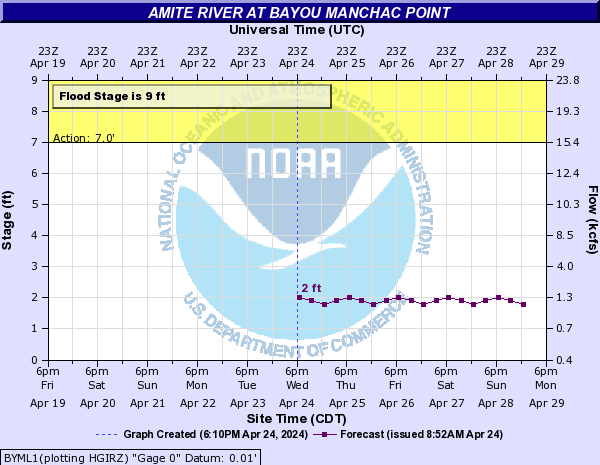
Where are you getting those descriptions associated with the maps? And can you post the ones for the Amite at Manchac Point?
Posted on 8/12/16 at 11:08 pm to urinetrouble
Last time I ever listen to you, you stupid OT. But what does that say about me? 
I was vulnerable after 7 days of a rainy beach trip.
I was vulnerable after 7 days of a rainy beach trip.
Posted on 8/12/16 at 11:09 pm to NorthEndZone
Is i12 east of baton Rouge closed in either direction? I find nothing on the dotd website but have been told it just happened near satsuma all the way to O'Neil lane.
Posted on 8/12/16 at 11:10 pm to rds dc
Lite rain in Walker by i12. We live in the neighborhood pond and water is very high. It hasn't rised in the last 2 hours but is not falling either. Hoping the rain holds off and I don't wake up to water on the floor. 3 houses at the end of my street no so luck. The water down there is up to mid thigh and still rising. I feel so sorry for anyone dealing with flood damage.
Posted on 8/12/16 at 11:10 pm to rds dc
First of the 00z models are in, a blend of the GFS and NAM 4K would be another 10-15" rain over the areas that have already been hammered.
Posted on 8/12/16 at 11:14 pm to rds dc
quote:
First of the 00z models are in, a blend of the GFS and NAM 4K would be another 10-15" rain over the areas that have already been hammered.
Can you be more specific about the NAM? I know it was being much more conservative compared to the GFS which has been consistent on showing 15 inches for the Baton Rouge area.
Posted on 8/12/16 at 11:14 pm to rds dc
Going to be a stressful night for me of radar watching and river watching. At least we have flood insurance, given I'm in a flood zone (Amite tributary runs behind my property). That 00z scenario is a nightmare, considering I haven't been in the house a month yet.
Posted on 8/12/16 at 11:15 pm to rds dc
So Zachary should expect 10-15" of rain?....

Posted on 8/12/16 at 11:15 pm to BigB0882
00z NAM:

00z GFS:

00z GFS:
Posted on 8/12/16 at 11:16 pm to rds dc
quote:
First of the 00z models are in, a blend of the GFS and NAM 4K would be another 10-15" rain over the areas that have already been hammered
What?

Posted on 8/12/16 at 11:17 pm to LSUsmartass
How are things where you are?
Posted on 8/12/16 at 11:17 pm to BigB0882
quote:
Can you be more specific about the NAM? I know it was being much more conservative compared to the GFS which has been consistent on showing 15 inches for the Baton Rouge area.
4K NAM has been too far east the past day or so, that is why I mentioned a blend of the GFS and 4K NAM.
00z 4K NAM

00z GFS

ETA: I see GM posted the same images above from TT
This post was edited on 8/12/16 at 11:19 pm
Posted on 8/12/16 at 11:18 pm to Flanders
quote:
Is i12 east of baton Rouge closed in either direction? I find nothing on the dotd website but have been told it just happened near satsuma all the way to O'Neil lane.
The only thing I'm finding is I-12 entrance/exit ramps are closed at the Satsuma exit, per WAFB.
Posted on 8/12/16 at 11:18 pm to urinetrouble
quote:
can you post the ones for the Amite at Manchac Point
https://water.weather.gov

 Page 35 of 472

Popular
Back to top