- My Forums
- Tiger Rant
- LSU Recruiting
- SEC Rant
- Saints Talk
- Pelicans Talk
- More Sports Board
- Fantasy Sports
- Golf Board
- Soccer Board
- O-T Lounge
- Tech Board
- Home/Garden Board
- Outdoor Board
- Health/Fitness Board
- Movie/TV Board
- Book Board
- Music Board
- Political Talk
- Money Talk
- Fark Board
- Gaming Board
- Travel Board
- Food/Drink Board
- Ticket Exchange
- TD Help Board
Customize My Forums- View All Forums
- Show Left Links
- Topic Sort Options
- Trending Topics
- Recent Topics
- Active Topics
Started By
Message
re: Tenth Anniversary of the 2011 Super Tornado Outbreak
Posted on 4/27/21 at 2:13 pm to Roll Tide Ravens
Posted on 4/27/21 at 2:13 pm to Roll Tide Ravens
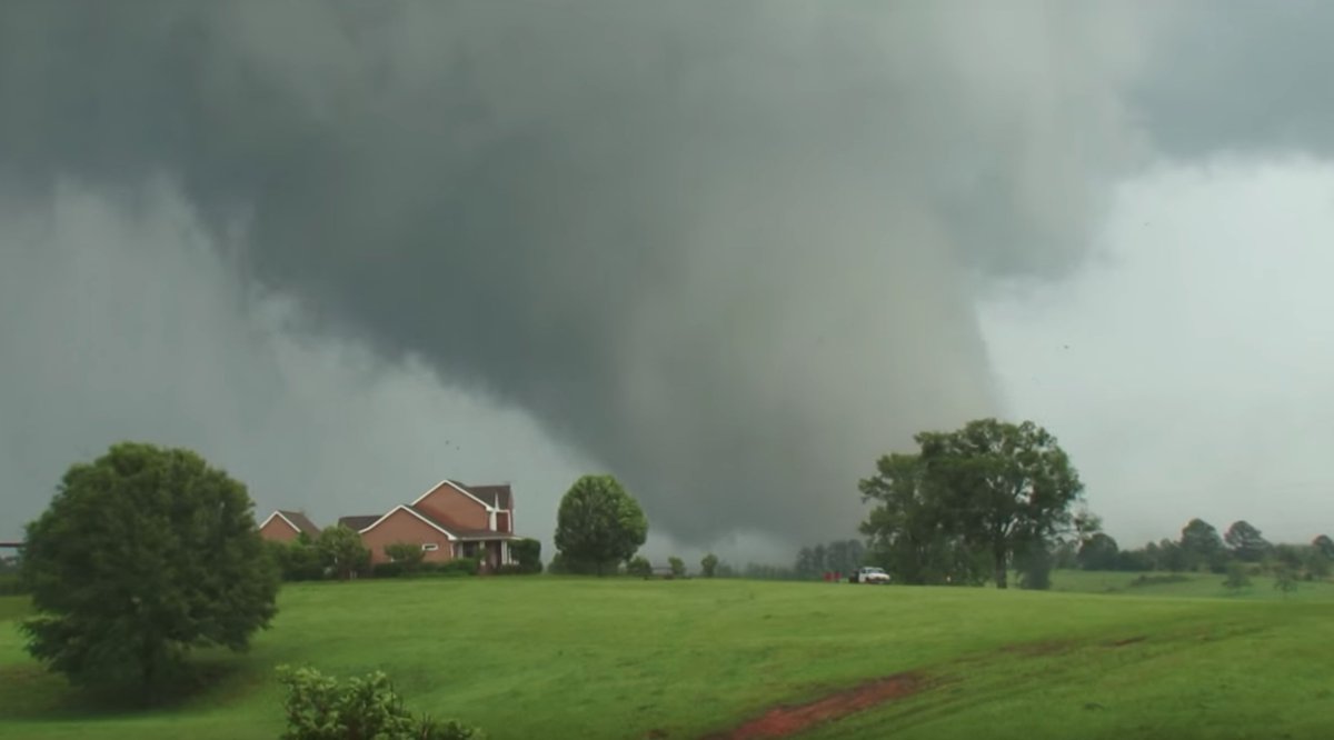
Reed Timmer's pic of Philadelphia, MS EF5:
Trench dug by the tornado:
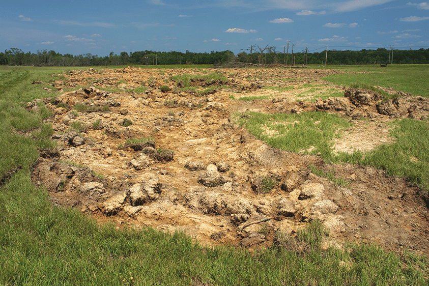
Trench dug by the tornado:
 1
1


Posted on 4/27/21 at 2:15 pm to LegendInMyMind
As bad as it was when it hit Cullman, it got even larger as it moved northeastward through Cullman County and into Marshall County.
Posted on 4/27/21 at 2:17 pm to Roll Tide Ravens
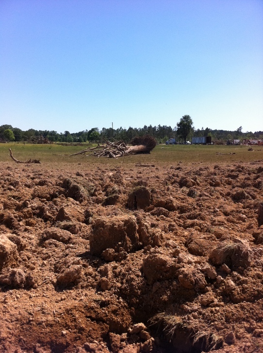
Another image of the trench in Philadelphia, MS:
This post was edited on 4/27/21 at 2:19 pm
Posted on 4/27/21 at 2:20 pm to LegendInMyMind
quote:
Trench dug by the tornado:
On Spann’s podcast last night, Alan Girard who was the meteorologist-in-charge at NWS Jackson at the time talked about this trench. He said another survey team was doing the survey for the Philadelphia tornado, but they called him and told him he needed to come see what the tornado had done to the ground. He couldn’t even comprehend what the survey team was describing to him over the phone. He recalled having to literally step down into the trench, it was that deep.
This post was edited on 4/27/21 at 2:21 pm
Posted on 4/27/21 at 2:20 pm to Roll Tide Ravens
quote:
As bad as it was when it hit Cullman, it got even larger as it moved northeastward through Cullman County and into Marshall County.
The debris ball on Reflectivity was one of the best presentations I've ever seen. At times it was completely detached from the supercell. We didn't have quite the tech for Correlation Coefficient verification then, but it wasn't needed when Reflectivity was showing the debris clearly.
Posted on 4/27/21 at 2:27 pm to LegendInMyMind
The best image I can find right now for the debris ball on Reflectivity for the Cullman EF4. There was no doubt, even without ground truth, that there was a violent tornado on the ground.
ETA: It also shows how we were able to get such great video that day. This is the type LP supercell you see out West that all the classic tornado pictures come from.
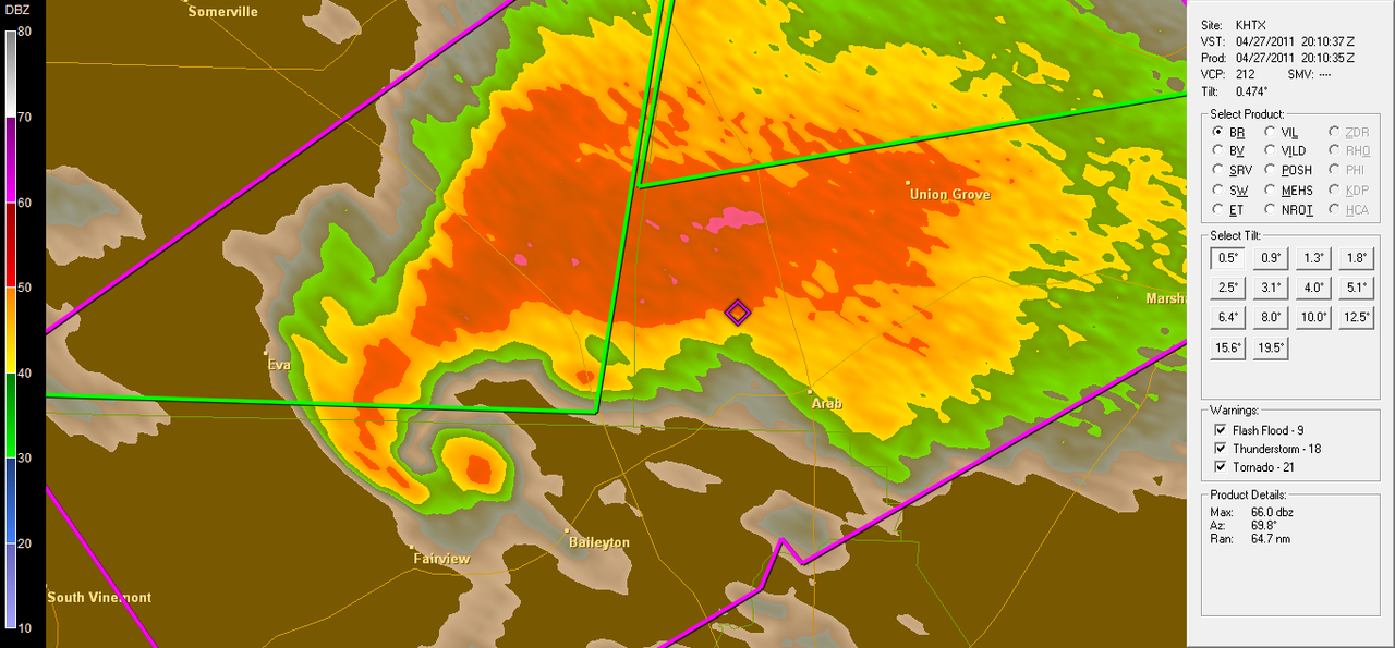
ETA: It also shows how we were able to get such great video that day. This is the type LP supercell you see out West that all the classic tornado pictures come from.
This post was edited on 4/27/21 at 2:35 pm
Posted on 4/27/21 at 2:44 pm to Roll Tide Ravens
quote:
Roll Tide Ravens
Did you link the YouTube playlist that has coverage from everywhere in chronological order? I haven't looked at all the links yet.
Posted on 4/27/21 at 2:54 pm to LegendInMyMind
quote:
Did you link the YouTube playlist that has coverage from everywhere in chronological order? I haven't looked at all the links yet.
Someone put the entire ABC 33/40 coverage together with every part of the coverage that was available into two videos, one for the AM storms and one for the PM storms. So I linked those two videos. I didn’t link coverage from other stations, because I don’t know if any other ones have all of their coverage online.
Posted on 4/27/21 at 2:54 pm to LegendInMyMind
This playlist is a good one. It goes storm-by-storm chronologically with video of tornadoes where available.
YouTube
This video is of a very young met with his hands full. That was an impossible situation as far as coverage goes.
North MS coverage
YouTube
This video is of a very young met with his hands full. That was an impossible situation as far as coverage goes.
North MS coverage
This post was edited on 4/27/21 at 2:56 pm
Posted on 4/27/21 at 3:14 pm to LegendInMyMind
That's a classic supercell, not a LP one.
Doesn't really take away from your point though, because it meant you got those great views.
Doesn't really take away from your point though, because it meant you got those great views.
Posted on 4/27/21 at 3:15 pm to Duke
quote:
Doesn't really take away from your point though, because it meant you got those great views.
Got me. Not HP.

Posted on 4/27/21 at 4:04 pm to LegendInMyMind
quote:
talked about enough that was impacted just as much, or maybe worse, as any other part of the state is Northeast Alabama
quote:
the EF5 in Rainsville, AL.
A buddy of mine was a pharmacist at the Rainsville Rite Aid when that happened. The stories he has from that day are incredible.
Also, my grandfather has a place in Ohatchee on Neely Henry Lake. We went the next morning to check on it as a pretty strong tornado had been reported that night. I'll never forget all the dead horses at this farm on AL177. Then there were Etowah County Sheriff deputies guarding the neighborhood from looters with ARs. There was a team of people fishing a body out of the water across the way. There were three pretty big houses across the water from his place and two were completely just gone. My grandfather's place had one piece of ceramic tile from who knows where embedded in the front door and that was the extent of the damage to his place maybe 200 yards away from those houses that were just gone.
It was all so surreal
Posted on 4/27/21 at 4:11 pm to IAmNERD
quote:
Ohatchee
Ohatchee is one of those places that doesn’t get the recognition it should. There was major loss of life in that area. The tornado that hit there was produced by the same supercell storm that had produced the Tuscaloosa-Birmingham tornado.
Posted on 4/27/21 at 5:07 pm to Roll Tide Ravens
10 years ago right now the Tuscaloosa-Birmingham tornado was moving into Tuscaloosa.
Posted on 4/27/21 at 5:11 pm to Roll Tide Ravens
I’m reminded now of something that has bothered Spann about the Tuscaloosa tornado. As the tornado was moving through the heart of Tuscaloosa, the ABC 33/40 radar system had a pixel displacement issue. It was basically showing the debris ball further south on the map than the tornado actually was. This led to Spann calling out some places that were actually south of the tornado, and not calling out some places in the path. Spann takes that situation really hard and is very critical of himself for it, even though it was the fault of the vendor who they got their radar system from.
Posted on 4/27/21 at 5:15 pm to IAmNERD
quote:
I'll never forget all the dead horses
That reminds me, in Phil Campbell a horse was found, I think laying on the slab of a home, that had been completely decapitated.
This post was edited on 4/27/21 at 5:15 pm
Posted on 4/27/21 at 5:42 pm to Roll Tide Ravens
quote:
This led to Spann calling out some places that were actually south of the tornado, and not calling out some places in the path. Spann takes that situation really hard and is very critical of himself for it, even though it was the fault of the vendor who they got their radar system from.
Good to know on the explanation, stood out watching the YouTube how he thought it was well south of where it was actually tracking.
Posted on 4/27/21 at 8:54 pm to Roll Tide Ravens
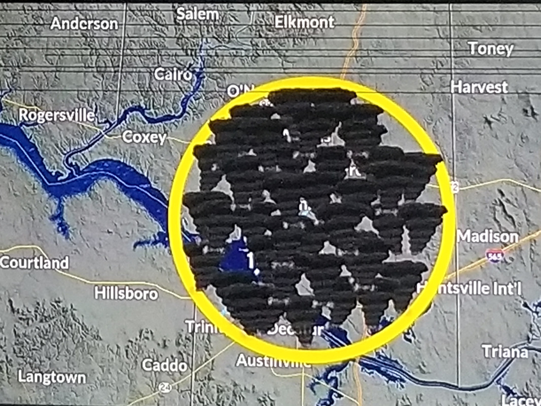
This graphic was on the WHNT-19 anniversary special. In the middle of the circle is Tanner, AL. Since Alabama tornado record keeping began in 1950, 41 tornadoes have touched down within a 10 mile radius of the town, including 2 EF5s. One of those was in 1974, the other was on April 27, 2011. My Pops witnessed the damage of both, and saw both storms.
I took a pic of the tv, so it isn't the greatest.
I took a pic of the tv, so it isn't the greatest.
Posted on 4/28/21 at 12:51 pm to LegendInMyMind
Posted on 4/28/21 at 8:59 pm to Yaboylaroy
quote:
Is there a better tornado video out there? The 4:15-5 minute mark is intense.
Here's an awesome amateur video shot from the Alberta City section of Tuscaloosa. The wind really starts picking up at the 2:05 mark and gets incredibly intense up to the 2:35 mark when the wind blows the glass window out.
The 2:15 to 2:35 mark shows some of the most incredible up close video
[link (https://youtu.be/kTgSaq2nRiU)]Near direct hit Tuscaloosa EF-4[/link]

 Page 6 of 7

Popular
Back to top