- My Forums
- Tiger Rant
- LSU Recruiting
- SEC Rant
- Saints Talk
- Pelicans Talk
- More Sports Board
- Fantasy Sports
- Golf Board
- Soccer Board
- O-T Lounge
- Tech Board
- Home/Garden Board
- Outdoor Board
- Health/Fitness Board
- Movie/TV Board
- Book Board
- Music Board
- Political Talk
- Money Talk
- Fark Board
- Gaming Board
- Travel Board
- Food/Drink Board
- Ticket Exchange
- TD Help Board
Customize My Forums- View All Forums
- Show Left Links
- Topic Sort Options
- Trending Topics
- Recent Topics
- Active Topics
Started By
Message
re: Tenth Anniversary of the 2011 Super Tornado Outbreak
Posted on 4/25/21 at 4:01 pm to Roll Tide Ravens
Posted on 4/25/21 at 4:01 pm to Roll Tide Ravens
quote:
I don’t know if this was ever confirmed, but I have heard talk that there were people who died in Hackleburg who were in an underground shelter.
I lived in Russellville at the time and heard the same from multiple people, as bad as the tornado in Tuscaloosa was the Hacklebhrg/ Phil Campbell one was worse, I drove through Hacklebhrg a day after and houses were stripped away down to the slab.
 1
1

Posted on 4/25/21 at 4:19 pm to Roll Tide Ravens
I was a student at Alabama. I was an amateur storm chaser at the time and foolishly left my video camera in the dorm. My thought process was: it was my third time that month chasing storms and, despite the fact the values were off the charts that afternoon, I figured I would fail once again to catch any footage of a tornado. I started tracking the cell that would eventually spawn the Tuscaloosa-Birmingham Tornado about an hour before it reached the city limits. I decided that this was my best bet at seeing a tornado that day and so remained in the downtown area.
At a little after 5:00 the storm started to become visible off to the southwest. I was thoroughly impressed with the structure of it and was blown away by the almost continual sound of thunder emitting from it as it moved toward Tuscaloosa. My feeling at that time was that if there wasn't a tornado inside that thunderstorm then there was no such thing as tornadoes. I took shelter inside the Tuscaloosa Public Works parking deck and took photographs with my iPhone as the tornado passed about a mile and a half south of my location.
Two days later I found myself helping with the clean-up in the Forest Lake area of Tuscaloosa. It looked like a World War I battlefield. The next day I took my services to Alberta City and found the damage there to be much worse than what I saw in Forest Lakes.
Posted on 4/25/21 at 5:10 pm to Roll Tide Ravens
quote:
Amateur video from the parking lot of University Mall in Tuscaloosa - LINK
Is there a better tornado video out there? The 4:15-5 minute mark is intense.
Posted on 4/25/21 at 5:55 pm to Roll Tide Ravens
quote:
There was hope that this morning squall line would work over the atmosphere and rob it of the energy that would be needed for the storms that afternoon. However, by 9am, there was widespread clearing and even sunshine across much of Mississippi and Alabama. At this point, everyone knew the stage was set for an outbreak of long-track, violent tornadoes that afternoon.
quote:
ABC 33/40 (Birmingham/James Spann) April 27, 2011 tornado coverage:
AM storms - LINK
as they transition from morning storm coverage to impact coverage between the 2 systems... James & Jason say basically the exact phrase from the 1st quote
a skycam shot on some bad traffic was showing sunlight and they were both like "sun = bad... we don't want to see the sun right now... this is bad for this afternoon"
Posted on 4/25/21 at 6:02 pm to rt3
quote:
There was hope that this morning squall line would work over the atmosphere and rob it of the energy that would be needed for the storms that afternoon.
There was hope, but it was nothing more than hopeful thinking. Watch the weather extreme videos Spann and crew did leading up to April 27. Even a day or two before they were speaking in near absolutes. They weren't the only ones, either. From the SPC, NWS offices, down to most on-air mets in most markets knew it was almost certain to be a two-round event.

Posted on 4/25/21 at 6:11 pm to LegendInMyMind
ABC 33/40 put together several videos for the 1 year anniversary back in 2012. One was about how the ABC 33/40 weather team was impacted by April 27th. In it Jason Simpson talks about how, during the midday lull, they had a meeting and he looked at the news director and asked, “have I ever told you that I expect a violent tornado outbreak with mass casualties?” and when the news director said “no” Jason said “well, today’s that day.”
Here’s the video: LINK
Here’s the video: LINK
Posted on 4/25/21 at 6:14 pm to rt3
Excerpt from the SPC Convective Outlook 1:00 AM update:
Complete discussion from SPC Convective Outlook update at 11:29 AM:
quote:
— AN OUTBREAK OF TORNADOES AND DAMAGING WINDS IS EXPECTED TODAY
THROUGH EVENING OVER PORTIONS OF NRN MS…NRN AL…TN AND KY. —
…LOWER MS VALLEY INTO TN/OH VALLEYS…
A COMPLICATED FORECAST SCENARIO WILL UNFOLD TODAY…BEGINNING RATHER
EARLY IN THE PERIOD OVER SRN AND ERN AR AND NRN LA. MODELS ARE IN
RELATIVELY GOOD AGREEMENT WITH THE PLACEMENT OF THE SURFACE LOW OVER
AR BETWEEN 12-15Z…THEN DEVELOPING IT NEWD ACROSS TN/KY BY 00Z.
NUMEROUS THUNDERSTORMS WILL BE ONGOING…AND SOME WILL BE
SEVERE…FROM NRN LA/SRN AR EWD ACROSS NRN MS…WRN AND MIDDLE TN
AND KY. DESPITE TIME OF DAY…PRESENCE OF RICH LOW LEVEL MOISTURE
WILL RESULT IN LITTLE CAPPING AND SURFACE BASED EFFECTIVE PARCELS.
THUS…A TORNADO AND DAMAGING WIND THREAT WILL BE PRESENT WITH THIS
ACTIVITY.
SOUTH OF THE ONGOING ACTIVITY…STRONG DAYTIME HEATING WILL OCCUR.
WITH BOUNDARY LAYER DEWPOINTS IN THE LOW 70S F…THIS WILL CREATE
STRONG TO EXTREME INSTABILITY OVER MS AND AL NWD TO THE ONGOING
CONVECTION. A CAPPING INVERSION WILL LIKELY KEEP MUCH OF THE WARM
SECTOR S OF THE EARLY STORMS CAPPED…ALLOWING A BUILD UP OF
INSTABILITY TO BE RELEASED WHEN LARGE SCALE FORCING ARRIVES DURING
THE AFTERNOON ALONG THE COLD FRONT AND ESPECIALLY NEAR THE
FRONT/OUTFLOW BOUNDARY INTERSECTION. THE RESULT WILL BE FAST MOVING
TORNADIC SUPERCELLS CAPABLE OF STRONG TO VIOLENT TORNADOES. GIVEN
THE FAST STORM MOTIONS AND RELATIVELY WIDE WARM SECTOR…SOME
TORNADOES COULD BE LONG LIVED. THE GREATEST THREAT FOR THESE TYPES
OF STORMS WILL BE OVER THE HIGH RISK AREA…OVER NRN MS AND
AL…INTO EXTREME NWRN GA AND SRN MIDDLE TN. THIS ACTIVITY WILL
PERSIST TO THE E…BUT CELLS MAY EVENTUALLY MERGE INTO MORE OF A
QLCS STRUCTURE CAPABLE OF PARTICULARLY DAMAGING WINDS AND A FEW
TORNADOES.
Complete discussion from SPC Convective Outlook update at 11:29 AM:
quote:
SPC AC 271629 DAY 1 CONVECTIVE OUTLOOK NWS STORM PREDICTION CENTER NORMAN OK 1129 AM CDT WED APR 27 2011 VALID 271630Z - 281200Z ...THERE IS A HIGH RISK OF SVR TSTMS ACROSS PARTS OF MS...AL...TN AND GA...... ...THERE IS A MDT RISK OF SVR TSTMS ACROSS PARTS OF MS...AL...TN...KY...WRN VA...WRN NC...WRN SC...NRN GA... ...THERE IS A SLGT RISK OF SVR TSTMS ACROSS PARTS OF THE MID-MS VALLEY...CNTRL TO ERN GULF COAST STATES...TN VALLEY...OH VALLEY...CNTRL TO SRN APPALACHIAN MTNS...CAROLINAS...MID-ATLANTIC AND NERN STATES... ...MAJOR TORNADO OUTBREAK EXPECTED THIS AFTERNOON AND EVENING ACROSS THE TN VALLEY AND SRN APPALACHIAN MTNS EXTENDING NWD INTO THE SRN OH VALLEY... ...TN VALLEY/SRN APPALACHIAN MTNS AND SRN OH VALLEY... A VIGOROUS UPPER-LEVEL TROUGH WILL MOVE INTO THE OZARKS TODAY AS A POWERFUL MID-LEVEL JET ROUNDS THE BASE OF THE TROUGH AND NOSES INTO THE OH AND TN VALLEYS. AT THE SFC... A LOW WILL MOVE QUICKLY NEWD ACROSS THE MID-MS VALLEY AS LOW-LEVEL MOISTURE IS TRANSPORTED NNEWD ACROSS THE OH AND TN VALLEYS THIS AFTERNOON. MODERATE DESTABILIZATION IS ALREADY IN PLACE ACROSS THE LOWER MS VALLEY AND THIS AIR MASS SHOULD MOVE NEWD INTO THE MODERATE AND HIGH RISK AREAS BY LATE THIS AFTERNOON. THE WARM AND MOIST AIR MASS ALONG WITH STRONG SHEAR PROFILES IN THE LOW TO MID-LEVELS WILL BE VERY FAVORABLE FOR SEVERE THUNDERSTORMS AND TORNADOES THIS AFTERNOON AND EVENING. THIS SYSTEM IS VERY ORGANIZED AND CONFIDENCE IS HIGH REGARDING THE POTENTIAL FOR A MAJOR TORNADO OUTBREAK THIS AFTERNOON AND EVENING ACROSS THE CNTRL GULF COAST STATES AND TN VALLEY EXTENDING NWD INTO THE SRN OH VALLEY. CONCERNING THE CURRENT SETUP...A LARGE MCS IS ONGOING ACROSS THE TN VALLEY. THIS CONVECTIVE SYSTEM IS TIMED TO MOVE INTO ERN TN AND NW GA BY 21Z. MESOANALYSIS SHOWS A RESERVOIR OF MODERATE INSTABILITY FROM LA EXTENDING EWD ACROSS SCNTRL MS WHERE MLCAPE VALUES ARE ESTIMATED IN THE 2000 TO 3000 J/KG RANGE. THIS MODERATE INSTABILITY SHOULD BE TRANSPORTED NEWD INTO THE HIGH RISK AREA THIS AFTERNOON AS THE MCS EXITS THE REGION TO THE EAST. AS THE THERMODYNAMIC SETUP IMPROVES...THE WIND SHEAR ENVIRONMENT WILL ALSO RAPIDLY BECOME MORE FAVORABLE AS THE NOSE OF A 80 TO 100 KT MID-LEVEL JET EJECTS EWD ACROSS THE REGION AND INTERACTS WITH A WELL-DEVELOPED LOW-LEVEL JET. THIS WILL CREATE LARGE LOOPING HODOGRAPHS FROM ERN MS AND NCNTRL AL NWD INTO SRN TN. 0-3 KM STORM RELATIVE HELICITIES IN THE 450 TO 600 M2/S2 RANGE SHOULD BE VERY FAVORABLE FOR TORNADIC SUPERCELLS. THE CURRENT THINKING IS THAT THE GREATEST TORNADO POTENTIAL WILL EXIST LATE THIS AFTERNOON AND EARLY THIS EVENING FROM COLUMBUS MS EWD TO BIRMINGHAM AND HUNTSVILLE AL. THIS AREA IS CURRENTLY SOUTH OF THE ONGOING MCS WHERE DESTABILIZATION SHOULD BE MOST FAVORABLE. AS SUPERCELLS INITIATE IN ERN MS AND TRACK ENEWD ACROSS THE HIGH RISK AREA LATE THIS AFTERNOON...A TORNADO OUTBREAK IS EXPECTED. A FEW LONG-TRACK STRONG TORNADOES AND POSSIBLY A VIOLENT TORNADO OR TWO MAY OCCUR AS THE LOW-LEVEL JET STRENGTHENS EARLY THIS EVENING. HAVE ADDED A 45 PERCENT SIG-TOR AREA WHERE CONFIDENCE IS THE HIGHEST CONCERNING THE POTENTIAL FOR LONG-TRACK TORNADOES. LARGE HAIL AND WIND DAMAGE WILL ALSO BE LIKELY WITH SUPERCELLS THAT DEVELOP. FURTHER TO THE NORTH ACROSS MIDDLE TN IN WCNTRL KY...THE ONGOING MCS IS HAMPERING DESTABILIZATION. HOWEVER...AS THE MID-LEVEL JET NOSES INTO THE REGION FROM THE WEST...THE MODERATE INSTABILITY IN NRN LA AND SRN AR IS EXPECTED TO ADVECT QUICKLY NNEWD ACROSS WCNTRL TN AND WCNTRL KY BETWEEN THE EXITING MCS AND A CLUSTER OF STORMS IN NW AR AND SRN MO. THIS SHOULD ALLOW THE MOIST AXIS TO BE LOCATED FROM WEST OF NASHVILLE NEWD TO NEAR LOUISVILLE WHERE NUMEROUS SFC-BASED THUNDERSTORMS ARE EXPECTED TO INITIATE LATE THIS AFTERNOON. THE LOW-LEVEL JET AND MID-LEVEL JET ARE FORECAST TO BE JUXTAPOSED ACROSS THIS CORRIDOR SUGGESTING SHEAR PROFILES WILL BE VERY FAVORABLE FOR SUPERCELLS AND TORNADOES EVEN IF DESTABILIZATION IS NOT AS GREAT AS IS EXPECTED. THE CURRENT THINKING IS THAT A BROKEN LINE OF TORNADIC SUPERCELLS WILL INITIATE ALONG THE WRN EDGE OF THE MODERATE RISK AREA AND TRACK EWD ACROSS CNTRL KY AND MIDDLE TN EARLY THIS EVENING. THE LOW-LEVEL SHEAR ENVIRONMENT WILL BE VERY FAVORABLE FOR TORNADOES AND A FEW LONG-TRACK STRONG TORNADOES MAY OCCUR. THE MODERATE RISK AREA HAS BEEN EXTENDED WWD ACROSS PARTS OF MIDDLE TN AND CNTRL KY TO ACCOUNT FOR THIS POSSIBILITY. LARGE HAIL AND WIND DAMAGE WILL ALSO BE POSSIBLE WITH SUPERCELLS THAT DEVELOP. AS A BROKEN LINE OF TORNADIC SUPERCELLS MOVES EWD ACROSS THE HIGH AND MODERATE RISK AREAS THIS EVENING...A TRANSITION TO MORE OF A WIND DAMAGE THREAT MAY OCCUR AS THE LINE CONGEALS AND BOWING LINE-SEGMENTS DEVELOP. AN ENHANCED WIND DAMAGE THREAT SHOULD EXIST AS FAR EAST AS WRN VA ...WRN NC AND WRN SC DURING THE LATE EVENING HOURS WHEN A LARGE MCS MOVES INTO THE SRN APPALACHIAN MTNS. THE TORNADO THREAT MAY SHIFT SWD LATE THIS EVENING INTO NRN GA WHERE THE STORMS MAY TEND TO REMAIN DISCRETE. ...CNTRL TO NRN APPALACHIAN MTNS/CAROLINAS/ERN GULF COAST STATES... THE UPPER-LEVEL TROUGH OVER THE CNTRL STATES WILL MOVE INTO THE MS VALLEY THIS EVENING AS A POWERFUL MID-LEVEL JET EJECTS NEWD OUT OF THE BASE OF THE TROUGH. THE EXIT REGION OF THE MID-LEVEL JET WILL MOVE INTO THE CNTRL APPALACHIAN MTNS AND ERN GREAT LAKES WHERE DEEP LAYER SHEAR PROFILES WILL BECOME MORE FAVORABLE FOR SEVERE STORMS TONIGHT. ALONG AND TO THE EAST OF THE JET AXIS...A LINE OF STRONG THUNDERSTORMS IS EXPECTED TO BE LOCATED FROM ERN OH EXTENDING SWD INTO FAR WRN SC AROUND 06Z. THIS LINE SHOULD MOVE EWD ACROSS NY...PA...VA...NC AND SC WHERE A WIND DAMAGE THREAT SHOULD EXIST DUE TO STRONG LOW-LEVEL FLOW. AN ENHANCED WIND DAMAGE THREAT COULD EXIST ACROSS VA AND WRN CAROLINAS WHERE THE MODELS DEVELOP MODERATE INSTABILITY AFTER 06Z. ..BROYLES/GARNER.. 04/27/2011
Posted on 4/25/21 at 6:27 pm to LegendInMyMind
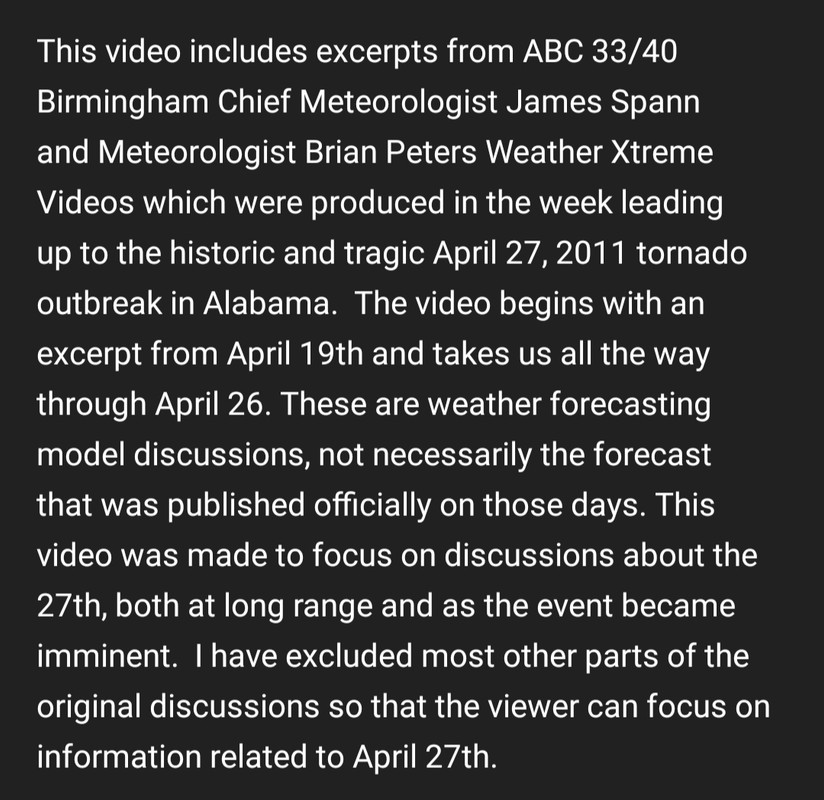
Compilation video of Spann's Weather Extreme videos leading up to it. This is only a part of each video focusing on the April, 27 2011 setup. The image is the description on the video.
YouTube
YouTube
This post was edited on 4/25/21 at 6:43 pm
Posted on 4/25/21 at 7:07 pm to LegendInMyMind
I meant to post the link to that in my links post. I will add it. Thanks for sharing it.

Posted on 4/25/21 at 7:49 pm to Roll Tide Ravens
I was at UA when that day happened. I remember seeing that tornado from half a mile away and seeing the lightning and entire roofs and other debris circling. It completely changed the way I look at severe weather. We are very weather aware now.

Posted on 4/25/21 at 8:15 pm to Roll Tide Ravens
Ten days prior to the 27th, Alabama had their A-Day game. Same A-Day they unveiled Coach Saban’s statue in front of BDS. Me and Dad drove down and stopped at the Walmart in Northport to pick up groceries to take to my sisters house. We got stuck inside cause there was a tornado near Hillcrest. So we put the stuff up and decided to hit the grocery store on Skyland later on. There was some rotation on Hwy 69 going towards Moundville.
10 days later, I sat in my living room with my laptop, watching ABC33/40 live stream with the tv on the Weather Channel. Thankfully my sister and brother-in-law were home. I turned on Paul Finebaum’s live stream when he was still in Vestavia I think and he was getting nervous on air. Of course the next day his show was dedicated to it and the NFL Draft was that night.
James Spann and Jason Simpson did an amazing job that day. It landed Jason the chief meteorologist job at WHNT. They won Emmy awards for their broadcast. Spann became a household name across the country.
Crazy to think that a month later, Joplin got hit by a big one.
Posted on 4/25/21 at 8:33 pm to Pisco
This is another video (it’s just audio, though) that I wanted to share. This is Meteorologist Jim Stefkovich being interviewed on a Birmingham news talk show that morning after the morning storms but before the afternoon round got started. At this time, Jim was the Meteorologist-in-Charge at the NWS in Birmingham. His words are downright eerie. He basically admits that he is scared about what was coming that afternoon, and had literally been in prayer about the situation because he knew how bad everything looked at that we were facing a potential historic tornado outbreak.
LINK
LINK
This post was edited on 4/25/21 at 8:36 pm
Posted on 4/25/21 at 8:46 pm to Roll Tide Ravens
quote:I drove through Hackleburg on 4/28/11 on my way to Mississippi. The devastation was incredible. There were houses like this one that were just gone.
I don’t know if this was ever confirmed, but I have heard talk that there were people who died in Hackleburg who were in an underground shelter. If true, I guess they got sucked out or debris was thrown in. For some people, they did everything they could do to be safe that day (got the warning, south shelter, etc.) and still didn’t make it. It was just their day to go.

Posted on 4/26/21 at 6:41 am to just1dawg
Spann shared this this morning. This was from his weather blog forecast discussion on April 26, 2011.

Posted on 4/26/21 at 11:54 am to Roll Tide Ravens
About our conversation yesterday regarding underground shelter not being enough in the Hackleburg/Phil Campbell areas:
I'm reading the Tornado Talk write up on that tornado specifically dealing with the damage in Phil Campbell. It said an underground storm shelter embedded in a hillside had the door and the concrete roof ripped away.
That being the case, the reports of people who were underground being among the dead could very well be true.
Posted on 4/26/21 at 12:56 pm to Roll Tide Ravens
quote:
ABC 33/40 (Birmingham/James Spann) April 27, 2011 tornado coverage:
AM storms - LINK
PM storms - LINK
start the PM video at ~2:32 PM tomorrow and it'll almost be like 10 years ago
Posted on 4/26/21 at 1:09 pm to rt3
quote:
start the PM video at ~2:32 PM tomorrow and it'll almost be like 10 years ago
Nah, baw. I still remember just fine.
I've watched the coverage several times over the years. I really, really wish some other channels would release their full coverage. I would like to see Brad Travis with WAAF in Huntsville cover the whole thing. He's my go-to in this area, despite Rainman Jason Simpson being with the CBS channel. I just like Brad's laid back approach, plus when they aren't on-air they will go live on facebook and their app. You get to see all the behind the scenes stuff and a more relaxed approach when they aren't on the air. I still watch Jason from time to time, but not like some people.
Anyway, releasing the full coverage, at least for the afternoon, would be great.
Posted on 4/26/21 at 1:17 pm to LegendInMyMind
quote:
Nah, baw. I still remember just fine.
I've watched the coverage several times over the years. I really, really wish some other channels would release their full coverage. I would like to see Brad Travis with WAAF in Huntsville cover the whole thing. He's my go-to in this area, despite Rainman Jason Simpson being with the CBS channel. I just like Brad's laid back approach, plus when they aren't on-air they will go live on facebook and their app. You get to see all the behind the scenes stuff and a more relaxed approach when they aren't on the air. I still watch Jason from time to time, but not like some people.
Anyway, releasing the full coverage, at least for the afternoon, would be great.
you can find a bunch of severe weather coverage on YouTube
I've seen the coverage of the tornado through Nashville... an EF-4 or 5 in Illinois where the storm was moving almost due north
live storm coverage is very interesting to me
Posted on 4/26/21 at 1:24 pm to rt3
quote:
you can find a bunch of severe weather coverage on YouTube
Yeah, it is always bits and pieces or spliced together. I'd like to see the full on-air coverage of that day from other mets/networks besides ABC 33/40. Hell, after about 4:30 that day we were without power for days. I've even tried searching for local news coverage in the days following because I didn't see any of it. We had the radio on most of the time, and they actually carried the nightly newscasts for a couple days after, but no video. You find the random clip here and there, but not much at all.
I also realize that most stations don't roll film to record complete wall-to-wall coverage, but I wish they did.
This post was edited on 4/26/21 at 1:27 pm
Posted on 4/26/21 at 1:50 pm to Roll Tide Ravens
another link to add to your collection there RTR...
The full episode of the Discovery Channel show Stormchasers about this day is up on YouTube
LINK
sucks knowing several of the people involved on this show and in this chase are now deceased (including Team Twistex which was taken out by the El Reno tornado)
The full episode of the Discovery Channel show Stormchasers about this day is up on YouTube
LINK
sucks knowing several of the people involved on this show and in this chase are now deceased (including Team Twistex which was taken out by the El Reno tornado)

 Page 2 of 7

Popular
Back to top