




- My Forums
- Tiger Rant
- LSU Recruiting
- SEC Rant
- Saints Talk
- Pelicans Talk
- More Sports Board
- Fantasy Sports
- Golf Board
- Soccer Board
- O-T Lounge
- Tech Board
- Home/Garden Board
- Outdoor Board
- Health/Fitness Board
- Movie/TV Board
- Book Board
- Music Board
- Political Talk
- Money Talk
- Fark Board
- Gaming Board
- Travel Board
- Food/Drink Board
- Ticket Exchange
- TD Help Board
Customize My Forums- View All Forums
- Show Left Links
- Topic Sort Options
- Trending Topics
- Recent Topics
- Active Topics
Started By
Message

Severe Weather Thread, TX LA MS AL GA FL (Slight) 3/3-3/4
Posted on 3/3/20 at 9:32 am

Posted on 3/3/20 at 9:32 am




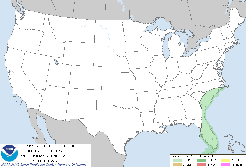
quote:
Day 1 Convective Outlook
NWS Storm Prediction Center Norman OK
0641 AM CST Wed Mar 04 2020
Valid 041300Z - 051200Z
...THERE IS A SLIGHT RISK OF SEVERE THUNDERSTORMS SOUTHEAST TX
EASTWARD TO SOUTHERN GA TODAY...
...SUMMARY...
Severe thunderstorms associated with wind damage, hail and a couple
of tornadoes are expected today from southeast Texas eastward to
southern Georgia, along and just north of I-10.
...Southeast TX to southern GA today...
The closed midlevel low over the Big Bend will eject
east-northeastward to the lower MS Valley tonight, as a northern
stream shortwave trough amplifies over the north central states. At
the surface, a low near San Antonio this morning will develop
generally eastward along the I-10 corridor along an east-west
baroclinic zone. Along and south of the boundary, boundary-layer
dewpoints of 65-70 F will be maintained through the day from
southeast TX eastward to the northeast Gulf coast, beneath a remnant
elevated mixed layer plume. Pockets of surface heating will support
MLCAPE of 1500-2500 J/kg along and south of the front, and MUCAPE
near 1000 J/kg will extend a couple of counties/parishes north of
the surface boundary. Meanwhile, deep-layer vertical shear will
remain favorable for supercells and organized bowing segments along
and north of the front.
Convection has been increasing in coverage since about 09z across
MS/AL, and rain-cooled air is reinforcing the front and it is now
moving southward across southern MS/AL. This trend will likely
continue today, with the front providing the main focus for severe
storms. Storm coverage is beginning to increase as of 12z across
central/east central TX along the deeper baroclinic zone, and
additional storm formation is likely in this area this morning as
the midlevel trough and stronger forcing for ascent approach from
the west (as evidenced by the ongoing strong-severe storms in the
Austin-San Antonio corridor). Large hail and damaging gusts will be
the main threats with the storms on the cool side of the boundary,
while a couple of tornadoes will be possible with supercells/bowing
segments interacting with the surface front and associated stronger
low-level shear/SRH compared to the warm sector to the south.
This post was edited on 3/4/20 at 10:27 am
 12
12


Posted on 3/3/20 at 9:43 am to DVinBR
TOR:CON 4?

Posted on 3/3/20 at 9:44 am to DVinBR
I’ve been waiting for the hype thread.

Posted on 3/3/20 at 9:46 am to DVinBR
Dangit, never gonna get my garden tilled.
Posted on 3/3/20 at 10:16 am to DVinBR
tornado that destroyed a good portion of nashville was in a slight risk area

Posted on 3/3/20 at 10:58 am to jeffsdad
quote:
Dangit, never gonna get my garden tilled
Mine was still a little too wet this weekend said frick it I'm planting in lumpy rows anyway
Posted on 3/3/20 at 9:18 pm to SeafoodPlatter
When this hitting?


Posted on 3/3/20 at 9:27 pm to tigercraig
HRRR and NAM looking weak for most areas in LA. Possibly these small isolated cells popping up?

Posted on 3/3/20 at 9:30 pm to jcaz
Don’t know wat a hrrr and Nam is. So it must be all good.
Posted on 3/3/20 at 9:59 pm to jeffsdad
Has EBR cancelled classes yet?


Posted on 3/3/20 at 10:01 pm to DVinBR
Need some severe weather within 138 miles of Dothan, Alabama to get my forecast right LETS GOOOO

Posted on 3/4/20 at 3:52 am to DVinBR
Damn little severe weather bubble right over Auburn.


Posted on 3/4/20 at 5:08 am to DeoreDX
quote:
Damn little severe weather bubble right over Auburn.
That's just Bruce Pearl breaking wind after eating at the Waffle House with Gus

Posted on 3/4/20 at 6:23 am to East Coast Band
This is today’s SPC convective outlook:


Posted on 3/4/20 at 6:35 am to The Boat
quote:
Need some severe weather within 138 miles of Dothan, Alabama to get my forecast right LETS GOOOO
I live in this bubble. It has thundered here all morning. More on the way in the next several hours.

Posted on 3/4/20 at 7:36 am to DVinBR
Wow that sounds great for us then. AVP checking in, ceiling out side is very low maybe 200’ and a nice steady light rain coming down. But radar showing some big rain in Texas.
Posted on 3/4/20 at 7:45 am to 4EvEr Bo REIN
Storms ramping up along the 20 corridor between Tyler and Shreveport, three storm warned clusters popping now. Looks like some very heavy rain.

Posted on 3/4/20 at 10:17 am to 4EvEr Bo REIN
That bow echo by Jackson is the real deal. 90 mph radar return wind speed. Probably tornado embedded
Posted on 3/4/20 at 10:18 am to CypressTrout10
That’s straight line winds in that bow echo. Probably 60-70mph surface winds with it.
Posted on 3/4/20 at 10:19 am to CypressTrout10
Just looked at the radar around Jackson and it looks nasty

 Page 1 of 3

Popular
Back to top
 Follow TigerDroppings for LSU Football News