- My Forums
- Tiger Rant
- LSU Recruiting
- SEC Rant
- Saints Talk
- Pelicans Talk
- More Sports Board
- Fantasy Sports
- Golf Board
- Soccer Board
- O-T Lounge
- Tech Board
- Home/Garden Board
- Outdoor Board
- Health/Fitness Board
- Movie/TV Board
- Book Board
- Music Board
- Political Talk
- Money Talk
- Fark Board
- Gaming Board
- Travel Board
- Food/Drink Board
- Ticket Exchange
- TD Help Board
Customize My Forums- View All Forums
- Show Left Links
- Topic Sort Options
- Trending Topics
- Recent Topics
- Active Topics
Started By
Message
re: Morganza Spillway may or may not open for a 3rd time -- lack of clear info from ACoE
Posted on 6/6/19 at 7:01 pm to OleWarSkuleAlum
Posted on 6/6/19 at 7:01 pm to OleWarSkuleAlum
quote:
Just heard from a reliable source that the structure is unsound and that led to the decision not to open. They identified issues after the 2011 event, but due to funding and political reasons sat on their hands not making the necessary repairs. They are worried the entire structure will fail if they are forced to open the Morganza. So they are just going to let it ride true Louisiana style...
There’s 0 chance this happened without word getting out in the last 8 years
This post was edited on 6/6/19 at 7:02 pm
 0
0

Posted on 6/6/19 at 7:11 pm to slackster
quote:
They don't necessarily owe us an explanation of any kind, but this is a unique situation.
You say you're going to open them. Then you back it up. You back it up again. Then you delay it indefinitely. Some people made significant financial decisions based on that data. It damn sure doesn't hurt to explain the logic being used.
This x10000
The “water just didn’t get high enough” excuse doesn’t cut it.
Explain the thought process of making the decision then delaying it twice now just calling the whole thing off.
What have we learned from this?
Posted on 6/6/19 at 7:16 pm to tgrbaitn08
quote:
What have we learned from this?
That it is ok to change a decision as new data is gathered?
The wishcasters are grabbing their pitchforks.
Posted on 6/6/19 at 7:16 pm to LNCHBOX
quote:
This could apply to so many things that I can't take it as a serious argument
They're a government agency. Explaining their logic to the people impacted - both positively and negatively - is a sound decision.
I'm not mad about it or anything, I just believe it's an important olice branch of sorts to the public.

Posted on 6/6/19 at 7:17 pm to tgrbaitn08
quote:
The “water just didn’t get high enough” excuse doesn’t cut it.
Especially when it’s forecast to get higher than the forecast called for when they initially made the decision to open it.
Posted on 6/6/19 at 7:18 pm to tgrbaitn08

Posted on 6/6/19 at 7:19 pm to fightin tigers
quote:
The wishcasters are grabbing their pitchforks.
No one is wishcasting anything. The last thing I wished for was for them to open it.
I just want to know what the whole thought process was on them being so indecisive and why.
Posted on 6/6/19 at 7:21 pm to tgrbaitn08
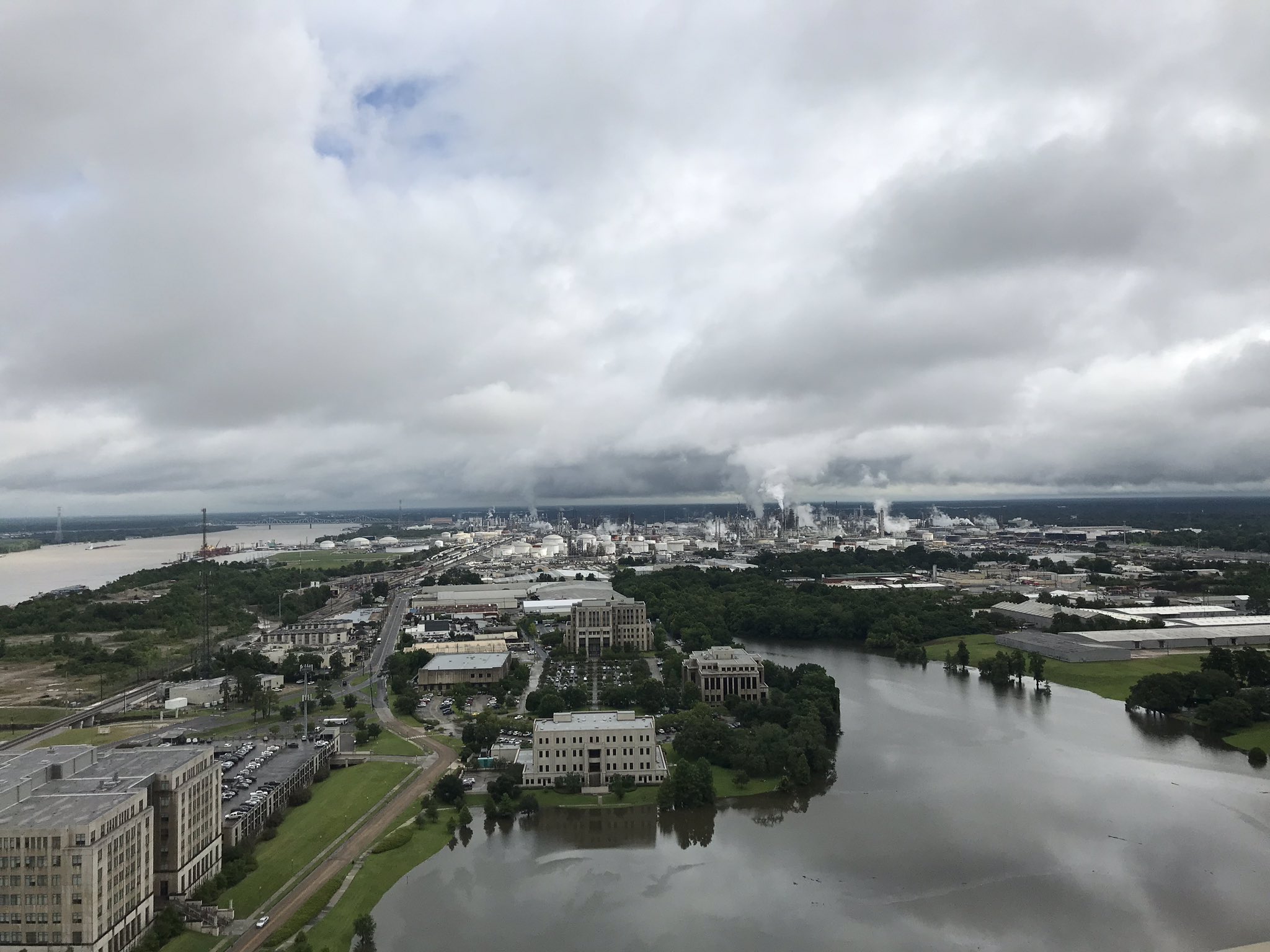
If I lived in the pathway I would be moving my stuff to a storage facility until this is over with since the ORCS is compromised.
Posted on 6/6/19 at 7:23 pm to WeeWee
quote:
Go look at a map of the area. You see all those points and bends in the river and do you see how much land is between the river and the levee? The levees up there are not right next to the river bank like they are in BR and of that is not included in measuring the navigational charts because they are not part of the shipping channel. The google car has never driven down the levee so they do not know the exact distance and they just use a algorithm to calculate it and that algorithm the algorithm says that it 41.4 miles.
Great, but none of that matters when your talking about the hydraulics of the system.
quote:
Wilson Point is a good ways up the river from Eagle Lake. I have had a hunting camp on Pittman Island which is right across the old river from Wilson Point for the past ten years. I saw the results of the '11 flood, the '16 flood the '17 flood and the '18-'19 flood in person. My hunting camp was ten feet off of the ground in '11 and it got 4.5 feet of water inside of it. In addition to having a hunting camp up there, I am from that part of NELA, in high school I worked two years for an ag consultant checking cotton all the way from McGehee Ar to Waterproof La, and I dated a girl for 18 months whose father owns and farms land in the point. I know the area by heart
WTF, you are the one who kept saying it was fricking Willow Point. I agree, it's Wilson Point! I know the area, too, in fact, I probably know you...
quote:
The levee did not just overtop. I saw it moments before it failed. I was there that day. I had been helping the farmers stack sandbags to try and reinforce the levee earlier in the day before they decided that it was pointless, and we started moving equipment out of the point and back to the protected side of the main levee. I did not see the levee overtop because I had just dropped a tractor off, but I was there to see it within 15 minutes of the levee overtopping and by that point it had overtopped and had a hole in about a 20 feet wide and growing by the minute. It ended up being a hole over 90 feet wide and some parts of the point had 30 feet of water. Also Did you see the picture of those houses with the water up to the roof? Those were two story houses.
Are you just saying stuff because you were there? Because nothing you said here contradicts what I've said.
There was a shitload of water in the point, and therefore a shitload of flow was removed from the river in a short period. Which is why there was a response upstream, albeit very small.
quote:
Simple physics. Opening the BCS gives the Ms river an additional outlet to the GOM. That reduces resistance to the flow of water and resistance and flow are inversely related. The Ms river average discharge is LINK 593,000 cuft/s. If the BCS is opened all the way up and the river would be discharging an additional 250,000 cuft/s of water. Do you really think that adding an additional 42% to the Ms River discharge would not affect the level of the river flow of water in BR? It might not happen at once but if you drain an additional 250,000 cuft/s of water you will eventually decrease the amount of water in BR because you are draining the river faster.
It is simple physics...which you clearly don't understand.
Posted on 6/6/19 at 7:30 pm to TDsngumbo
quote:
Especially when it’s forecast to get higher than the forecast called for when they initially made the decision to open it.
Could be as simple as them being proactive and knowing it would be a wetter than usual season.
Hasn't turned out as wet as they expected.
This post was edited on 6/6/19 at 7:32 pm
Posted on 6/6/19 at 7:32 pm to fightin tigers
quote:
The wishcasters are grabbing their pitchforks.
Horse shite, but you know that.
Posted on 6/6/19 at 7:35 pm to OleWarSkuleAlum

This post was edited on 6/6/19 at 7:36 pm
Posted on 6/6/19 at 7:38 pm to fightin tigers
quote:
Could be as simple as them being proactive and knowing it would be a wetter than usual season.
Hasn't turned out as wet as they expected.
Sorta like the levees they weren’t expecting to break during Katrina?
Posted on 6/6/19 at 7:40 pm to tgrbaitn08
Devils Lake in BR water is high

Posted on 6/6/19 at 7:42 pm to MrLSU
quote:
Devils Lake in BR water is high
Bruh, haven’t you heard, it’s no big deal.
Just a big misunderstanding
Posted on 6/6/19 at 7:51 pm to FutureMikeVIII
quote:
Go look at a map of the area. You see all those points and bends in the river and do you see how much land is between the river and the levee? The levees up there are not right next to the river bank like they are in BR and of that is not included in measuring the navigational charts because they are not part of the shipping channel. The google car has never driven down the levee so they do not know the exact distance and they just use a algorithm to calculate it and that algorithm the algorithm says that it 41.4 miles.
Great, but none of that matters when your talking about the hydraulics of the system.
Longer river distance = more water in the river at the same height => more water has to exit the system for a drop to be noticed upstream.
quote:
WTF, you are the one who kept saying it was fricking Willow Point. I agree, it's Wilson Point! I know the area, too, in fact, I probably know you...
If I said Willow point then it was a typo because I have been multi-tasking all day.
quote:
There was a shitload of water in the point, and therefore a shitload of flow was removed from the river in a short period. Which is why there was a response upstream, albeit very small.
But the BCS would not be open for a short period of time It would be open for a long period of time. That is the key to my original point. If the Willow Point break could cause a drop in the level at Greenville for 12 hours then opening the BCS to full design capacity for an extended period of time will eventually cause a change in the river level in BR and will reduce pressure on the levees.
quote:
Simple physics. Opening the BCS gives the Ms river an additional outlet to the GOM. That reduces resistance to the flow of water and resistance and flow are inversely related. The Ms river average discharge is LINK 593,000 cuft/s. If the BCS is opened all the way up and the river would be discharging an additional 250,000 cuft/s of water. Do you really think that adding an additional 42% to the Ms River discharge would not affect the level of the river flow of water in BR? It might not happen at once but if you drain an additional 250,000 cuft/s of water you will eventually decrease the amount of water in BR because you are draining the river faster.
It is simple physics...which you clearly don't understand.
Is the BCS designed to protect BR? No not directly, but it does protect it indirectly. Opening the BCS to full capacity decreases the distance that some of the water in the river at Baton Rouge will have to flow to reach the GOM that will decrease the linear resistance to some of the flow of the river. Opening the river also give the water another outlet which also reduces the resistance. Increased flow of water out of the Mississippi River will cause the river at Baton Rouge to either drop or atleast rise slower than if the BCS was not open.
Posted on 6/6/19 at 8:08 pm to FutureMikeVIII
quote:
simple physics...which you clearly don't understand.
I don't understand why people use this saying. Have you taken physics? This is not simple. This requires extensive modeling research.
Simple physics would be non calculus stuff like average velocity.
Posted on 6/6/19 at 8:09 pm to tgrbaitn08
quote:
Sorta like the levees they weren’t expecting to break during Katrina?
Maybe the ORCS and Morganza are built like they designed.
Or maybe it boils down to win some lose some.
Posted on 6/6/19 at 8:09 pm to MrLSU
quote:
Devils Lake in BR water is high
Does that drain to the Mississippi?
Posted on 6/6/19 at 8:10 pm to MrLSU
quote:
since the ORCS is compromised.

 Page 99 of 107

Back to top