- My Forums
- Tiger Rant
- LSU Recruiting
- SEC Rant
- Saints Talk
- Pelicans Talk
- More Sports Board
- Coaching Changes
- Fantasy Sports
- Golf Board
- Soccer Board
- O-T Lounge
- Tech Board
- Home/Garden Board
- Outdoor Board
- Health/Fitness Board
- Movie/TV Board
- Book Board
- Music Board
- Political Talk
- Money Talk
- Fark Board
- Gaming Board
- Travel Board
- Food/Drink Board
- Ticket Exchange
- TD Help Board
Customize My Forums- View All Forums
- Show Left Links
- Topic Sort Options
- Trending Topics
- Recent Topics
- Active Topics
Started By
Message
re: May 4th Severe Weather Threat Thread (Flash Flood Emergency - Birmingham & Hoover, Ala.)
Posted on 5/3/21 at 7:45 pm to NorthEndZone

Posted on 5/3/21 at 7:45 pm to NorthEndZone
Those storms coming together just at Celina. That’s where they are saying there’s circulation. Melissa just East and Anna just NE of there. Going to get nasty there any second.
 0
0

Posted on 5/3/21 at 7:45 pm to McCaigBro69
Where are you?

Posted on 5/3/21 at 7:46 pm to LSUGrrrl
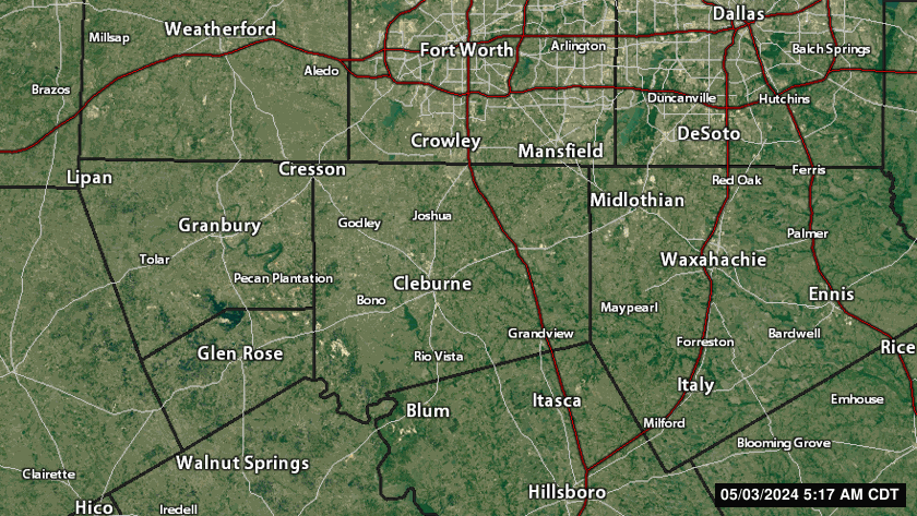
Dallas near Haskell and Blackburn.

Posted on 5/3/21 at 7:46 pm to McCaigBro69
quote:
Jeff Piotrowski
@Jeff_Piotrowski
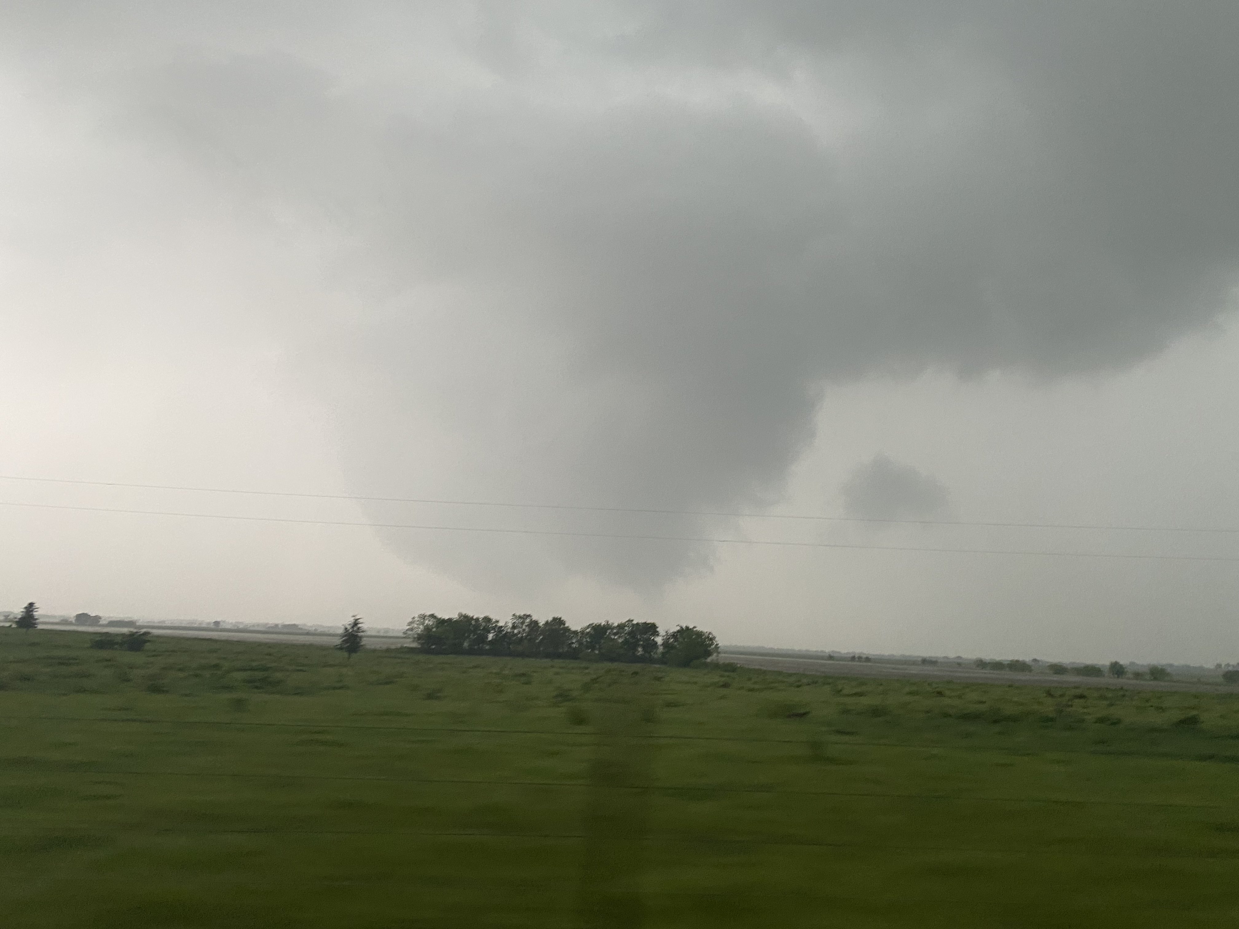
Tracking rain wrapped tornado now now NW@of Covington Tx. #txwx
@NWSFortWorth
Posted on 5/3/21 at 7:46 pm to LSUGrrrl
You in The Trails?
Posted on 5/3/21 at 7:46 pm to McCaigBro69
You’re gonna get that nasty cell moving NE from Cleburne.
Posted on 5/3/21 at 7:47 pm to Sao
quote:
You in The Trails?
No but very close.
A little SE
This post was edited on 5/3/21 at 7:48 pm
Posted on 5/3/21 at 7:48 pm to LSUGrrrl
I hope. Will make me not feel retarded for cancelling several work projects tonight.
Posted on 5/3/21 at 7:49 pm to LSUGrrrl
quote:
that nasty cell moving NE from Cleburne.
Posted on 5/3/21 at 7:50 pm to NorthEndZone
This Wfaa storm coverage is awful. Half of the people they are going to remotely can’t even get their location right.
Posted on 5/3/21 at 7:51 pm to NorthEndZone
quote:
that nasty cell moving NE from Cleburne.
Watching that one real close being in Ellis County.
Posted on 5/3/21 at 7:52 pm to McCaigBro69
Fox4news for weather only.
Posted on 5/3/21 at 7:52 pm to LSUGrrrl
I am switching over now.
Posted on 5/3/21 at 7:53 pm to OleVaught14
quote:
Watching that one real close being in Ellis County.
You need to be. Broad circulation but that one is dangerous.
Posted on 5/3/21 at 7:54 pm to Bobby OG Johnson
Can confirm there's a storm near DFW. Was just on Bear Creek East and only got 16 in 
Posted on 5/3/21 at 7:56 pm to wutangfinancial
Lol
Posted on 5/3/21 at 8:02 pm to LSUGrrrl
quote:
You need to be. Broad circulation but that one is dangerous.
Tracking right towards Waxahachie
Posted on 5/3/21 at 8:04 pm to OleVaught14
BULLETIN - EAS ACTIVATION REQUESTED
Tornado Warning
National Weather Service Fort Worth TX
800 PM CDT Mon May 3 2021
The National Weather Service in Fort Worth has issued a
* Tornado Warning for...
East central Johnson County in north central Texas...
West central Ellis County in north central Texas...
* Until 830 PM CDT.
* At 800 PM CDT, a severe thunderstorm capable of producing a tornado
was located over Grandview, or 9 miles south of Alvarado, moving
northeast at 20 mph.
HAZARD...Tornado and golf ball size hail.
SOURCE...Radar indicated rotation.
IMPACT...Flying debris will be dangerous to those caught without
shelter. Mobile homes will be damaged or destroyed.
Damage to roofs, windows, and vehicles will occur. Tree
damage is likely.
* This dangerous storm will be near...
Maypearl around 825 PM CDT.
This includes Interstate 35W between mile markers 15 and 19.
Posted on 5/3/21 at 8:05 pm to NorthEndZone
Looks like OleVaught14 is on deck now.
Posted on 5/3/21 at 8:06 pm to LSUGrrrl

 Page 11 of 28

Popular
Back to top