- My Forums
- Tiger Rant
- LSU Recruiting
- SEC Rant
- Saints Talk
- Pelicans Talk
- More Sports Board
- Fantasy Sports
- Golf Board
- Soccer Board
- O-T Lounge
- Tech Board
- Home/Garden Board
- Outdoor Board
- Health/Fitness Board
- Movie/TV Board
- Book Board
- Music Board
- Political Talk
- Money Talk
- Fark Board
- Gaming Board
- Travel Board
- Food/Drink Board
- Ticket Exchange
- TD Help Board
Customize My Forums- View All Forums
- Show Left Links
- Topic Sort Options
- Trending Topics
- Recent Topics
- Active Topics
Started By
Message
re: Let's Do It Again: Severe Threat 3/30 - Line of Severe Storms leaving SELA. AL in it now
Posted on 3/26/22 at 2:18 pm to LegendInMyMind
Posted on 3/26/22 at 2:18 pm to LegendInMyMind
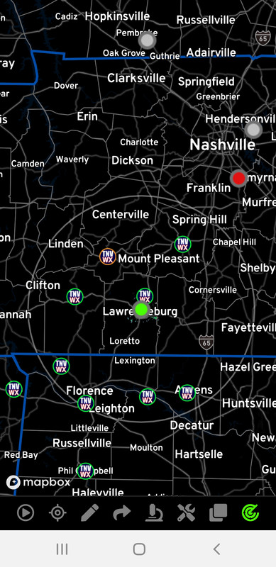
Hey, Wishinitwas....if you see this post, I found another radar that may be of use to you in your area. Radar Omega has a WLX in Lawrenceburg. It does have High Res Reflectivity and Velocity. It may have enough range to be of use to you.
 1
1


Posted on 3/26/22 at 2:37 pm to Duke
quote:
Meteorologist Nick Mikulakulasksas aka tigerdroppings field reporter tBoat Another storm system with some similarities to the last one is on tap for next week. This one will be Wednesday instead of Tuesday, but the time of day looks similar.
Eh, let’s get into it. SPC has placed us in a 15% risk for severe weather next Wednesday, as wind shear looks like it will, once again, be quite high. There will be enough instability in place, and a very strong storm system to make use of this instability/shear combo, so it looks like another solid severe threat across the area. Details will remain elusive through the weekend, but models have been pretty consistent on strength, and timing with this system. SPC has mentioned that they might have to elevate the threat in coming outlooks, and I think that’s likely given the set up. One thing I’ve noticed with this storm is that, regardless of just how strong the storms are, we will see some strong wind area wide. The low pressure that is driving this event will be stronger than the last one. That means a stronger change in pressure between the low pressure system passing to our north, and high pressure off to the east.
So models are suggesting widespread wind gusts in the 40-60 mph range, even away from the strongest storms. It wouldn’t surprise me to see stronger wind in the most robust storms. We saw scattered strong wind with the last system, but it looks like most, or all of us see it this time. That kind of wind isn’t overly dangerous when it comes to structural damage, but there could be some power outage problems.
So at least have that in mind. Hopefully that changes, but it’s worth a mention. Otherwise, it looks like another 1-3 inches of rain over a 3-6 hour window as this thing rolls through Wednesday morning into early afternoon. The 3-6 hour duration is how long it will last at a given spot. I understand that the morning and afternoon last longer than 3-6 hours.
That longer window of time is how long it will take for this squall line to move across the area. Damaging wind should be our main threat, though isolated tornadoes are possible. I can’t rule out some isolated hail, but as it stands now, that’s not the big concern. I’ll be updating this one regularly since it looks like a substantial, and areawide threat. Stay tuned! Or stay on Facebook? I don’t know. Just check back tomorrow.

Posted on 3/26/22 at 2:59 pm to Paul Allen
quote:
Why the central part of the state compared to the northern and southern part of the state?
Memphis is so shitty even tornadoes give a wide berth.
This post was edited on 3/26/22 at 3:02 pm

Posted on 3/26/22 at 3:21 pm to Douglas Quaid
quote:How dare you insult the biggest city in the world—the Paris of the west.
Memphis is so shitty even tornadoes give a wide berth.
LINK
This post was edited on 3/26/22 at 3:23 pm

Posted on 3/26/22 at 3:21 pm to Douglas Quaid
Chillin Titty milk
Posted on 3/26/22 at 5:38 pm to Impotent Waffle
Meteorologist Nick Mikiludkasklas aka tigerdroppings field reporter tBoat There isn’t much change regarding the evolution of our Wednesday severe threat. SPC has increased the risk for severe weather to 30% for a large part of the area, including Alexandria and Pineville, but that’s not a big surprise.
I’ve posted the map so you can see what areas are included, or close to this greater risk. It looks like a squall line will march steadily across the area Wednesday morning into early afternoon. The main threat will be damaging wind. Models indicate a high chance of 40+ mph gusts throughout the area, even away from the strongest storms. The stronger cells along the squall line will easily bring 50-70 mph wind gusts, while the strong low level wind shear will allow for the possibility of a few tornadoes along the line.
If there were supercells that could form ahead of the line, those could bring all modes of severe weather, but at this point, I’m thinking this is mainly a single line of storms. The fast motion of this system means most will see 1-3 inches of rain, so this isn’t a big flooding threat. I’ll update things tomorrow, but I don’t expect major changes.
Posted on 3/26/22 at 5:51 pm to S

That split in the jet is probably going to lead to this lining out early.
Posted on 3/26/22 at 11:55 pm to Duke
Just make sure everything calms TF down by the time it hits the Alabama line. MS can have this one—I’m sure we’ll get ours in April.
Still way too cool in B’ham—frost warning tonight; green-up is way behind schedule.
Still way too cool in B’ham—frost warning tonight; green-up is way behind schedule.

Posted on 3/27/22 at 12:39 am to Duke
I remember when bad weather was just called bad weather. Now every storm is the worst storm.
Posted on 3/27/22 at 2:53 am to LegendInMyMind
quote:
Hey, Wishinitwas....if you see this post, I found another radar that may be of use to you in your area. Radar Omega has a WLX in Lawrenceburg. It does have High Res Reflectivity and Velocity. It may have enough range to be of use to you.
I appreciate the info as always
I’ll have to check it out to see if it’s close enough, the circle on that map doesn’t quite make it to me but it might not be the limits of the beam
Also, what the frick is a radar doing in Lawrenceburg?
Posted on 3/27/22 at 8:16 am to Wishnitwas1998
Update

quote:
An appreciable severe-weather risk appears increasingly likely across the Lower Mississippi Valley and Middle Gulf Coast region on Wednesday/Day 4. This includes the potential for widespread damaging winds and tornadoes, including the possibility of a regional tornado outbreak including strong (EF2+) tornadoes. On Wednesday, an increasingly moist air mass is expected across the region ahead of an upper-level trough that will take on an increasingly negative tilt, with very strong deep-layer/low-level winds coincident with a modestly unstable air mass. The potential for extensive early day precipitation/cloud cover ahead of the cold front casts some uncertainty in terms of destabilization details, particularly with northward extent into the Tennessee and Ohio River Valleys. Regardless, the extremely strong wind fields are concerning for the potential for long-lived supercells/fast-moving bowing segments where modest destabilization does occur. The most-concerning severe-favorable ingredients currently appear most probable across sizable portions of Louisiana, Mississippi, and Alabama.

Posted on 3/27/22 at 9:39 am to AllDayEveryDay
quote:
Now every storm is the worst storm.
Who is saying that this upcoming system is the “worst”? It’s SPC’s job to forecast upcoming systems that could produce severe weather and they aren’t declaring it to be the “worst” just by forecasting it.
Posted on 3/27/22 at 9:45 am to Roll Tide Ravens
Some People think these threads shouldn’t be made unless it’s going to be the next April 27 2011 type outbreak
Posted on 3/27/22 at 9:59 am to AllDayEveryDay
quote:
I remember when bad weather was just called bad weather. Now every storm is the worst storm.
quote:
It's the heart of severe season and we got another round coming middle of the week.
An upper level low will eject out of the Rockies on Monday into Tuesday and a surface low will form on the east side of the Rockies. This system will progress east and the upper low will take on a negative tilt by Wednesday, bringing abundant shear over the lower Mississippi Valley.
Low pressure placement will play a role and also storm mode (individual cells vs a line of storms). Jet stream placement suggests a more linear mode.
Still a few days out, so just letting y'all know its coming and we'll track and figure out details as we get closer.

Posted on 3/27/22 at 11:25 am to Wishnitwas1998
quote:
I’ll have to check it out to see if it’s close enough, the circle on that map doesn’t quite make it to me but it might not be the limits of the beam
Also, what the frick is a radar doing in Lawrenceburg?
Wait until the next round comes through and I will let you know the limits. No need to pay the nine bucks unless you just want to.
As to why in Lawrenceburg? I have no idea. I didn't even know it was there until I got this app, and I don't remember having ever heard it being talked about.
Posted on 3/27/22 at 11:32 am to LegendInMyMind
Lawrenceburg radar is from a local weather-minded radio station group. IIRC the station manager is a former TV weather guy who realized that the corridor from Lawrenceburg, TN to Florence, AL is in one of those underserved coverage gaps, both for media in general and specifically weather radar and coverage.
Posted on 3/27/22 at 11:42 am to Duke
NAM goes mostly linear with a few bubblers out in front of a broken line as the line starts to form in East TX and Western LA. Plenty of spin to be had, but CAPE isn't really off the charts. Maybe it is the orientation of the line or timing of the LLJ. Parameters seem maximized along the MS River valley heading into the evening. Around 6pm everything blows up along the river.
Posted on 3/27/22 at 11:43 am to DoctorTechnical
quote:
Lawrenceburg radar is from a local weather-minded radio station group. IIRC the station manager is a former TV weather guy who realized that the corridor from Lawrenceburg, TN to Florence, AL is in one of those underserved coverage gaps, both for media in general and specifically weather radar and coverage.
Appreciate that info.
Now, we need the same thing to happen down in SW AL.
Posted on 3/27/22 at 12:17 pm to LegendInMyMind
quote:
Parameters seem maximized along the MS River valley heading into the evening. Around 6pm everything blows up along the river.
Sounds fun for me
Posted on 3/27/22 at 12:34 pm to deltaland

 Page 2 of 92

Popular
Back to top