- My Forums
- Tiger Rant
- LSU Recruiting
- SEC Rant
- Saints Talk
- Pelicans Talk
- More Sports Board
- Fantasy Sports
- Golf Board
- Soccer Board
- O-T Lounge
- Tech Board
- Home/Garden Board
- Outdoor Board
- Health/Fitness Board
- Movie/TV Board
- Book Board
- Music Board
- Political Talk
- Money Talk
- Fark Board
- Gaming Board
- Travel Board
- Food/Drink Board
- Ticket Exchange
- TD Help Board
Customize My Forums- View All Forums
- Show Left Links
- Topic Sort Options
- Trending Topics
- Recent Topics
- Active Topics
Started By
Message
Central Utah Trip Review - Capitol Reef and Escalante
Posted on 4/28/26 at 1:29 pm

Posted on 4/28/26 at 1:29 pm
Sharing some photos from our action packed 3 days in Southern Utah, focusing around the Capitol Reef area. This park gets little love, because it is overshadowed by Zion, Bryce Canyon, and Arches. Because of this, the crowds are low, which is great if that’s your thing. We had a fantastic time, the weather was cool and dry (for the most part). I had just gotten a drone around Christmas last year and was excited to fly it in the desert. Unfortunately the storm moving in brought crazy winds for the first two days, so there was very little of that. With that being my only complaint, I’d say we did alright.
We stayed at Capitol Reef Resort. It had incredible views, hot tub, Conestoga wagons, and teepees if you so chose. We opted for a regular-arse room with a cliff view. The first night, we got there just in time to hit the hot tub and go to bed.

DAY 1
The hotel was about 10 minutes from the park. He headed out in the morning and went to our first stop, Hickman Bridge Trail. Nice easy trail with some cool views. This was my youngest son’s (3 y/o) first full hike outside the carrier and he did great.


This is the bridge, pictures don’t really do it justice. It was huge, and probably 100 feet tall.

Found an antelope squirrel hanging out under the bridge. Besides deer and elk on one evening drive, this was the only wildlife we saw the whole trip.


Lots of cacti in bloom everywhere we went.

Next, we kept cruising down the main park road (UT 24) until we got to our first dirt road of the trip. Coal Mine Road has access to a few interesting sights, and is a flat, easy drive. You can see Factory Butte the whole way down the road. Our first stop was not too far after turning on. It doesn’t have a name and isn’t a marked location or trail, but this was high on the list of the coolest things we did. The fact that few people know about it certainly adds to the allure. It’s a usually dry wash, but there were a few little pools of water. When you first climb down, it doesn’t look like much, but quickly becomes surreal.


You can go a bit further, but this pool was deep enough that we didn’t want to get wet, so it was our turn around point. Because the wash blocked the wind, I was able to fly my drone for a minute.

After walking back, we drove to the Moonscape Overlook. It’s another dirt road off of Coal Mine. The turn is pretty much right across from the middle of Factory Butte.

This place is insane! Before you get close to the edge, you feel like you are just on regular flat ground. But then you realize you are on a 1,000 foot cliff.


After exploring the edges for a few minutes, we drove back down towards Factory Butte, then went on the road that leads to it to get a closer look.
Went back to home base, got some lunch, then headed out again about few hours before sunset to the next stop: Bentonite Hills. It’s accessed by a dirt road, Hartnett Road, which was our favorite of all the dirt we rode on. Right in the beginning, there is a short but fun water crossing. Here is a video from when we headed back for the night. In addition to that, there are beautiful views every stretch of the way.


There is a small sign for the hills and a few spots to pull over and park. We got out and went exploring. The best time to be there is when the light is low, sunrise or sunset. We were a little early for sunset, but because it is lower than the road, some of it was already in the shadows. You can see the difference in the colors. In the shadows, you get more blues/greens/purples to come out. Beautiful either way.


This might look like animal poop, but it’s actually black boulders that are about 10 feet wide.


We walked around for 20ish minutes, then got started back on the drive home. One thing I love about out-and-back trails is that you get a chance to see things you missed in the opposite direction. Like this… One of my favorite photos from the trip.


We stayed at Capitol Reef Resort. It had incredible views, hot tub, Conestoga wagons, and teepees if you so chose. We opted for a regular-arse room with a cliff view. The first night, we got there just in time to hit the hot tub and go to bed.
DAY 1
The hotel was about 10 minutes from the park. He headed out in the morning and went to our first stop, Hickman Bridge Trail. Nice easy trail with some cool views. This was my youngest son’s (3 y/o) first full hike outside the carrier and he did great.
This is the bridge, pictures don’t really do it justice. It was huge, and probably 100 feet tall.
Found an antelope squirrel hanging out under the bridge. Besides deer and elk on one evening drive, this was the only wildlife we saw the whole trip.
Lots of cacti in bloom everywhere we went.
Next, we kept cruising down the main park road (UT 24) until we got to our first dirt road of the trip. Coal Mine Road has access to a few interesting sights, and is a flat, easy drive. You can see Factory Butte the whole way down the road. Our first stop was not too far after turning on. It doesn’t have a name and isn’t a marked location or trail, but this was high on the list of the coolest things we did. The fact that few people know about it certainly adds to the allure. It’s a usually dry wash, but there were a few little pools of water. When you first climb down, it doesn’t look like much, but quickly becomes surreal.
You can go a bit further, but this pool was deep enough that we didn’t want to get wet, so it was our turn around point. Because the wash blocked the wind, I was able to fly my drone for a minute.
After walking back, we drove to the Moonscape Overlook. It’s another dirt road off of Coal Mine. The turn is pretty much right across from the middle of Factory Butte.
This place is insane! Before you get close to the edge, you feel like you are just on regular flat ground. But then you realize you are on a 1,000 foot cliff.
After exploring the edges for a few minutes, we drove back down towards Factory Butte, then went on the road that leads to it to get a closer look.
Went back to home base, got some lunch, then headed out again about few hours before sunset to the next stop: Bentonite Hills. It’s accessed by a dirt road, Hartnett Road, which was our favorite of all the dirt we rode on. Right in the beginning, there is a short but fun water crossing. Here is a video from when we headed back for the night. In addition to that, there are beautiful views every stretch of the way.
There is a small sign for the hills and a few spots to pull over and park. We got out and went exploring. The best time to be there is when the light is low, sunrise or sunset. We were a little early for sunset, but because it is lower than the road, some of it was already in the shadows. You can see the difference in the colors. In the shadows, you get more blues/greens/purples to come out. Beautiful either way.
This might look like animal poop, but it’s actually black boulders that are about 10 feet wide.
We walked around for 20ish minutes, then got started back on the drive home. One thing I love about out-and-back trails is that you get a chance to see things you missed in the opposite direction. Like this… One of my favorite photos from the trip.
 1
1

Posted on 4/28/26 at 1:30 pm to RonFNSwanson
DAY 2
Our second day, we headed south to Escalante for some adventure. UT12 is the main road you take to get there. If you’ve never driven it, it’s one of Utah’s most famous roads, and is a must-do if you’re in the area. Leaving Capitol Reef, you quickly get to Dixie National Forest, a high elevation pine forest that seems quite out of place among all the red rocks.


Once you get through the forest, the views really come alive. The road goes up, down, left, and right winding through canyons. At one point you are at the top of a mountain driving on the ridge line, with steep drops on either side.


I wish I had more footage, but sometimes you just gotta drive and admire. We made it to Escalante (well, right before) and turned on Hole in the Rock Road. It’s a 50 mile dirt road that connects to tons of amazing sights. It is as straight as a desert dirt road can be, but it is horribly washboarded. Our first turn off was on Harris Wash road to hike the Cosmic Ashtray. Harris Wash was the toughest road we went on, lots of tight turns, big holes, and a few deep sand spots. This one tested my wife’s patience for sure, but I think the payoff was worth it.
We survived the road (and the yelling) and started the hike. This is not really popular and there isn’t much of a trail, so Alltrails with a downloaded map is pretty much a requirement. I think if it was easier to get to, it would be up there with delicate arch as one of the faces of Southern Utah.
After walking on a sandy trail for 5 minutes you get to an open rock section. This is the “trail”.


Things like this were all over. It was so beautiful.


And here we have it. Pictures can’t really show the scale of this massive hole. The sand is so smooth it looks like an orange lake. In the first picture, you can see some footprints. If you have the equipment and skills (I don’t) you can climb in and out of it. I was really upset about my lack of drone flights for the whole trip, but this is probably the biggest bummer of it all. Ah well, I’ll get ‘em next time.


Back down the mountain, the dirt road, and on to the other dirt road. For about 30 more miles. The we arrived at our next stop, Peekaboo and Spooky Slot Canyons. This is a long trail (Alltrails has it at 4.8 miles, but it is actually almost 7), but was so worth it. There is about 2 miles of desert hiking before you get to Peekaboo, so I carried my youngest in the hiking carrier. But he was on his own after that. There is a post at the beginning of a trailhead to make sure you can fit through, and in my opinion, it should be smaller. There are parts that are tight that stretch for 20 yards, so you better not be claustrophobic.

The desert path was lovely and had some great blooms. It can be hard to follow, but people have set up rock cairns to mark the way. Alltrails is a must though. We passed a group of Asian tourists who were lost and asked if they could follow us. We obliged.


After a while you will come to a small canyon (it had some narrow spots, but I wouldn’t call it a slot), that is super cool to walk though. The best part is it is before the slot canyon loop, so you get to walk it twice.


We made it to Peekaboo. The first part is by far the hardest, you have to climb up about 10 feet to get inside. There was an easy spot to get to about halfway, then you have to use footholds for the rest. It was no problem for my wife and I, but I’m not sure if we would have gotten the kids up without the help of a rope supplied by our Asian friends. I helped one of them up, but the rest said “hell no” and we parted ways. There were no vehicles left in the parking lot when we were done, so I assume they made it back safely.


We popped up for a second, but that was not the end… Back in we went.


Little birds’ nest toward the end.

Once you get out, there is about a mile of desert hiking between the two slots.


On to Spooky. This one starts out easy, but quickly turns gnarly. At one point you are walking fine, then you get to a section of boulders that are just hanging in the canyon. You have to navigate through them, about a 12-15 foot drop in total. It was a little dicey for me, but once I was down, the biggest challenge was getting the kids down without getting hurt. Bum shuffling to me until I could reach them and pull them down was the best way. After that it was “easy”, with 1-3 foot drops and tight turns every so often. Then you get to the big finish. An extremely narrow section with very little breaks. You have to carry your bags in your hand and just crab walk. This was easy for the kids, so they were running way ahead. Didn’t get many pictures in spooky, these were my last two. The second pic is about twice as wide as the narrow sections at the end.


We emerged from the slot, happy to see daylight again, and head back through the rest of the trail. Was it fun? Yes. Was it stressful? Yes. Was it scary for the kids? Only at the beginning climb and the boulder drop. Was it worth it? I’m still not sure. The further removed we are, the more I remember it fondly, so maybe so.
40 miles of dirt to get back to Hwy 12 and head home for the night. We made it back just in time for 30 mins of hot tub and beers. Much needed. Oh yeah… and it was snowing in the mountains on the way back.
Our second day, we headed south to Escalante for some adventure. UT12 is the main road you take to get there. If you’ve never driven it, it’s one of Utah’s most famous roads, and is a must-do if you’re in the area. Leaving Capitol Reef, you quickly get to Dixie National Forest, a high elevation pine forest that seems quite out of place among all the red rocks.
Once you get through the forest, the views really come alive. The road goes up, down, left, and right winding through canyons. At one point you are at the top of a mountain driving on the ridge line, with steep drops on either side.
I wish I had more footage, but sometimes you just gotta drive and admire. We made it to Escalante (well, right before) and turned on Hole in the Rock Road. It’s a 50 mile dirt road that connects to tons of amazing sights. It is as straight as a desert dirt road can be, but it is horribly washboarded. Our first turn off was on Harris Wash road to hike the Cosmic Ashtray. Harris Wash was the toughest road we went on, lots of tight turns, big holes, and a few deep sand spots. This one tested my wife’s patience for sure, but I think the payoff was worth it.
We survived the road (and the yelling) and started the hike. This is not really popular and there isn’t much of a trail, so Alltrails with a downloaded map is pretty much a requirement. I think if it was easier to get to, it would be up there with delicate arch as one of the faces of Southern Utah.
After walking on a sandy trail for 5 minutes you get to an open rock section. This is the “trail”.
Things like this were all over. It was so beautiful.
And here we have it. Pictures can’t really show the scale of this massive hole. The sand is so smooth it looks like an orange lake. In the first picture, you can see some footprints. If you have the equipment and skills (I don’t) you can climb in and out of it. I was really upset about my lack of drone flights for the whole trip, but this is probably the biggest bummer of it all. Ah well, I’ll get ‘em next time.
Back down the mountain, the dirt road, and on to the other dirt road. For about 30 more miles. The we arrived at our next stop, Peekaboo and Spooky Slot Canyons. This is a long trail (Alltrails has it at 4.8 miles, but it is actually almost 7), but was so worth it. There is about 2 miles of desert hiking before you get to Peekaboo, so I carried my youngest in the hiking carrier. But he was on his own after that. There is a post at the beginning of a trailhead to make sure you can fit through, and in my opinion, it should be smaller. There are parts that are tight that stretch for 20 yards, so you better not be claustrophobic.
The desert path was lovely and had some great blooms. It can be hard to follow, but people have set up rock cairns to mark the way. Alltrails is a must though. We passed a group of Asian tourists who were lost and asked if they could follow us. We obliged.
After a while you will come to a small canyon (it had some narrow spots, but I wouldn’t call it a slot), that is super cool to walk though. The best part is it is before the slot canyon loop, so you get to walk it twice.
We made it to Peekaboo. The first part is by far the hardest, you have to climb up about 10 feet to get inside. There was an easy spot to get to about halfway, then you have to use footholds for the rest. It was no problem for my wife and I, but I’m not sure if we would have gotten the kids up without the help of a rope supplied by our Asian friends. I helped one of them up, but the rest said “hell no” and we parted ways. There were no vehicles left in the parking lot when we were done, so I assume they made it back safely.
We popped up for a second, but that was not the end… Back in we went.
Little birds’ nest toward the end.
Once you get out, there is about a mile of desert hiking between the two slots.
On to Spooky. This one starts out easy, but quickly turns gnarly. At one point you are walking fine, then you get to a section of boulders that are just hanging in the canyon. You have to navigate through them, about a 12-15 foot drop in total. It was a little dicey for me, but once I was down, the biggest challenge was getting the kids down without getting hurt. Bum shuffling to me until I could reach them and pull them down was the best way. After that it was “easy”, with 1-3 foot drops and tight turns every so often. Then you get to the big finish. An extremely narrow section with very little breaks. You have to carry your bags in your hand and just crab walk. This was easy for the kids, so they were running way ahead. Didn’t get many pictures in spooky, these were my last two. The second pic is about twice as wide as the narrow sections at the end.
We emerged from the slot, happy to see daylight again, and head back through the rest of the trail. Was it fun? Yes. Was it stressful? Yes. Was it scary for the kids? Only at the beginning climb and the boulder drop. Was it worth it? I’m still not sure. The further removed we are, the more I remember it fondly, so maybe so.
40 miles of dirt to get back to Hwy 12 and head home for the night. We made it back just in time for 30 mins of hot tub and beers. Much needed. Oh yeah… and it was snowing in the mountains on the way back.
Posted on 4/28/26 at 1:31 pm to RonFNSwanson
DAY 3
By morning, snow had reached Capitol Reef. We woke up to two inches on the ground. I had been wanting to see snow covered red rocks for a long time, and I feel incredibly luck to have it time perfectly on our last day. The winds were calm, so I was able to get the drone up to take a few shots and videos.


It snowed until 10 am, so we enjoyed the views while packing up slowly. After the previous day, we were definitely wanting more chill vibes before heading home. We found them on the Capitol Reef Scenic Drive and Grand Wash Road. The wash is a dirt road, but it was easy, even with it slightly muddy. The park is a lot lower elevation than where we were staying, so a lot of the snow was melting and falling as rain when we got in. But moisture and cloudy skies were really making all the colors pop.


Scenes from Grand Wash


We had one more hike planned, a nice river stroll on the Sulphur Falls Trail. It’s a fun, easy hike less than 2 miles, but you do have to cross the river close to 20 times. I could easily see spending the day here, there were so many great spots to stop and have a picnic. The waterfall itself isn’t super impressive, but it has a big open area to hang out. And my boys loved running through the pool. My oldest got his pants wet and did the hike back in his underwear .
.


The falls. You can climb on the rocks to the right if you want and get a view of more of it. I think it had 3 different water levels that you can see when you get over there.


After the hike, we hit the road back home, only stopping for the original Curry Pizza location. Indian flavors on thin crust pizza, delightful.
By morning, snow had reached Capitol Reef. We woke up to two inches on the ground. I had been wanting to see snow covered red rocks for a long time, and I feel incredibly luck to have it time perfectly on our last day. The winds were calm, so I was able to get the drone up to take a few shots and videos.
It snowed until 10 am, so we enjoyed the views while packing up slowly. After the previous day, we were definitely wanting more chill vibes before heading home. We found them on the Capitol Reef Scenic Drive and Grand Wash Road. The wash is a dirt road, but it was easy, even with it slightly muddy. The park is a lot lower elevation than where we were staying, so a lot of the snow was melting and falling as rain when we got in. But moisture and cloudy skies were really making all the colors pop.
Scenes from Grand Wash
We had one more hike planned, a nice river stroll on the Sulphur Falls Trail. It’s a fun, easy hike less than 2 miles, but you do have to cross the river close to 20 times. I could easily see spending the day here, there were so many great spots to stop and have a picnic. The waterfall itself isn’t super impressive, but it has a big open area to hang out. And my boys loved running through the pool. My oldest got his pants wet and did the hike back in his underwear
The falls. You can climb on the rocks to the right if you want and get a view of more of it. I think it had 3 different water levels that you can see when you get over there.
After the hike, we hit the road back home, only stopping for the original Curry Pizza location. Indian flavors on thin crust pizza, delightful.
Posted on 4/28/26 at 1:49 pm to RonFNSwanson
quote:
wanting to see snow covered red rocks
That red clay on rocks with ice can be downright terrifying to drive on.
Did y'all see... I think it's luna mesa?
Posted on 4/28/26 at 1:57 pm to RonFNSwanson
now THATS a review 
love capitol reef, its a wonder of the world
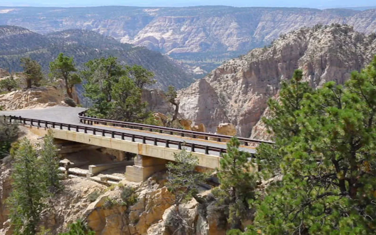
next time you go that way (on 12) try and take the road to hell's backbone bridge
love capitol reef, its a wonder of the world
next time you go that way (on 12) try and take the road to hell's backbone bridge
Posted on 4/29/26 at 7:43 am to X123F45
quote:
Did y'all see... I think it's luna mesa?
Hard to find much about that online, but from what I can tell it seems to be in that moonscape overlook area. So, not directly... but maybe
Posted on 4/29/26 at 10:07 pm to RonFNSwanson
If I remember right it's off of that 70 mile gravel drive in. It's a gray sort of slick rock. Stretches for miles.
I always remember it because it's so much gray for such a far distance even the sky feels like the wrong color
ETA: it's northeast of escalante actually. I was mistaken.
I always remember it because it's so much gray for such a far distance even the sky feels like the wrong color
ETA: it's northeast of escalante actually. I was mistaken.
This post was edited on 4/29/26 at 10:10 pm
Posted on 4/30/26 at 6:05 am to RonFNSwanson
Great trip review! 
So, for you (or others on the board) that have been to this area, what advice would you give on touring the area to see "The Mighty Five" (Zion, Bryce Canyon, Capitol Reef, Arches, and Canyonlands). We've never done any and the wife (no pics) wants that to be our next trip one day.
Time of year to go? Weather? Park(s)? Places to stay? We're retired, so plenty of time and flexibility, and up there (i.e. 70 yrs. old), so nothing over the top for us. I've read Bryce is the easiest and most "senior friendly" of the parks, Zion not so much and it has shuttles and more crowds.
Thanks again!
This post was edited on 4/30/26 at 6:10 am
Posted on 4/30/26 at 1:48 pm to Nole Man
Zion…a commitment. Either stay at the lodge (book early) or you have to use the shuttle from the visitor center which can be a nightmare if the park is busy. And the park is usually busy. The drive thru the park on hwy 9 is spectacular if you just want a taste. To do it right you need several days
Bryce…super easy. Drive all the way to the end of the loop and then stop at the pull outs on the right on the way back (everything is on the east side of the road). At the amphitheater you can take a hike down into the hoodoos. Bryce can be done in a day
From Bryce to Capitol Reef, take hwy 12 for the most beautiful drive in the nation. Start early and take your time.
Capitol Reef…Ron nailed it in the OP
Arches/Canyonlands…stay in Moab. Don’t go mid summer it is dangerously hot. Book timed entry to get into arches. Bring water. Arches takes at least two days Canyonlands is much more remote but just as beautiful
Posted on 4/30/26 at 3:04 pm to cgrand
Well said. I would add that Arches has a lot of great drives, so you don't need to hike much. But there are some short, easy hikes.
The hike to Delicate Arch is a little over 2 miles and has a steep section, but nothing crazy. It's a big open rock bed (kinda like the pics in this thread from the Cosmic Ashtray hike). So you could turn it into a zig zag if you wanted. But it's well worth the effort. Such an incredible view when you get to the top.
The hike to Delicate Arch is a little over 2 miles and has a steep section, but nothing crazy. It's a big open rock bed (kinda like the pics in this thread from the Cosmic Ashtray hike). So you could turn it into a zig zag if you wanted. But it's well worth the effort. Such an incredible view when you get to the top.
Posted on 4/30/26 at 3:16 pm to Nole Man
quote:
Time of year to go? Weather? Park(s)? Places to stay?
The only one I've been to is Bryce; hit it as part of a bigger trip in 2006.
Drove in from Boulder one day, did the park the next, left for Vegas the next. We were there at the end of July. It was hot but not unbearable. I think it was in the low 90s (warmer than the 80s we had in Cheyenne earlier in the week, much nicer than the 100+ we had in Vegas).
We stayed at the Best Western Ruby's Inn (now called Bryce Canyon City). It's a big compound with regular hotel rooms, cabins, souvenir store, restaurant, filling station, etc.
There is a NPS shuttle that circulated through the amphitheatre area (visitor center and five overlooks) and there are a few stops right outside the park, including at Ruby's. We got up early and took one of the first shuttles in and did a sort of hop on/hop off and between walking and the shuttle we saw all of the amphitheatre area. Took the shuttle back and got the car and drove the park road as far south as it goes and stopped at several of the overlooks in that part of the park. There were some summer thunderstorms that popped up so we had to cut out a couple of the overlooks because of how exposed some of them are.
Posted on 5/1/26 at 3:04 pm to RonFNSwanson
Awesome trip now you need to get into river life. Buy youselves a raft for the summer
This post was edited on 5/1/26 at 3:04 pm
Posted on 5/1/26 at 4:41 pm to RonFNSwanson
Take a bow man, what an incredible post and review.
Posted on 5/4/26 at 7:42 am to Yeti_Chaser
quote:
now you need to get into river life. Buy youselves a raft for the summer
We got a kayak at the end of last summer. Took it out a few times. Gonna have some fun with it this year.
Posted on 5/4/26 at 8:59 am to RonFNSwanson
We got really into overnight trips since we got here. The Green River at the Flaming Gorge dam is close and a really fun trip
Posted on 5/5/26 at 7:41 pm to Nole Man
La. native but lived in Utah about 30 yr before moving back. Never thought I'd like the desert, but fell in love with it- at the right time of the year!. Agree 100% withcgrand, and others on here.
DONT MISS Hwy12. Great short, mostly flat hike off Hwy 12 to Lower Calf Creek Falls.
You can look these up, but Notom Rd on back side of Capitol Reef is a cool road, some Indian ruins along the way. Don't miss the Fiery Furnace hike in Arches. Another less crowded area is the San Rafael Swell.
I make at least one trip a year back out there.
Also Anasazi Indian State Park in Boulder is neat- last i was there, there was a very informative native lady at the desk inside
This post was edited on 5/5/26 at 7:43 pm

 Page 1 of 1


Popular
Back to top