- My Forums
- Tiger Rant
- LSU Recruiting
- SEC Rant
- Saints Talk
- Pelicans Talk
- More Sports Board
- Fantasy Sports
- Golf Board
- Soccer Board
- O-T Lounge
- Tech Board
- Home/Garden Board
- Outdoor Board
- Health/Fitness Board
- Movie/TV Board
- Book Board
- Music Board
- Political Talk
- Money Talk
- Fark Board
- Gaming Board
- Travel Board
- Food/Drink Board
- Ticket Exchange
- TD Help Board
Customize My Forums- View All Forums
- Show Left Links
- Topic Sort Options
- Trending Topics
- Recent Topics
- Active Topics
Started By
Message
 1
1

Posted on 12/29/21 at 4:36 pm to deltaland
How’s the area along 45 from Tupelo to Starkville looking over the next couple of hours?
This post was edited on 12/29/21 at 4:38 pm

Posted on 12/29/21 at 4:40 pm to Jeb Busch Lite
quote:
How’s the area along 45 from Tupelo to Starkville looking over the next couple of hours?
The line of storms will move through that area during that time frame. Gotta keep watching to see if they will be severe or tornadic.
Posted on 12/29/21 at 4:43 pm to Roll Tide Ravens
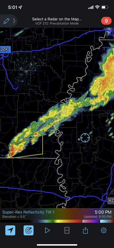
Those two cells on the MS/AL state line may be ones to watch.
ETA: I take that back, they are ones to watch.
ETA: I take that back, they are ones to watch.
This post was edited on 12/29/21 at 4:45 pm
Posted on 12/29/21 at 4:52 pm to LegendInMyMind
The one now east of Tupelo is hooking a bit.
ETA - then a few minutes later it flattens out a bit. Having trouble getting any rotation started.
That's good for those in the danger zone.
ETA - then a few minutes later it flattens out a bit. Having trouble getting any rotation started.
That's good for those in the danger zone.
This post was edited on 12/29/21 at 4:56 pm
Posted on 12/29/21 at 4:57 pm to LegendInMyMind
quote:
LegendInMyMind
If i havent said so yet, you've been pumping out some damn strong weather posts recently.
Posted on 12/29/21 at 4:59 pm to Duke
First MS Tornado Warning on the board South of Slate Springs.
Posted on 12/29/21 at 5:02 pm to LegendInMyMind
I’m keeping an eye on that one in Arkansas it’s entering a favorable environment and nothing to impede it. And heading for my area
Posted on 12/29/21 at 5:50 pm to deltaland
Well that one just oddly disappeared 
Posted on 12/29/21 at 6:04 pm to deltaland
Several Alabama counties added to the existing tornado watch. Those counties are in yellow:

This post was edited on 12/29/21 at 6:07 pm

Posted on 12/29/21 at 6:06 pm to LegendInMyMind
quote:
LegendInMyMind
You’re gonna have to change your name to “LegendInDukesMind”.
Posted on 12/29/21 at 6:14 pm to Briella
Nah. Duke has real education. I'm just a hobbyist.
Posted on 12/29/21 at 6:27 pm to Briella
I will say that it is spooky walking out on the porch and hearing a constant rumble in the distance. Lots of lightning with these storms.
This post was edited on 12/29/21 at 6:28 pm
Posted on 12/29/21 at 6:39 pm to LegendInMyMind
Severe Weather Statement
National Weather Service Birmingham AL
636 PM CST Wed Dec 29 2021
ALC057-093-300115-
/O.CON.KBMX.TO.W.0083.000000T0000Z-211230T0115Z/
Marion AL-Fayette AL-
636 PM CST Wed Dec 29 2021
...A TORNADO WARNING REMAINS IN EFFECT UNTIL 715 PM CST FOR
SOUTHEASTERN MARION AND NORTHWESTERN FAYETTE COUNTIES...
At 636 PM CST, a severe thunderstorm capable of producing a tornado
was located near Guin, or near Winfield, moving east at 45 mph.
HAZARD...Tornado.
SOURCE...Radar indicated rotation.
IMPACT...Flying debris will be dangerous to those caught without
shelter. Mobile homes will be damaged or destroyed. Damage
to roofs, windows, and vehicles will occur. Tree damage is
likely.
Locations impacted include...
Winfield, Guin, Brilliant, Glen Allen, Gu-
Win, Tucker, Bazemore and Texas.
PRECAUTIONARY/PREPAREDNESS ACTIONS...
TAKE COVER NOW! Move to a basement or an interior room on the lowest
floor of a sturdy building. Avoid windows. If you are outdoors, in a
mobile home, or in a vehicle, move to the closest substantial shelter
and protect yourself from flying debris.
Posted on 12/29/21 at 6:46 pm to Duke
What’s this look like into the night for the NOLA/northshore area?
This post was edited on 12/29/21 at 6:47 pm
Posted on 12/29/21 at 6:49 pm to LSUisKING12
Reports of damage near Winfield, AL but no specifics yet.
Posted on 12/29/21 at 7:02 pm to Roll Tide Ravens
Posted on 12/29/21 at 7:02 pm to Roll Tide Ravens
There was a tight rotation with a CC drop on a couple frames.
Posted on 12/29/21 at 7:03 pm to Roll Tide Ravens
Confirmed tornado damage in downtown Winfield, AL (Marion County) in NW Alabama, per Spann.

 Page 5 of 7

Popular
Back to top