- My Forums
- Tiger Rant
- LSU Recruiting
- SEC Rant
- Saints Talk
- Pelicans Talk
- More Sports Board
- Fantasy Sports
- Golf Board
- Soccer Board
- O-T Lounge
- Tech Board
- Home/Garden Board
- Outdoor Board
- Health/Fitness Board
- Movie/TV Board
- Book Board
- Music Board
- Political Talk
- Money Talk
- Fark Board
- Gaming Board
- Travel Board
- Food/Drink Board
- Ticket Exchange
- TD Help Board
Customize My Forums- View All Forums
- Show Left Links
- Topic Sort Options
- Trending Topics
- Recent Topics
- Active Topics
Started By
Message
Posted on 4/21/20 at 10:29 pm to rt3
quote:
sadly south Mississippi has gotten the ability to forget about the 'rona for 2 straight Sundays thanks to back-to-back weekends with EF-4s
That Soso-Bassfield EF-4 was damn near as bad as the Tuscaloosa tornado only wider and went thru a less populated area.
Solid old cabin, survived Katrina fine.


Posted on 4/21/20 at 10:34 pm to rds dc
Some big hail in OK tonight

10% Tornado hatch over most of DFW


10% Tornado hatch over most of DFW

Posted on 4/21/20 at 10:39 pm to rds dc
The weather is supposed to roll through my area in the middle of the night tomorrow night....not looking forward to that at all
Posted on 4/21/20 at 10:54 pm to tigerlife36
I live west of the I35 corridor - where the dry line is to set up tomorrow and weather folks are saying the same thing ...after this round patterns will change bringing the severe weather threat to minimal going into early May, at least.
Storms are due west and north of us now
Storms are due west and north of us now
This post was edited on 4/21/20 at 10:56 pm
Posted on 4/22/20 at 7:46 am to rds dc
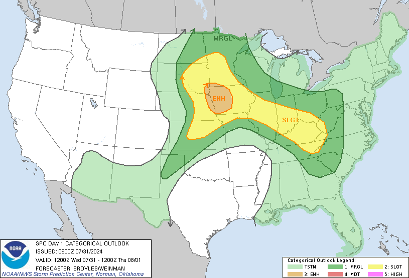
This just got upgraded to enhanced for Arlatex, storms this morning in Arkansas setting the tone for this afternoon, just went outside wind was ripping.


This post was edited on 4/22/20 at 7:48 am
Posted on 4/22/20 at 7:53 am to Strannix
This isn’t getting as much attention as the last 2 events which is worrisome. Seems like whenever that happens it ends up worse than expected and people get hurt because they aren’t prepared
Posted on 4/22/20 at 7:58 am to deltaland
I dont think the models came into agreement early on this one, this will be a classic dryline uncapped airmass event, should start firing up soon
Posted on 4/22/20 at 8:27 am to Strannix
That description really sounds like a couple of lesbian Victoria Secret models are about to get off on each other by farting.
You weather people really speak your own jive talk.
You weather people really speak your own jive talk.
Posted on 4/22/20 at 8:33 am to deltaland
I wasn’t even aware of the threat until I read this thread this morning. Just starting the sprinkle here but guess I’ll pay attention now.
Posted on 4/22/20 at 8:40 am to rds dc
quote:
Starts as a classic I35 dryline event
do explain sir
Posted on 4/22/20 at 8:43 am to Bullfrog
quote:
That description really sounds like a couple of lesbian Victoria Secret models are about to get off on each other by farting.
:thatsmyfetish:
Posted on 4/22/20 at 8:45 am to DomincDecoco
quote:
Typically, the boundary between two air masses is a front. In the U.S. Southern Plains, however, another phenomenon separates the dry air blowing from the Mexican Plateau from the moist air from the Gulf of Mexico. This boundary is called the "dryline". In the U.S., it exists most commonly in western and central Texas, western Oklahoma, southern Kansas, eastern New Mexico, and southeastern Colorado. The dryline rarely extends beyond this region and, when it does, it does not travel more than a few hundred kilometers beyond the region.
quote:
Storms develop along a dryline because the dry air behind the boundary is less dense than the moisture-rich air ahead of it. The rising air that results from this collision triggers the formation of thunderstorms on the immediate eastern side of the dryline.
If the air aloft in the atmosphere above the dryline is too warm, however, the atmosphere can be "capped", resulting in no thunderstorm development.
Posted on 4/22/20 at 8:51 am to rds dc
There's parts around here still out of power from Sunday.
Posted on 4/22/20 at 8:58 am to rds dc
well shite I guess its our turn
Posted on 4/22/20 at 9:01 am to 50_Tiger
Shut your whore mouth. We had our turn last year.
Posted on 4/22/20 at 9:02 am to LSUGrrrl
quote:
Shut your whore mouth. We had our turn last year.
Oh yes the multiple weeks of tornadoes coming within 5 mi North or South of me felt amazing.
NOT
Popular
Back to top


 0
0


