- My Forums
- Tiger Rant
- LSU Recruiting
- SEC Rant
- Saints Talk
- Pelicans Talk
- More Sports Board
- Fantasy Sports
- Golf Board
- Soccer Board
- O-T Lounge
- Tech Board
- Home/Garden Board
- Outdoor Board
- Health/Fitness Board
- Movie/TV Board
- Book Board
- Music Board
- Political Talk
- Money Talk
- Fark Board
- Gaming Board
- Travel Board
- Food/Drink Board
- Ticket Exchange
- TD Help Board
Customize My Forums- View All Forums
- Show Left Links
- Topic Sort Options
- Trending Topics
- Recent Topics
- Active Topics
Started By
Message
re: Tornado! Multi State Outbreak - New Tri-State Tornado
Posted on 2/28/17 at 10:07 pm to razorbackfan4life
Posted on 2/28/17 at 10:07 pm to razorbackfan4life
 1
1

Posted on 2/28/17 at 10:15 pm to razorbackfan4life
quote:
Jeff Piotrowski is about 20 miles east of that tornado. He's heading right towards it
He's going to find something for sure

Posted on 2/28/17 at 10:16 pm to rds dc
chasing in the dark isn't my jam... I don't like dying
Posted on 2/28/17 at 10:17 pm to baytiger
quote:
chasing in the dark isn't my jam... I don't like dying
I hear there are plenty of tress in that area to take cover under
Posted on 2/28/17 at 10:18 pm to rds dc
quote:
He's going to find something for sure
He's one crazy fella.
I enjoy watching his periscopes though. He gets near the action and keeps it entertaining.

Posted on 2/28/17 at 10:22 pm to razorbackfan4life
Check out his Periscope if you want some entertainment. He's going crazy over the inflow bands right now.
Posted on 2/28/17 at 10:23 pm to razorbackfan4life
that video quality is arse
Posted on 2/28/17 at 10:26 pm to razorbackfan4life
quote:
Check out his Periscope if you want some entertainment.
I'm watching. The lightning is similar to, but not as intense as, the night EF-4 Garland, TX from a couple of years ago. I've never seen anything like that light show as we drove into it.
Posted on 2/28/17 at 10:28 pm to rds dc
And that radar site just barely makes it to see another day!
Posted on 2/28/17 at 10:28 pm to rds dc
he's not on the indiana storm, he's in kansas.
Posted on 2/28/17 at 10:32 pm to GEAUXmedic
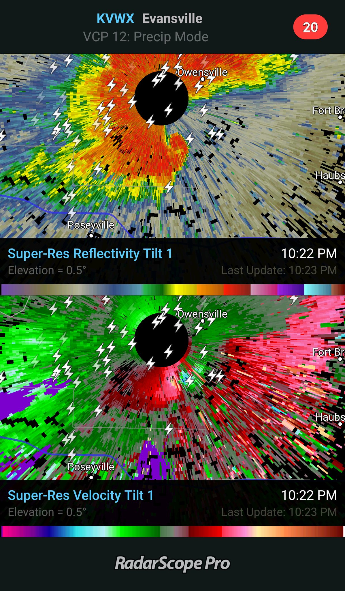
If you check out Springfields radar you can really see that couplet.
Jeff just saw Power Flashes.
Jeff just saw Power Flashes.

Posted on 2/28/17 at 10:34 pm to rds dc
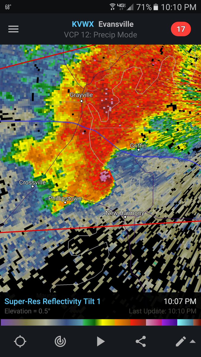
Tornado Debris Signiture still very impressive just NE of Fort Branch, Indiana.
Posted on 2/28/17 at 10:36 pm to Roll Tide Ravens
TDS on the CC

Posted on 2/28/17 at 10:38 pm to Roll Tide Ravens
Just a batch of discrete, tornado warned supercells, at night, in February!

Posted on 2/28/17 at 10:40 pm to Roll Tide Ravens
quote:
TDS on the CC
There is a big Toyota facility there.
Posted on 2/28/17 at 10:41 pm to rds dc
Not good
Posted on 2/28/17 at 10:49 pm to lsuman25
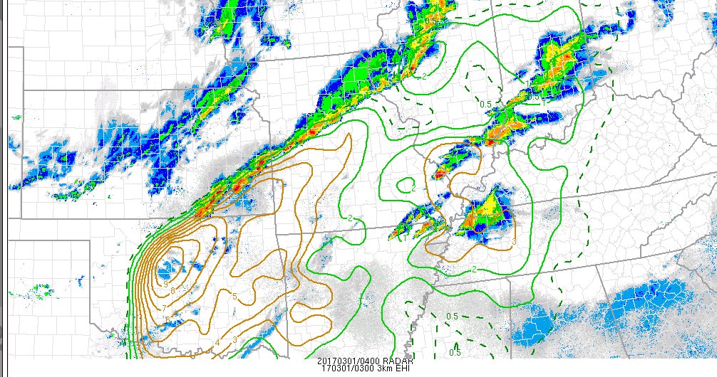
A couple of cells trying to go up in Oklahoma. Those could quickly go svr with tornado potential:

Posted on 2/28/17 at 10:52 pm to rds dc
Is Memphis mostly in the clear overnight on this one? Local news hasn't given an update and I want to know how peacefully I can sleep.
Posted on 2/28/17 at 10:53 pm to rds dc
New tornado watch coming for N. TX, OK, and Arky:
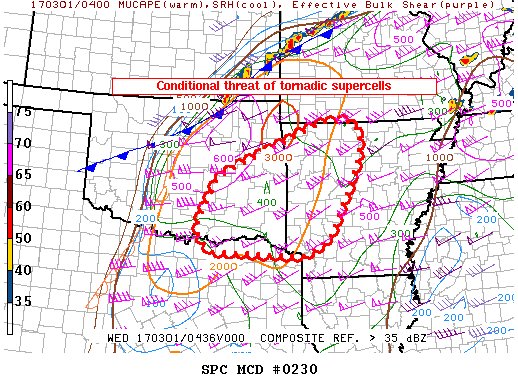
Mesoscale Discussion 0230
NWS Storm Prediction Center Norman OK
1046 PM CST Tue Feb 28 2017
Areas affected...Eastern Oklahoma into western Arkansas
Concerning...Severe potential...Tornado Watch likely
Valid 010446Z - 010645Z
Probability of Watch Issuance...80 percent
SUMMARY...Isolated to scattered severe thunderstorms may develop in
the next few hours over eastern Oklahoma into western Arkansas.
Tornadoes and very large hail are possible.
DISCUSSION...Showers appear to be deepening across parts of eastern
Oklahoma, in advance of strong cooling aloft and approaching the
surface moist axis where dewpoints are in the lower 60s. Due to
strong winds and mixing, the boundary layer remains warm with
temperatures in the 70s and relatively weak CIN. Given extreme
cooling aloft, lapse rates are very steep, with MLCAPE to around
2000 J/kg. Shear is more impressive, with area VWPs indicating 0-1
SRH in excess of 500 to 600 m2/s2. Clearly, the environment favors
tornadic supercells, conditional on storms forming. Several CAM
solutions indicate storms in this area. A tornado watch is likely to
be needed soon.
..Jewell/Edwards.. 03/01/2017

 Page 4 of 5

Popular
Back to top