- My Forums
- Tiger Rant
- LSU Recruiting
- SEC Rant
- Saints Talk
- Pelicans Talk
- More Sports Board
- Coaching Changes
- Fantasy Sports
- Golf Board
- Soccer Board
- O-T Lounge
- Tech Board
- Home/Garden Board
- Outdoor Board
- Health/Fitness Board
- Movie/TV Board
- Book Board
- Music Board
- Political Talk
- Money Talk
- Fark Board
- Gaming Board
- Travel Board
- Food/Drink Board
- Ticket Exchange
- TD Help Board
Customize My Forums- View All Forums
- Show Left Links
- Topic Sort Options
- Trending Topics
- Recent Topics
- Active Topics
Started By
Message
Posted on 8/22/17 at 1:46 pm to slackster
I'd be ok with that as long as it doesn't stall over us
Posted on 8/22/17 at 1:47 pm to ForeverLSU02
It shows how weak the steering is with how slow it moves what would be bad is if this things stalls right off the coast and never makes the first landfall in Texas.
Posted on 8/22/17 at 1:48 pm to ForeverLSU02
quote:
I'd be ok with that as long as it doesn't stall over us
4 days with a tropical system no further west than San Antonio would likely mean a shite ton of rain while it meanders.
Posted on 8/22/17 at 1:48 pm to Cosmo
quote:
South LA can handle 2 feet of rain spread over a week but not over 2 days
I hope this is true but from what I've seen in my area since the flood, I'm skeptical. The drainage around Central and Denham has been shite since the flood and any sustained rain I've seen lately causes, at the minimum, a good bit of street flooding.
Posted on 8/22/17 at 1:50 pm to JonTheTigerFan


This post was edited on 8/22/17 at 1:52 pm
Posted on 8/22/17 at 1:51 pm to JonTheTigerFan
quote:I've noticed this as well.
The drainage around Central and Denham has been shite since the flood and any sustained rain I've seen lately causes, at the minimum, a good bit of street flooding.
Posted on 8/22/17 at 1:51 pm to slackster
Yeah, I think the Euro is looking at possibly that front steering it like that?
Posted on 8/22/17 at 1:55 pm to tke857


aaannnnnnnnnnnnnnnd the shite just hit the fan for grocery stores.
Seriously, look at that. Just a 75 mile jog to the east means double-digit rainfall totals across SELA.
This post was edited on 8/22/17 at 1:56 pm
Posted on 8/22/17 at 1:56 pm to JonTheTigerFan
The disconcerting thing is that the GFS and Euro basically agree on the slow movement. They both still have it in northern Mississippi in 9 days.
The Canadian is a little faster to move it out, but still has it in E Tenn. after 7 and a half days.

The Canadian is a little faster to move it out, but still has it in E Tenn. after 7 and a half days.
Posted on 8/22/17 at 1:58 pm to TDsngumbo
Those are probably not very accurate as certain areas would get colossal downpour while areas around it not as much. But yeah, that's how it always works with these systems just 50 miles makes a huge difference on impact area.
Posted on 8/22/17 at 1:58 pm to TDsngumbo
time to stock up now. in a week we will be seeing flooded streets at the very least. our hombres in Laf and west will need to think about getting some aqua dams
Posted on 8/22/17 at 1:59 pm to deuce985
I don't know about that. This will likely be a very "wet" system, not like Cindy was. A slow moving system like this one will provide tons of onshore flow from the gulf over a wide area, providing tons of rain for everyone.
Posted on 8/22/17 at 1:59 pm to NorthEndZone
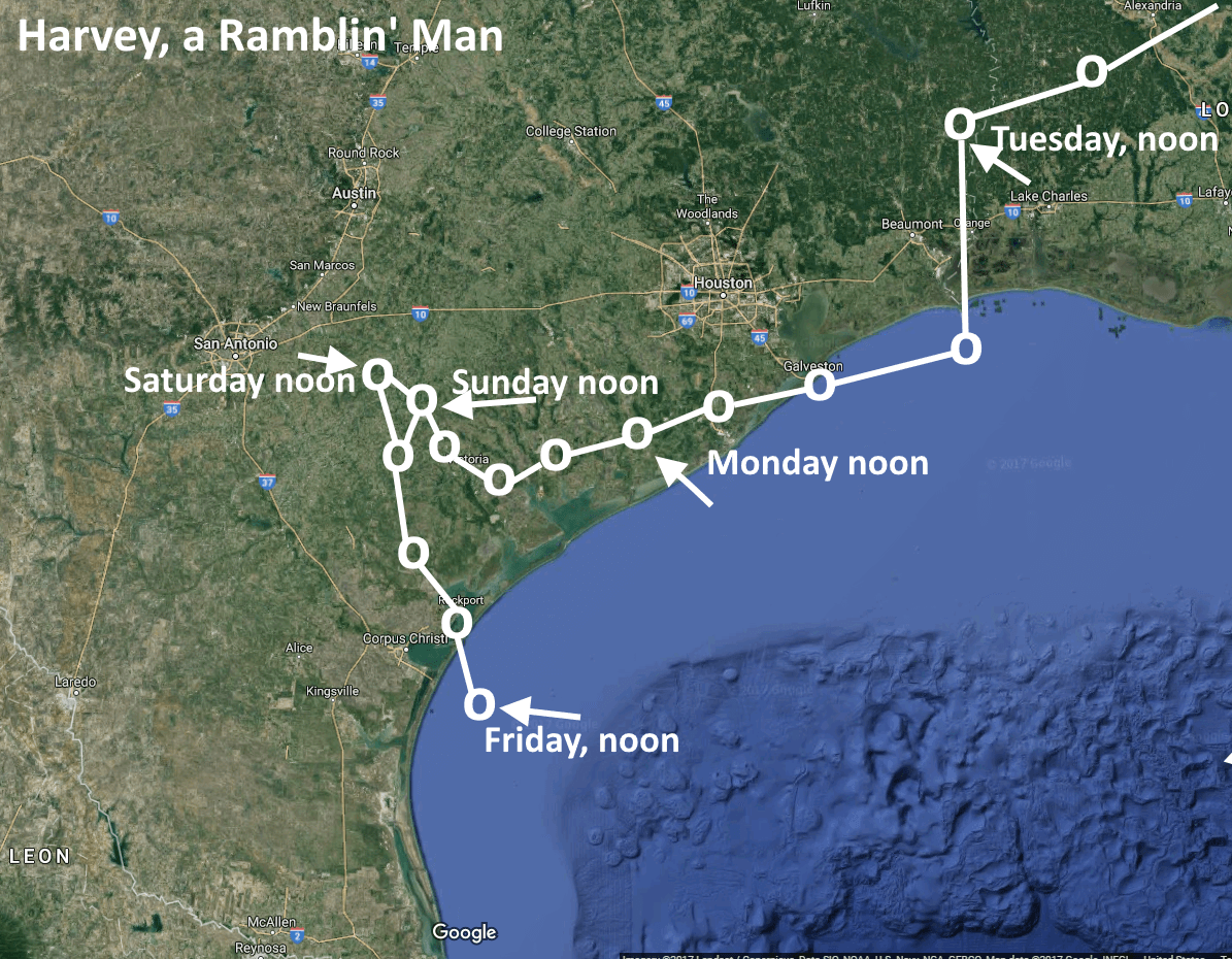
The Euro has been very consistent for, what, 3 runs now? Showing the movement into TX then back out and into SWLA. If this ends up any further east then SELA is flooding and it may flood any way depending on the overall size. Not good at all.
Posted on 8/22/17 at 2:00 pm to BigB0882
quote:
then back out and into SWLA
This would be catastrophic.
Posted on 8/22/17 at 2:01 pm to BigB0882
I'm leaving Lousiana if I flood again.
Posted on 8/22/17 at 2:01 pm to deuce985
18-21 inches in my area is still a little disconcerting. Regardless of anything else.
Posted on 8/22/17 at 2:02 pm to BigB0882
I'd get very worried if this thing is on water tomorrow and the runs are showing the same thing.
Posted on 8/22/17 at 2:03 pm to TDsngumbo
from space city weather

LINK
Great blog for those that are looking to get away from Houston news stupidity. Just mute it for j-rey

quote:
I post this not because you should take the track above as gospel—it is far from it. Rather, the model is illustrative of the fact that this is a tropical system that could very well move inland into Texas somewhere along the coast, more or less stall, and drop 10 to 15 inches of rain (or more) on someone’s head over a two or three day period. Widespread areas may see 4 to 8 inches. I’m not saying this is a repeat of Tropical Storm Allison, as that would be irresponsible. But these kinds of slow moving systems are the ones that often produce widespread flooding.
The next question is, where will the heaviest rainfall occur? Frankly, there is no good answer to that right now. The data gathered by the Hurricane Hunter today will help, so hopefully by Wednesday we should have a slightly better idea. For example, a landfall near Brownsville would be a lot better for Houston than one near Corpus Christi.
What you should know now is that there is the potential for a major rainfall event in Texas this weekend, including possibly the Houston area. Most likely, this will occur sometime on Saturday, Sunday, or Monday. Secondarily, we will be concerned about storm surge and winds if Harvey becomes a strong tropical storm or modest hurricane, but those seem lesser threats at this time.
More, when we know it.
LINK
Great blog for those that are looking to get away from Houston news stupidity. Just mute it for j-rey
This post was edited on 8/22/17 at 2:06 pm
Popular
Back to top


 0
0


