- My Forums
- Tiger Rant
- LSU Recruiting
- SEC Rant
- Saints Talk
- Pelicans Talk
- More Sports Board
- Fantasy Sports
- Golf Board
- Soccer Board
- O-T Lounge
- Tech Board
- Home/Garden Board
- Outdoor Board
- Health/Fitness Board
- Movie/TV Board
- Book Board
- Music Board
- Political Talk
- Money Talk
- Fark Board
- Gaming Board
- Travel Board
- Food/Drink Board
- Ticket Exchange
- TD Help Board
Customize My Forums- View All Forums
- Show Left Links
- Topic Sort Options
- Trending Topics
- Recent Topics
- Active Topics
Started By
Message
 1
1


Posted on 10/9/20 at 3:58 pm to redstick13
He better watch his arse in Creole when the wind switches. 

Posted on 10/9/20 at 3:59 pm to lsu777
quote:
BTW Westlake still has power, pretty much all of it.
I still have it in south LC... knock on wood
Posted on 10/9/20 at 3:59 pm to LPLGTiger
LPLG. On my patio with beer and wind.
Posted on 10/9/20 at 3:59 pm to Cosmo
quote:
lol it isnt 105
Lying fricks
Eric Blake is a liar!
Explanation:
quote:
Reports from an Air Force Reserve Hurricane Hunter aircraft and WSR-88D Doppler radar data indicate that Delta has weakened some more since the last advisory. The eye structure on the radar has become less organized, with about 50 percent of the eyewall remaining in the northern semicircle. The aircraft reported maximum 700-mb flight-level winds have decreased to the 100-105 kt range, along with maximum SFMR surface wind estimates in the 80-85 kt range. In addition, the central pressure has risen to near 966 mb. Based on these data, the initial intensity is lowered to 90 kt.
This post was edited on 10/9/20 at 4:03 pm

Posted on 10/9/20 at 3:59 pm to LSUfanNkaty
quote:
Fingers crossed for ya man. Just walked through my attic. Nice breeze through it right now though lol
Appreciate it.
I thinking I will be fine.
BTW kplc is saying 35-40ish mph sustained right now and the highest gust was 52.
Gust seems right but doesn't it seem like that high sustained.
Posted on 10/9/20 at 4:00 pm to Question
quote:
Got some leaking in the barn/apartment right now. I'm no expert but these gusts seem faster than 35-40mph?
Kplc was saying 52 is highest so far.
Well shite...just updated and said 49 was highest and 35 sustained. Seems right, other seemed high.
This post was edited on 10/9/20 at 4:02 pm
Posted on 10/9/20 at 4:01 pm to Bobby OG Johnson
quote:
000
WTNT41 KNHC 092056
TCDAT1
Hurricane Delta Discussion Number 21
NWS National Hurricane Center Miami FL AL262020
400 PM CDT Fri Oct 09 2020
Reports from an Air Force Reserve Hurricane Hunter aircraft and
WSR-88D Doppler radar data indicate that Delta has weakened some
more since the last advisory. The eye structure on the radar has
become less organized, with about 50 percent of the eyewall
remaining in the northern semicircle. The aircraft reported maximum
700-mb flight-level winds have decreased to the 100-105 kt range,
along with maximum SFMR surface wind estimates in the 80-85 kt
range. In addition, the central pressure has risen to near 966 mb.
Based on these data, the initial intensity is lowered to 90 kt.
The initial motion is now north-northeastward or 015/12 kt, with the
hurricane moving between a deep-layer ridge over the eastern Gulf of
Mexico and a mid- to upper-level trough over the U.S. Southern
Plains. This motion should continue through the next 24 h or so,
followed by a turn toward the northeast as Delta or its remnants
move along the southern edge of the mid-latitude westerlies. While
the track guidance remains tightly clustered, the guidance is a
little faster than the previous run. So, the new track forecast is
similar in direction, but slightly faster than the previous one.
The forecast track has the center of Delta making landfall in
southwestern Louisiana in the next few hours and then moving across
central and northeastern Louisiana tonight and Saturday morning.
After that, the system should move across northern Mississippi into
the Tennessee Valley before it dissipates.
Increasing vertical shear and decreasing oceanic heat content along
the forecast track could cause a little more weakening in the last
few hours before landfall. However, there will still be
significant impacts from winds and storm surge (see Key Messages
below). After landfall, rapid weakening is anticipated, with Delta
expected to weaken to a tropical storm tonight and to a tropical
depression by Saturday afternoon. As in the last advisory, the
cyclone is forecast to dissipate between 60-72 h based on the
consensus of the global models.
Key Messages:
1. Life-threatening storm surge is occurring and will continue near
and east of where Delta makes landfall this evening, and a Storm
Surge Warning is in effect from High Island, Texas, to the Mouth of
the Pearl River, Louisiana. The highest inundation of 7 to 11 feet
is expected somewhere between Rockefeller Wildlife Refuge and Morgan
City, Louisiana.
2. Hurricane-force winds are expected this afternoon and evening
within portions of the Hurricane Warning area, especially along the
coast of southwest Louisiana. Hurricane-force winds will also
spread inland across portions of southern Louisiana near the path of
Deltas center this evening and tonight.
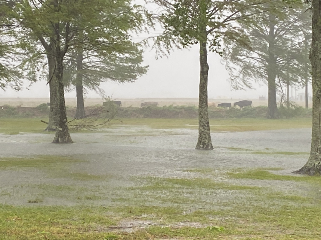
3. Heavy rainfall will lead to significant flash flooding and minor
to major river flooding in parts of Louisiana today and Saturday.
Additional flooding is expected across portions of the central Gulf
Coast into the Lower Mississippi Valley.
FORECAST POSITIONS AND MAX WINDS
INIT 09/2100Z 29.3N 93.2W 90 KT 105 MPH
12H 10/0600Z 31.1N 92.5W 60 KT 70 MPH...INLAND
24H 10/1800Z 33.1N 91.0W 35 KT 40 MPH...INLAND
36H 11/0600Z 34.4N 89.2W 30 KT 35 MPH...INLAND
48H 11/1800Z 35.9N 87.1W 25 KT 30 MPH...INLAND
60H 12/0600Z 37.6N 84.8W 20 KT 25 MPH...POST-TROP/REMNT LOW
72H 12/1800Z...DISSIPATED
$$
Forecaster Beven
Posted on 10/9/20 at 4:01 pm to mikelbr
I use it for hunting and fishing often. If you use the search function you can lock in locations you frequent.
Posted on 10/9/20 at 4:02 pm to rt3
We had 2 camps at Rutherford Beach growing up. Rita said goodbye
Posted on 10/9/20 at 4:02 pm to lsu777
quote:
Gust seems right but doesn't it seem like that high sustained.
No I would agree with 40 or so sustained. Out past the houses south of town it’s easily that. Gusts about 50-60 max IMO

Posted on 10/9/20 at 4:02 pm to lsumailman61
quote:
Mom says tidal surge coming up quick in Intracoastal City
That ain't good for Forked Island. How does it compare to Laura?

Posted on 10/9/20 at 4:03 pm to loogaroo
quote:
He better watch his arse in Creole when the wind switches.
He has a good haul to the Gibbstown bridge with nothing but marsh in between. He better hope hwy 27 doesn't fill up with marsh mud and grass again.
Posted on 10/9/20 at 4:03 pm to lsu777
The guy in Creole getting a flash flood warning after it's been pouring like a mother fricker for 1.5 hours cracks me up.
Posted on 10/9/20 at 4:03 pm to Mac
1st wind gust of note just passed my location in Ellick

Posted on 10/9/20 at 4:03 pm to rt3
On TWC, I just saw a XEROX sign for the first time in many years.
Posted on 10/9/20 at 4:04 pm to lsu777
quote:
.just updated and said 49 was highest and 35 sustained.
welp...I may not be chillin on the front porch later then
Posted on 10/9/20 at 4:04 pm to Jwho77
Decent gusts occurring more frequently in da berry
Posted on 10/9/20 at 4:04 pm to slackster
I’ll tkae it if it spares those poor people to our west.
What does that do to your ban bet??
What does that do to your ban bet??
Posted on 10/9/20 at 4:05 pm to rt3
KALB saying there's already sustained 19 mph in Ellick

 Page 471 of 601

Popular
Back to top