- My Forums
- Tiger Rant
- LSU Score Board
- LSU Recruiting
- SEC Rant
- SEC Score Board
- Saints Talk
- Pelicans Talk
- More Sports Board
- Coaching Changes
- Fantasy Sports
- Golf Board
- Soccer Board
- O-T Lounge
- Tech Board
- Home/Garden Board
- Outdoor Board
- Health/Fitness Board
- Movie/TV Board
- Book Board
- Music Board
- Political Talk
- Money Talk
- Fark Board
- Gaming Board
- Travel Board
- Food/Drink Board
- Ticket Exchange
- TD Help Board
Customize My Forums- View All Forums
- Show Left Links
- Topic Sort Options
- Trending Topics
- Recent Topics
- Active Topics
Started By
Message

Duke, Bobby, rds, Boat (others who are interested) OU's RaXPol radar in the field
Posted on 5/25/21 at 12:50 pm
Posted on 5/25/21 at 12:50 pm
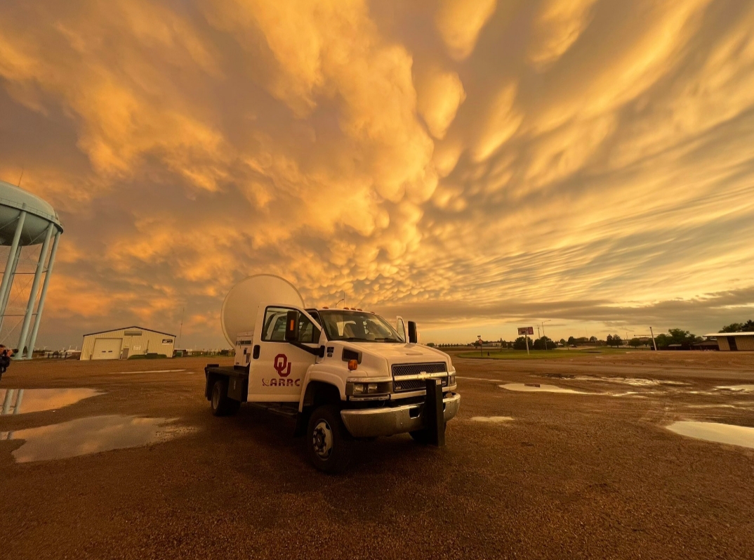
The University of Oklahoma has had their RaXPol radar in the field during the severe setups on the Plains the past few days. The images they are getting are pretty damn cool. They got the entire life cycle of the Selden, KS tornado yesterday.
@raxpol
@raxpol
A gif with radar loops of a tornadic storm (I'm not sure if it is the same one as above). The blip in the middle of the gif is when they had to relocate because they were directly in the path of the tornado. They also caught a satellite tornado on radar that passed over them.

They are down today for a scheduled day off, but should be back out tomorrow for the Enhanced Risk (currently) setups tomorrow and Thursday.
The Plains tornado season appears to be back and nearing high gear.
@raxpol
quote:
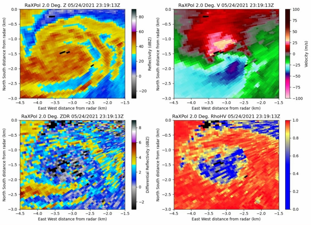
A few preliminary looks at yesterday's data: First, the Selden tornado in its mature phase had several wrapping rainbands just outside of the main circulation, with many coherent subvortices evident on the outer periphery which were confirmed visually. LINK
@raxpol
quote:
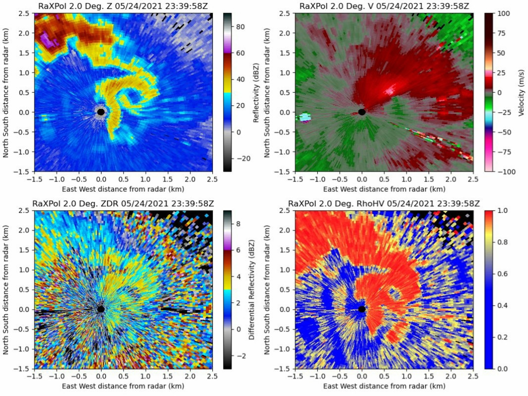
As the main circulation became rain-wrapped and gradually weakened to the west, a new cyclonic/anticyclonic pair of circulations developed to the east, and the anticyclonic circulation became weakly tornadic, with the ground swirl narrowly missing RaXPol and crew by ~30 m! LINK
A gif with radar loops of a tornadic storm (I'm not sure if it is the same one as above). The blip in the middle of the gif is when they had to relocate because they were directly in the path of the tornado. They also caught a satellite tornado on radar that passed over them.
They are down today for a scheduled day off, but should be back out tomorrow for the Enhanced Risk (currently) setups tomorrow and Thursday.
The Plains tornado season appears to be back and nearing high gear.
This post was edited on 5/25/21 at 12:51 pm
 5
5


Posted on 5/25/21 at 12:53 pm to LegendInMyMind
Cool...and sweet mammatus clouds.

Posted on 5/25/21 at 1:04 pm to LegendInMyMind
Posting for a free cooler
Posted on 5/25/21 at 1:28 pm to The Boat
quote:
Posting for a free cooler
Cirrus business.
Posted on 5/25/21 at 1:29 pm to The Boat
quote:
Posting for a free cooler
:denied:

Posted on 5/25/21 at 2:04 pm to LegendInMyMind
Really cool.

Posted on 5/25/21 at 2:25 pm to LegendInMyMind
Amazing what these scans show...

Posted on 5/26/21 at 4:30 pm to LegendInMyMind
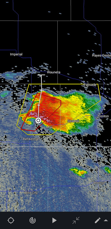
Bump for Duke. And to say that they should be back in the field today with the Moderate Risk area in Kansas and Nebraska.
Posted on 5/26/21 at 4:33 pm to LegendInMyMind
Doubt they are on this one, but it would have been a hell of a super cell to see on their radar:

 Page 1 of 1


Popular
Back to top