- My Forums
- Tiger Rant
- LSU Recruiting
- SEC Rant
- Saints Talk
- Pelicans Talk
- More Sports Board
- Fantasy Sports
- Golf Board
- Soccer Board
- O-T Lounge
- Tech Board
- Home/Garden Board
- Outdoor Board
- Health/Fitness Board
- Movie/TV Board
- Book Board
- Music Board
- Political Talk
- Money Talk
- Fark Board
- Gaming Board
- Travel Board
- Food/Drink Board
- Ticket Exchange
- TD Help Board
Customize My Forums- View All Forums
- Show Left Links
- Topic Sort Options
- Trending Topics
- Recent Topics
- Active Topics
Started By
Message
Posted on 3/4/25 at 8:06 am to deltaland
Rough night in TX panhandle wind wise. Forecast for gusts to by We have a sleet/rain mix currently. Forecast for rest of day: WHAT...Northwest winds 40 to 50 mph with gusts up to 70 mph expected.
Posted on 3/4/25 at 8:42 am to MorbidTheClown
ENH area was just expanded.
The latest convection discussion is more aggressive than the previous. It appears to be trending the wrong way
The latest convection discussion is more aggressive than the previous. It appears to be trending the wrong way
Posted on 3/4/25 at 8:46 am to deltaland
What's the timing look like on this thing?
Posted on 3/4/25 at 8:48 am to Roll Tide Ravens
I've planned my grass cutting around this event. I am ready.
Posted on 3/4/25 at 9:02 am to deltaland
quote:
The closer to the coast you are the higher the tornado threat will be due to higher dewpoints
I would say somewhere along and south of a line from Shreveport to Jackson to Montgomery (maybe not quite as far east as Montgomery) is probably the best tornado threat today. There may be a corridor somewhere in that vicinity where the better dynamics and unstable air overlap. North of there, there will be strong dynamics, but meager instability.
This post was edited on 3/4/25 at 9:10 am
Posted on 3/4/25 at 9:11 am to Roll Tide Ravens
tornado warning issued, heart of Shreveport...
Posted on 3/4/25 at 9:12 am to Roll Tide Ravens
Here is the significant tornado parameter from the HRRR valid at 4:00 PM CST this afternoon.


Posted on 3/4/25 at 9:18 am to LSURoss
Just had a tornado around Blanchard, LA and headed toward Shreveport
Posted on 3/4/25 at 9:23 am to Roll Tide Ravens
Getting some good breaks in the clouds near Baton Rouge area
Posted on 3/4/25 at 9:28 am to lsuman25
quote:
Getting some good breaks in the clouds near Baton Rouge area
Yay for instability!
Posted on 3/4/25 at 9:33 am to ArkBengal
Radar confirmed, now in Bossier Parish
Posted on 3/4/25 at 9:38 am to chinhoyang
wdsu
@wdsu
·
14h
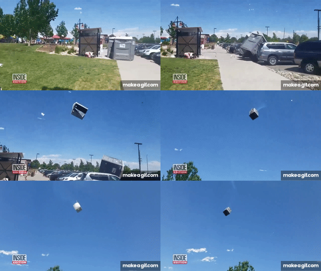
A threat of high winds has forced the City of New Orleans to remove Porta Potties from the parade route. NOPD Superintendent Anne Kirkpatrick is asking everyone to use the bathroom before the parades begin.

@wdsu
·
14h
A threat of high winds has forced the City of New Orleans to remove Porta Potties from the parade route. NOPD Superintendent Anne Kirkpatrick is asking everyone to use the bathroom before the parades begin.
Posted on 3/4/25 at 9:45 am to Roll Tide Ravens
It was pretty nasty here in Bossier for the last 30 minutes or so, but seems to be calming down. Never lost power
Posted on 3/4/25 at 9:47 am to Triple Bogey
No school closures? Guess they used all their days with the snow event
Posted on 3/4/25 at 9:53 am to deltaland
quote:
ENH area was just expanded.
Wait, expanded AGAIN?
Posted on 3/4/25 at 10:15 am to Roll Tide Ravens

That's the most I've seen posted for our area in a while. Is the thinking still that the biggest threat will be from discrete storms or are they thinking more of a solid line?
Popular
Back to top


 0
0


