- My Forums
- Tiger Rant
- LSU Recruiting
- SEC Rant
- Saints Talk
- Pelicans Talk
- More Sports Board
- Coaching Changes
- Fantasy Sports
- Golf Board
- Soccer Board
- O-T Lounge
- Tech Board
- Home/Garden Board
- Outdoor Board
- Health/Fitness Board
- Movie/TV Board
- Book Board
- Music Board
- Political Talk
- Money Talk
- Fark Board
- Gaming Board
- Travel Board
- Food/Drink Board
- Ticket Exchange
- TD Help Board
Customize My Forums- View All Forums
- Show Left Links
- Topic Sort Options
- Trending Topics
- Recent Topics
- Active Topics
Started By
Message
 0
0

Posted on 3/14/25 at 7:27 pm to Wishnitwas1998
If you’re in Mansfield, Missouri get to cover. I think that’s on the ground
Is the NWS Springfield asleep or what?
ETA kind of weakened but it looked healthy for a moment. Still a cell to watch, it has nothing ahead of it to inhibit inflow
Is the NWS Springfield asleep or what?
ETA kind of weakened but it looked healthy for a moment. Still a cell to watch, it has nothing ahead of it to inhibit inflow
This post was edited on 3/14/25 at 7:31 pm
Posted on 3/14/25 at 7:30 pm to deltaland
quote:
If you’re in Mansfield, Missouri get to cover. I think that’s on the ground
Is the NWS Springfield asleep or what?
Looks like side lobe contamination.
Posted on 3/14/25 at 7:32 pm to LegendInMyMind
quote:
Looks like side lobe contamination.
What’s this?
Posted on 3/14/25 at 7:34 pm to deltaland
It is a radar artifact that sometimes shows up. It can look a lot like a surefire circulation.
Posted on 3/14/25 at 7:35 pm to deltaland
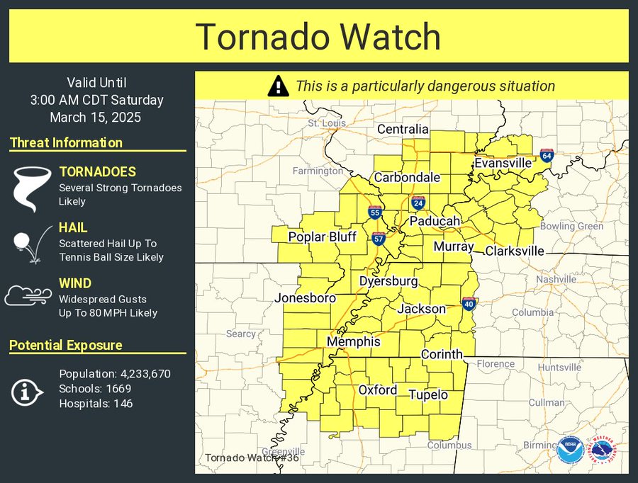
Why when they issue watches do they leave gaps in the boxes?
Seems stupid. Guess if you live in Brinkley, Ar or Shelby Ms you have nothing to worry about. Tornado will just skip over the gap
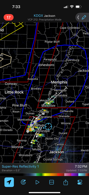
Seems stupid. Guess if you live in Brinkley, Ar or Shelby Ms you have nothing to worry about. Tornado will just skip over the gap
Posted on 3/14/25 at 7:35 pm to deltaland
reports of activity around Ft. Leonard Wood , southwest of Rolla
Posted on 3/14/25 at 7:37 pm to LegendInMyMind
quote:
is a radar artifact that sometimes shows up. It can look a lot like a surefire circulation.
Ah gotcha. How can you tell the difference?
Posted on 3/14/25 at 7:39 pm to deltaland
quote:
Ah gotcha. How can you tell the difference?
Location of the rotation relative to the storm and checking it against different heights of the radar. The easiest way is to Google it and see some examples. There are some explainers out there, too.
This post was edited on 3/14/25 at 7:40 pm
Posted on 3/14/25 at 7:40 pm to deltaland
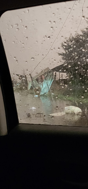
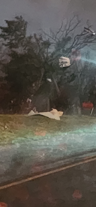
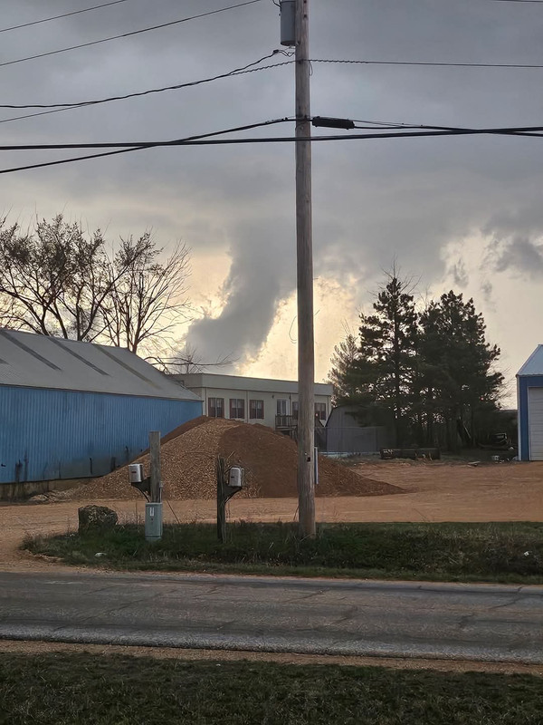
From the storm that went through Seymour, MO
Posted on 3/14/25 at 7:41 pm to SidewalkTiger
Any major structure damage that you've seen?

Posted on 3/14/25 at 7:41 pm to LegendInMyMind
Posted on 3/14/25 at 7:42 pm to stlslick
quote:
Supposedly, the area hit, is a Mennonite and amish populated area.
A lot of both in the area
Posted on 3/14/25 at 7:43 pm to LegendInMyMind
quote:
Any major structure damage that you've seen?
Not so far
Posted on 3/14/25 at 7:45 pm to AHM21
If the winds behind this activity and that for tomorrow are an indication of potential severity...please heed all cautions and warnings. It has been beyond blustery out our way.
Posted on 3/14/25 at 7:46 pm to wfallstiger
May be a watch issued soon for East Texas and west Louisiana
Posted on 3/14/25 at 7:46 pm to AHM21
wind picking up here, but in bursts, and the clouds are hauling arse from the South
.
.
Posted on 3/14/25 at 7:47 pm to stlslick
Those 2 cells near Clarksville, Ar are going to be a problem soon
Posted on 3/14/25 at 7:48 pm to stlslick
The storm that went north of Seymour, MO from town

Posted on 3/14/25 at 7:49 pm to deltaland

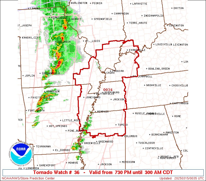
 Page 14 of 88

Popular
Back to top