




- My Forums
- Tiger Rant
- LSU Recruiting
- SEC Rant
- Saints Talk
- Pelicans Talk
- More Sports Board
- Fantasy Sports
- Golf Board
- Soccer Board
- O-T Lounge
- Tech Board
- Home/Garden Board
- Outdoor Board
- Health/Fitness Board
- Movie/TV Board
- Book Board
- Music Board
- Political Talk
- Money Talk
- Fark Board
- Gaming Board
- Travel Board
- Food/Drink Board
- Ticket Exchange
- TD Help Board
Customize My Forums- View All Forums
- Show Left Links
- Topic Sort Options
- Trending Topics
- Recent Topics
- Active Topics
Started By
Message

ENHANCED RISK of severe weather - all of southeast Louisiana Tuesday-evening
Posted on 11/16/15 at 8:25 am


Posted on 11/16/15 at 8:25 am
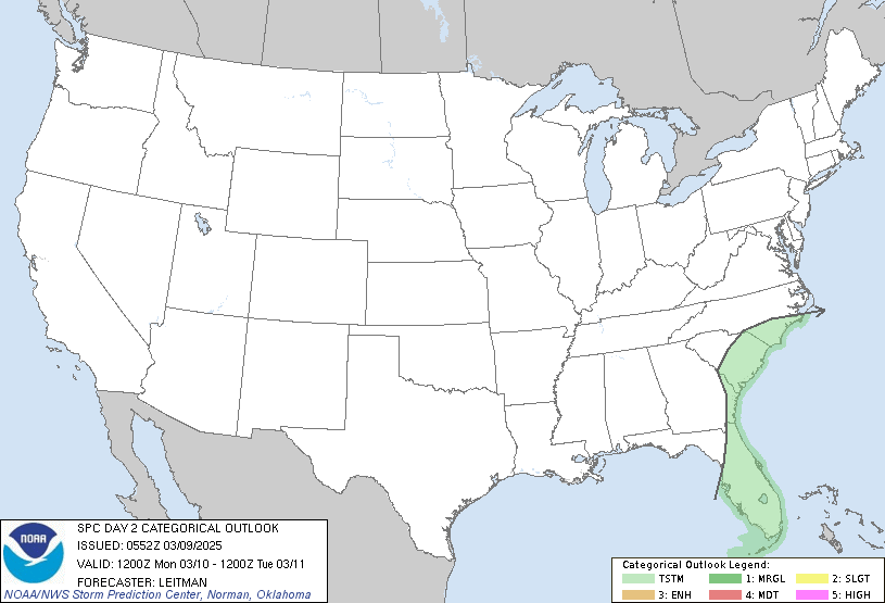
quote:
LATEST MODEL GUIDANCE SUGGESTS MARITIME TROPICAL AIR MASS WILL MOVE
ONSHORE FROM THE TX GULF COAST TO SRN MS WHERE LOWER 70S DEW POINTS
ARE EXPECTED. HOWEVER...INLAND PROGRESSION WILL BE RETARDED
SOMEWHAT AS TRAJECTORIES FROM DOMINANT SFC ANTICYCLONE EAST OF THE
APPALACHIANS WILL LIMIT NWD MOISTURE SURGE. ADDITIONALLY...EXPANSIVE
PRECIPITATION SHIELD WITHIN WARM ADVECTION ZONE WILL LIMIT
DESTABILIZATION NORTH OF I-20. FOR THIS REASON IT APPEARS THE
STRONGEST INSTABILITY WILL BE LOCATED ACROSS SRN LA WHERE MLCAPE
COULD EXCEED 1000 J/KG. STRONGLY SHEARED ENVIRONMENT WILL FAVOR
MAINTENANCE OF EARLY-DAY SQUALL LINE BUT IT/S NOT ENTIRELY CLEAR
WHETHER PRE-SQUALL LINE SUPERCELLS WILL EVOLVE ACROSS THE WARM
SECTOR. DESPITE THE UNCERTAINTY OF STORM MODE...AND EXPECTED
MARGINAL LAPSE RATES...HAVE OPTED TO INTRODUCE CAT3 SEVERE ACROSS
PORTIONS OF THE LOWER MS VALLEY. DAMAGING WINDS APPEAR POSSIBLE AND
ISOLATED TORNADOES COULD CERTAINLY EVOLVE...ESPECIALLY IF DISCRETE
STORMS MANAGE TO EVOLVE AHEAD OF THE SQUALL LINE OR NEAR THE
RETREATING WARM FRONT.
FYI - the last time we were in the "enhanced" risk category, morning turned to night and we were absolutely slammed with 80mph winds all across the Baton Rouge area in late April.
This post was edited on 11/16/15 at 9:06 am
 8
8

Posted on 11/16/15 at 8:28 am to TDsngumbo
wtf. Clear skies all around me


Posted on 11/16/15 at 8:28 am to TDsngumbo
So do I need to move my car to high ground again?

Posted on 11/16/15 at 8:39 am to TDsngumbo
I remember that day. Line was coming across La. and wiping out power all over. Went into lockdown at school. Was scary stuff
Posted on 11/16/15 at 8:45 am to TDsngumbo
quote:
Significant risk of severe weather
enhanced? Well dammit, which is it?
This post was edited on 11/16/15 at 8:46 am

Posted on 11/16/15 at 9:10 am to TDsngumbo
less caps in quote. thx


Posted on 11/16/15 at 9:25 am to TDsngumbo
quote:
less caps in quote. thx
I appreciate the all caps, seems like you're yelling something important. Or you know, just copied info from the national weather service.
Posted on 11/16/15 at 9:27 am to TDsngumbo
quote:That shite was nuts
morning turned to night and we were absolutely slammed with 80mph winds all across the Baton Rouge
Posted on 11/16/15 at 9:31 am to Solicitor
I agree. An excellent application of capitalization.


Posted on 11/16/15 at 9:34 am to MrSmith
We don't get the spring like storms in November. Wouldn't be the same as the April storm.

Posted on 11/16/15 at 9:34 am to ToulatownTiger
quote:
I remember that day. Line was coming across La. and wiping out power all over. Went into lockdown at school. Was scary stuff
Same here, I was in Gonzales with my kids home from school that day because we were in the process of moving and I took them all in the bathroom closet bc shite got real and black as night at 10am that morning. They still remember it too.

Posted on 11/16/15 at 9:34 am to TDsngumbo
quote:
INLAND PROGRESSION WILL BE RETARDED
Watch out, NOAA, here come the SJWs.

 Page 1 of 1


Popular
Back to top
 Follow TigerDroppings for LSU Football News