- My Forums
- Tiger Rant
- LSU Recruiting
- SEC Rant
- Saints Talk
- Pelicans Talk
- More Sports Board
- Fantasy Sports
- Golf Board
- Soccer Board
- O-T Lounge
- Tech Board
- Home/Garden Board
- Outdoor Board
- Health/Fitness Board
- Movie/TV Board
- Book Board
- Music Board
- Political Talk
- Money Talk
- Fark Board
- Gaming Board
- Travel Board
- Food/Drink Board
- Ticket Exchange
- TD Help Board
Customize My Forums- View All Forums
- Show Left Links
- Topic Sort Options
- Trending Topics
- Recent Topics
- Active Topics
Started By
Message
re: Weather for Monday, May 20. Attention: N TX, Cen. OK, S KS High risk forecast
Posted on 5/20/19 at 7:06 pm to StraightCashHomey21

Posted on 5/20/19 at 7:06 pm to StraightCashHomey21
quote:
StraightCashHomey21
Glad you guys are good so far.
Line of storms will be in our area in a bit. Hopefully it stays under control.
I said it earlier today here, but our temps never got very warm even when the warm front moved above us. We are 74 right now and have continued to have rain showers off and on most of the day. Just stopped raining again a bit ago. Have had absolutely no sun break throughs today since the warm front moved through to really heat things up.
 2
2

Posted on 5/20/19 at 7:16 pm to Hawgeye
There's like four Tor warnings on the southern cluster E-NE of Midland. Just not where we expected all the warnings to be by this point.
Posted on 5/20/19 at 7:29 pm to Duke
The storms that keep rolling through here in BA and in Tulsa are elevated. The biggest concern from our local guys seems to be flooding.
Is the dry line still out west Duke? Is that why we aren’t blowing away right now?
Is the dry line still out west Duke? Is that why we aren’t blowing away right now?
Posted on 5/20/19 at 7:41 pm to RollTide1987
quote:
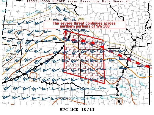
Especially when you consider this is only the second time SPC has placed values this severe on a potential outbreak - the other one, of course, being the Super Outbreak of 2011.
I'm pretty sure every one of those values will ultimately be valid. We're just lucky the longer track stuff missed everyone so far.
ETA - obviously the high end didn't materialize, but it hadn't been a bust either.
This post was edited on 5/20/19 at 7:43 pm
Posted on 5/20/19 at 7:41 pm to Hawgeye
Posted on 5/20/19 at 7:47 pm to Hawgeye
quote:
Is the dry line still out west Duke?
Yes, it wasn't going to encroach too far west anyway.
quote:
The biggest concern from our local guys seems to be flooding.
Flooding is a real concern for most of Oklahoma tonight. The frontal boundary isn't moving much and there's a hell of a warm moist inflow coming in.
Posted on 5/20/19 at 7:47 pm to Hawgeye
Not Duke but it appears the dry line is still near Panhandle and south
Posted on 5/20/19 at 7:53 pm to wfallstiger
Looking at the chasers on Twitter, it's a good thing today didn't play out as feared. Traffic jams in rural Oklahoma. Spotty cell service from overburdened systems.
There's too many people chasing and there's going to be a high fatality event one of these days.
There's too many people chasing and there's going to be a high fatality event one of these days.

Posted on 5/20/19 at 7:55 pm to Duke
quote:
There's too many people chasing and there's going to be a high fatality event one of these days.
Kelley Williamson

This post was edited on 5/20/19 at 7:56 pm
Posted on 5/20/19 at 7:55 pm to Duke
outflow boundary has gone through OKC and temp has dropped to the 50s now.
Posted on 5/20/19 at 7:56 pm to Duke
quote:
There's too many people chasing and there's going to be a high fatality event one of these days.
These storms were booking it today too. A widespread event could have been disastrous. The live stream from one of the links in the OP had chasers that continuously stopped due to chaser traffic.
Posted on 5/20/19 at 7:59 pm to Duke
Local(Tulsa) guy seems to be concerned a bit with some storms just popping around Okmulgee

Posted on 5/20/19 at 8:02 pm to deeprig9
Posted on 5/20/19 at 8:02 pm to Hawgeye
They'd need to get raging in a hurry. Not a lot of room to run.

Posted on 5/20/19 at 8:03 pm to Duke
quote:
There's too many people chasing and there's going to be a high fatality event one of these days.
It would be highly entertaining and thin out the retard herds trying to get within 10 feet of an EF-5.
This post was edited on 5/20/19 at 8:56 pm
Posted on 5/20/19 at 8:05 pm to Duke
quote:
They'd need to get raging in a hurry. Not a lot of room to run.
Yea. He zoomed in not seconds after I posted and his concern dropped some.
When does the NWS issue updates on watches, forecasts, etc? Interested in seeing if they make any changes.
My areas biggest concern is just how slow moving these are now that they’re all together and the lakes being flooded. Keystone Lake was just opened up into the Arkansas River to give relief. Now even more heavy rain.
Posted on 5/20/19 at 8:07 pm to Hawgeye
Northeast of Cushing tornado warning

Posted on 5/20/19 at 8:08 pm to Hawgeye
Yeah, a line may cause some trouble but it and nothing it spins out is gonna leave your house as nothing but a slab.
Posted on 5/20/19 at 8:10 pm to Scoop
Come again?

Posted on 5/20/19 at 8:13 pm to SEClint
quote:
Kelley Williamson
The Weather Cannel put him in too much danger... But I guessed he loved doing it..........

 Page 26 of 31

Popular
Back to top