




- My Forums
- Tiger Rant
- LSU Recruiting
- SEC Rant
- Saints Talk
- Pelicans Talk
- More Sports Board
- Fantasy Sports
- Golf Board
- Soccer Board
- O-T Lounge
- Tech Board
- Home/Garden Board
- Outdoor Board
- Health/Fitness Board
- Movie/TV Board
- Book Board
- Music Board
- Political Talk
- Money Talk
- Fark Board
- Gaming Board
- Travel Board
- Food/Drink Board
- Ticket Exchange
- TD Help Board
Customize My Forums- View All Forums
- Show Left Links
- Topic Sort Options
- Trending Topics
- Recent Topics
- Active Topics
Started By
Message

NASA maps show how fast NOLA is sinking
Posted on 5/17/16 at 12:54 pm


Posted on 5/17/16 at 12:54 pm
LINK
quote:
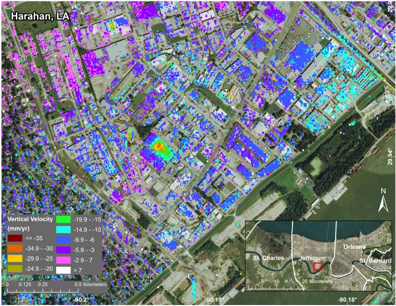
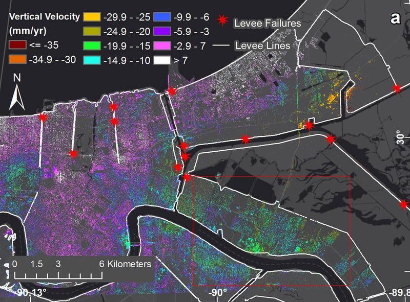
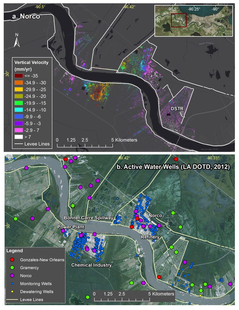
Using NASA airborne radar, scientists have shown the degree to which New Orleans and its surrounding areas are sinking each year. Mostly caused by groundwater extraction, it’s yet another disaster in the making.
These new maps, produced by researchers at NASA’s Jet Propulsion Laboratory and the Center for Geoinformatics at Louisiana State University, are the most accurate and detailed yet of the the region’s sinking pattern. The data for the study, which now appears in Journal of Geophysical Research, was collected from June 2009 to July 2012.
quote:
Geologists call this elevation-dropping process “subsidence,” and it’s typically driven by a combination of both natural and human-caused factors. In New Orleans, it’s caused by groundwater pumping and dewatering (i.e. pumping away surface water to prevent standing water and soggy ground).
The most severe sinking was observed upriver along the Mississippi River around major industrial areas, and in Michoud. Both of these areas experience drops of about two inches each year. Other notable drops in elevation were measured in the city’s Upper and Lower 9th Ward, and in Metairie, where the measured ground movements were linked to water levels in the Mississippi River. At Bonnet Carré Spillway east of Norco (the area’s last line of protection against springtime river floods breaching the levees), the scientists detected upwards of 1.6 inches of annual subsidence.
quote:
That might not sound like much, but these slow and steady drops add up quickly over time. Assuming this rate of subsidence continues, it could translate to an eight-feet drop in the most severely affected regions. Not only would this make flooding worse, but it would also expand the geographic reach of encroaching inland waters.
Back in 2005, around 80 percent of New Orleans and large tracts of neighboring parishes became flooded, and the waters lingered for weeks. Considering how climate change is contributing to rising ocean levels, this has the makings of yet another major disaster.
 6
6


Posted on 5/17/16 at 12:56 pm to sicboy


Posted on 5/17/16 at 12:57 pm to sicboy
Is this an update? its sinking faster than it was yesterday?

Posted on 5/17/16 at 1:00 pm to sicboy
It's about time to Titanic New Orleans.

You meant well and had a really good run, but in the end she let go.

You meant well and had a really good run, but in the end she let go.
Posted on 5/17/16 at 1:01 pm to BuckeyeFan87
this thread is sinking

Posted on 5/17/16 at 1:01 pm to Paddyshack
Oh wait.
So you guys are saying it was posted already?
So you guys are saying it was posted already?

Posted on 5/17/16 at 1:05 pm to sicboy
Fatties gonna fatty again
Posted on 5/17/16 at 1:05 pm to sicboy
your ecred is already sunk so the good news is that ain't sinking no more.


Posted on 5/17/16 at 1:15 pm to sicboy
You posted pictures.
This is better than yesterday's thread, IMO.
This is better than yesterday's thread, IMO.


Posted on 5/17/16 at 1:33 pm to sicboy
So, those who can't swim could be in imminent danger?

 Page 1 of 1


Popular
Back to top
 Follow TigerDroppings for LSU Football News