- My Forums
- Tiger Rant
- LSU Recruiting
- SEC Rant
- Saints Talk
- Pelicans Talk
- More Sports Board
- Coaching Changes
- Fantasy Sports
- Golf Board
- Soccer Board
- O-T Lounge
- Tech Board
- Home/Garden Board
- Outdoor Board
- Health/Fitness Board
- Movie/TV Board
- Book Board
- Music Board
- Political Talk
- Money Talk
- Fark Board
- Gaming Board
- Travel Board
- Food/Drink Board
- Ticket Exchange
- TD Help Board
Customize My Forums- View All Forums
- Show Left Links
- Topic Sort Options
- Trending Topics
- Recent Topics
- Active Topics
Started By
Message
re: Hurricane Maria - Visiting the Outer Banks before Moving OTS
Posted on 9/19/17 at 4:39 pm to TxWadingFool
Posted on 9/19/17 at 4:39 pm to TxWadingFool
D. Estimated (by SFMR or visually) Maximum Surface Wind Inbound: 137kts (~ 157.7mph)
H. Minimum Sea Level Pressure: 913mb (26.96 inHg)
M. Eye Shape & Diameter: Circular with a diameter of 10 nautical miles (12 statute miles)
Ten mile eye, expanded from earlier. Pressure confirmed 913 mb. Cat 5 winds in the SW side of the eyewall.
Oh and the eyewall replacement might be a faux one like we saw with Irma. Double max not quite as apparent and radar looks like the inner eyewall might have won this round. More time needed to be certain of course.
 1
1

Posted on 9/19/17 at 4:40 pm to Duke
So still at 161 mph winds but the pressure is still dropping so it should keep strengthening.

Posted on 9/19/17 at 4:41 pm to ihometiger
quote:
so it should keep strengthening.
Yeah! Its gonna be bad bad.
Posted on 9/19/17 at 5:04 pm to Rox
Anybody google map PR? that place is in a bad spot. Lot of appts and buildings near the coast. i hope they evacuate people to move inland.The whole island will catch hell though. hope your friend is away from the ocean.Well as far away as you can get on PR.
Posted on 9/19/17 at 5:10 pm to Duke
quote:
Oh and the eyewall replacement might be a faux one like we saw with Irma. Double max not quite as apparent and radar looks like the inner eyewall might have won this round. More time needed to be certain of course.
Clearly, something happened to the storm. Secondary wind max, followed by expanding wind field and eye grew in size. If it is done with whatever that was, it will probably strengthen some more before PR.
Posted on 9/19/17 at 5:12 pm to rds dc
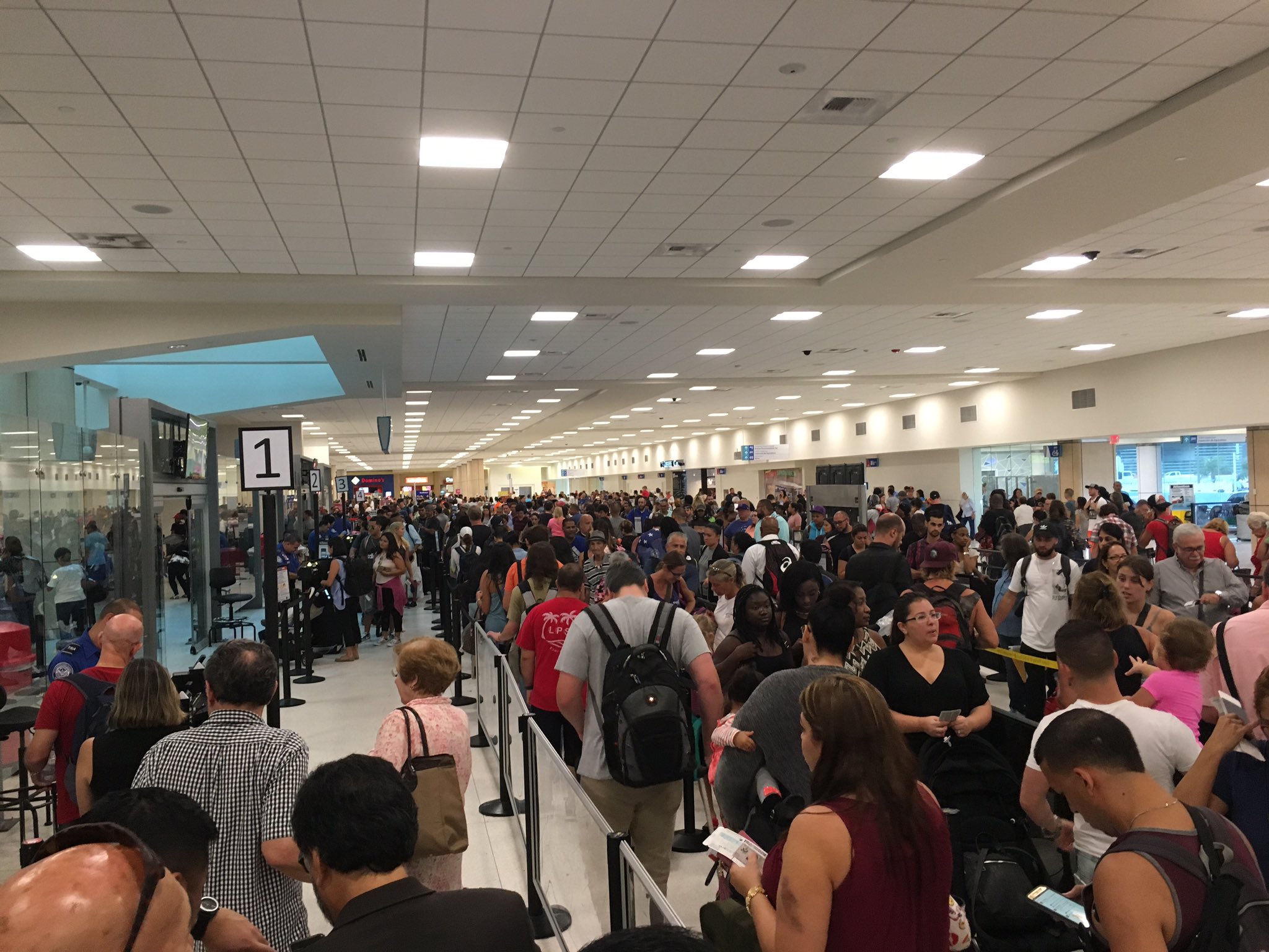
San Juan Airport from a few hours ago
Posted on 9/19/17 at 5:13 pm to rds dc
quote:
Clearly, something happened to the storm. Secondary wind max, followed by expanding wind field and eye grew in size. If it is done with whatever that was, it will probably strengthen some more before PR.
The end result was like a replacement cycle, but without the weakening and long battle killing in the inner eye.
Weird. Irma had a similar thing happen IIRC.
Posted on 9/19/17 at 5:19 pm to Duke
Hurricane center forecasters have said it “now appears likely” that Maria will still be at category 5 intensity when it moves over the US Virgin Islands and Puerto Rico, according to the AP.
The center of the storm was forecast to move over or near the US Virgin Island of St Croix and Puerto Rico on Tuesday night and Wednesday, leading to “life-threatening” floods.
LINK
The center of the storm was forecast to move over or near the US Virgin Island of St Croix and Puerto Rico on Tuesday night and Wednesday, leading to “life-threatening” floods.
LINK
Posted on 9/19/17 at 5:32 pm to ihometiger
910 mb and 170 mph+ unflagged on recent pass.
Make that about 175 mph unflagged.
Make that about 175 mph unflagged.
This post was edited on 9/19/17 at 5:36 pm
Posted on 9/19/17 at 5:37 pm to Duke
Damn

Posted on 9/19/17 at 5:38 pm to Duke
quote:Jesus H. Christ
910 mb and 170 mph+ unflagged on recent pass.
Make that about 175 mph unflagged.
Posted on 9/19/17 at 5:39 pm to Duke
This might make a run at sub 900 mb tonight
Posted on 9/19/17 at 5:40 pm to Duke
Holy shite

Posted on 9/19/17 at 5:46 pm to Duke
Posted on 9/19/17 at 5:50 pm to lsuman25
Top 10 all time as of now.
Pressure drop 3 mb/hr currently. Could make a run at 900 mb. St. Croix still in the path of strongest winds.
Pressure drop 3 mb/hr currently. Could make a run at 900 mb. St. Croix still in the path of strongest winds.
Posted on 9/19/17 at 5:54 pm to Duke
I remember in one of the other threads, someone posted the top 10 strongest hurricanes, with wind and pressure columns. Does anyone have that saved?
Posted on 9/19/17 at 5:58 pm to When in Rome
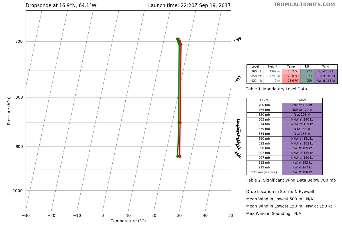
...700 PM AST POSITION AND INTENSITY UPDATE... ...EXTREMELY DANGEROUS CATEGORY 5 HURRICANE MARIA STILL STRENGTHENING...
7:00 PM AST Tue Sep 19
Location: 16.9°N 64.1°W
Moving: WNW at 10 mph
Min pressure: 909 mb
Max sustained: 175 mph
7:00 PM AST Tue Sep 19
Location: 16.9°N 64.1°W
Moving: WNW at 10 mph
Min pressure: 909 mb
Max sustained: 175 mph

Posted on 9/19/17 at 6:00 pm to lsuman25
quote:
Min pressure: 909 mb
Well, now it's one of the top ten most intense hurricanes by pressure.
This post was edited on 9/19/17 at 6:01 pm
Posted on 9/19/17 at 6:01 pm to lsuman25
quote:Mother of God. And strengthening?
Min pressure: 909 mb Max sustained: 175 mph
Posted on 9/19/17 at 6:01 pm to lsuman25
quote:
STILL STRENGTHENING...
Could we actually see this storm hit 190 tonight?
UPDATE EDIT:
Dropsonde just measured 195 mph winds in Maria, I hope to god that's just a gust!
This post was edited on 9/19/17 at 6:16 pm

 Page 27 of 43

Popular
Back to top